
- Home
- Rural Development
- Nature Trails
- Nature Trails
- Central Sector
- Cañada Real Soriana Occidental
Stage 6: Arcones – Villarejo
Description
A stage that runs between juniper and pine woods and is well worth the effort.
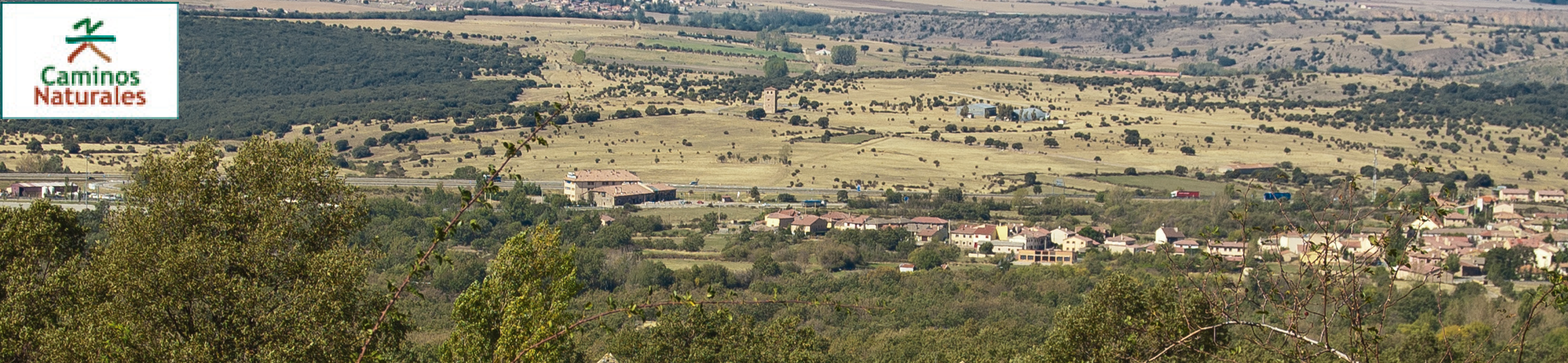
This physically demanding stage starts by crossing a dreamy juniper (Juniperus thurifera) forest. As the trail goes uphill and downhill a succession of spectacular views unfolds, which the traveller shall remember for long. From the aforementioned juniper forest, the trail goes on to a forest of Scots pine (Pinus sylvestris) and to a steep area from which the subterranean pass to cross the A-1 highway is taken. Pastures and finally juniper (Quercus pyrenaica) woods are once again the landscape of the Cañada Real Soriana Occidental drover's way, before ending in the village of Villarejo, in the municipality of Santo Tomé del Puerto.

This stage, which runs for over 21 km between La Mata and the village of Villarejo, in the municipality of Santo Tomé del Puerto, is one of the most physically demanding stages of the Cañada Real Soriana Occidental Nature Trail. The stages starts at the corresponding information panel next to the village of La Mata, in the municipality of Arcones. Shortly afterwards, kilometre point 85 may be found among medium-sized juniper trees .
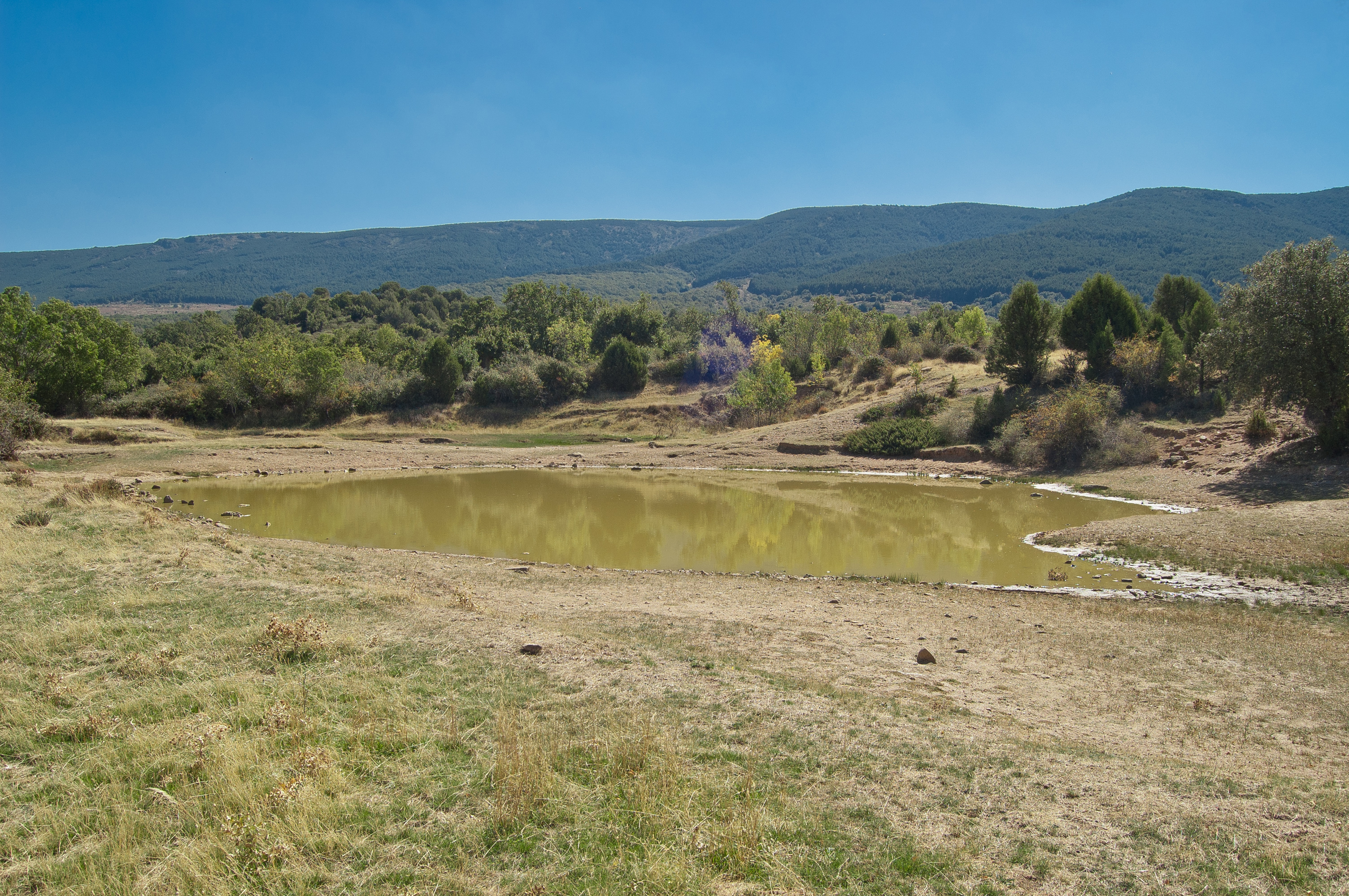
After leaving behind two perfectly signalled crossroads, on which the trial just continues straight on, the road reaches kilometre point 86, by a series of pools, the largest of which never dries. At the subsequent fork the trail takes the path to the left before reaching the resting area called La Tranca de la Dehesa where a large juniper offers a welcoming shadow which invites the traveller to take a break.

In the following section, the trail goes uphill and downhill through a beautiful juniper forest. After crossing the gate that serves as border between the municipalities of Arcones and Prádena, patches of Scots pine dot the landscape besides the junipers. Kilometre point 88 is located at a crossroads, where the trail continues straight on. At this point, a new section that goes uphill and downhill beings. Fords are found at their lowest point, and some steep slopes demand additional effort and care from the traveller. The harshness of these slopes should not prevent the traveller from enjoying the spectacular specimens of juniper which have grown in this area since ancient times, and which offer a view straight out of fairy tales.
Once in the municipality of Prádena, several creeks are crossed, among which the Poyales creek and the Palancares creek are especially noteworthy. After kilometre point 89, the trail leaves behind the juniper woods and the pastures characteristic of the Cañada Real Soriana Occidental drover's way return. A new gate with a revolving door for pedestrians marks the appearance of a new Scots pine patch in the estates neighbouring the cattle road. A new uphill and downhill section beings, albeit not as steep as the previous one, before reaching a cattle grid, where two large pruned Pyrenean oaks stand out against Scots pines.
Along the next kilometre, more specimens of Pyrenean oak, which were trimmed in the past, are found, as are specimens of juniper trees. After a short uphill section, a new cattle grid has to be crossed before turning right by a wide path. Just After taking this path the resting area Vereda de la Cañadilla may be found.
Going up this path, after crossing the Quiñones river, the town of Casla can be seen as the trail enters its municipality.
The trail enters a section dominated by Scots pines and again goes uphill and downhill, sometimes becoming really steep. After kilometre point 9, a gate with a revolving door for pedestrias serves as a border between municipalities of Casla and Santo Tomé del Puerto. From that point, the localities of Sigueruelo and Siguero stand.
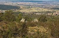
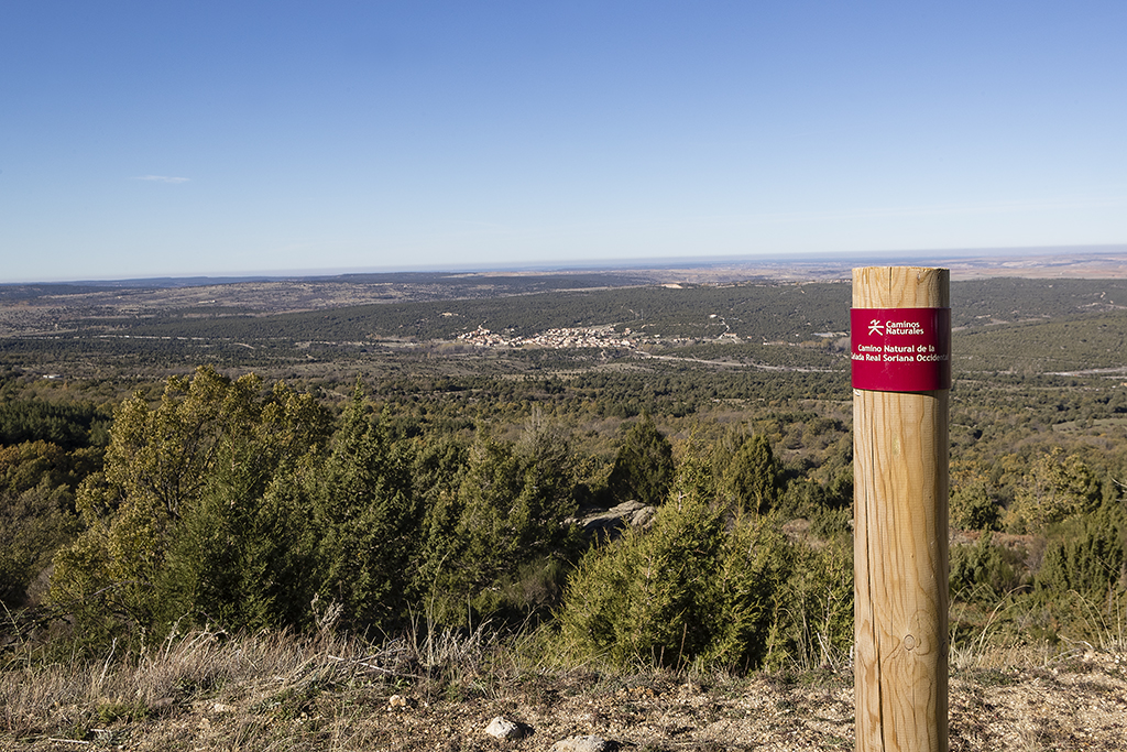
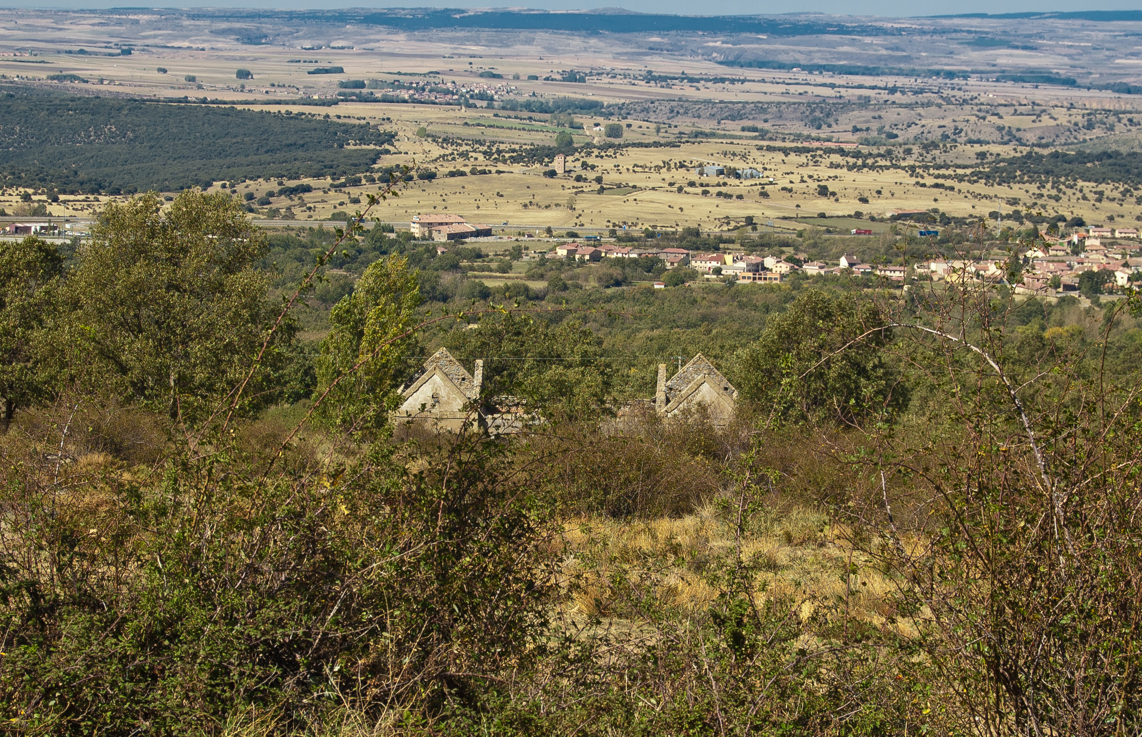
The beauty of the landscape stuns the traveller. The Scots pine forest lies to the right, which sometimes allow a peek of the heights of Sierra de Guadarrama in a natural frame of branches. To the left, the traveller's eyes get lost in the horizon, in a landscape dotted by the small villages of the province of Segovia.
After leaving behind kilometre point 98 and enjoying the beautiful panoramic view over the town of Las Rades, the trail becomes even a little tougher going down and then up a steep hill. Just afterwards, the trail zigzags down a properly signalled road in which the zigzag makes the slope less steep. The trail continues down to the milestone of kilometre point 100 of the Cañada Real Soriana Occidental Nature Trail, after which the trial continues parallel to the A-1 highway.
The road turns right and crosses under the lanes of the A-1 highway in the direction of Madrid. The downhill section ends at the crossing of the Duratón river. Then, the trail goes up again and reaches a gate with a revolving door for pedestrians before crossing under the A-1 highway lanes in the direction of Burgos. Once the highway has been completely crossed, the trail turns immediately right and goes along an asphalt road in a bad condition which shortly afterwards becomes again a dirt path.
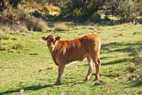
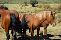
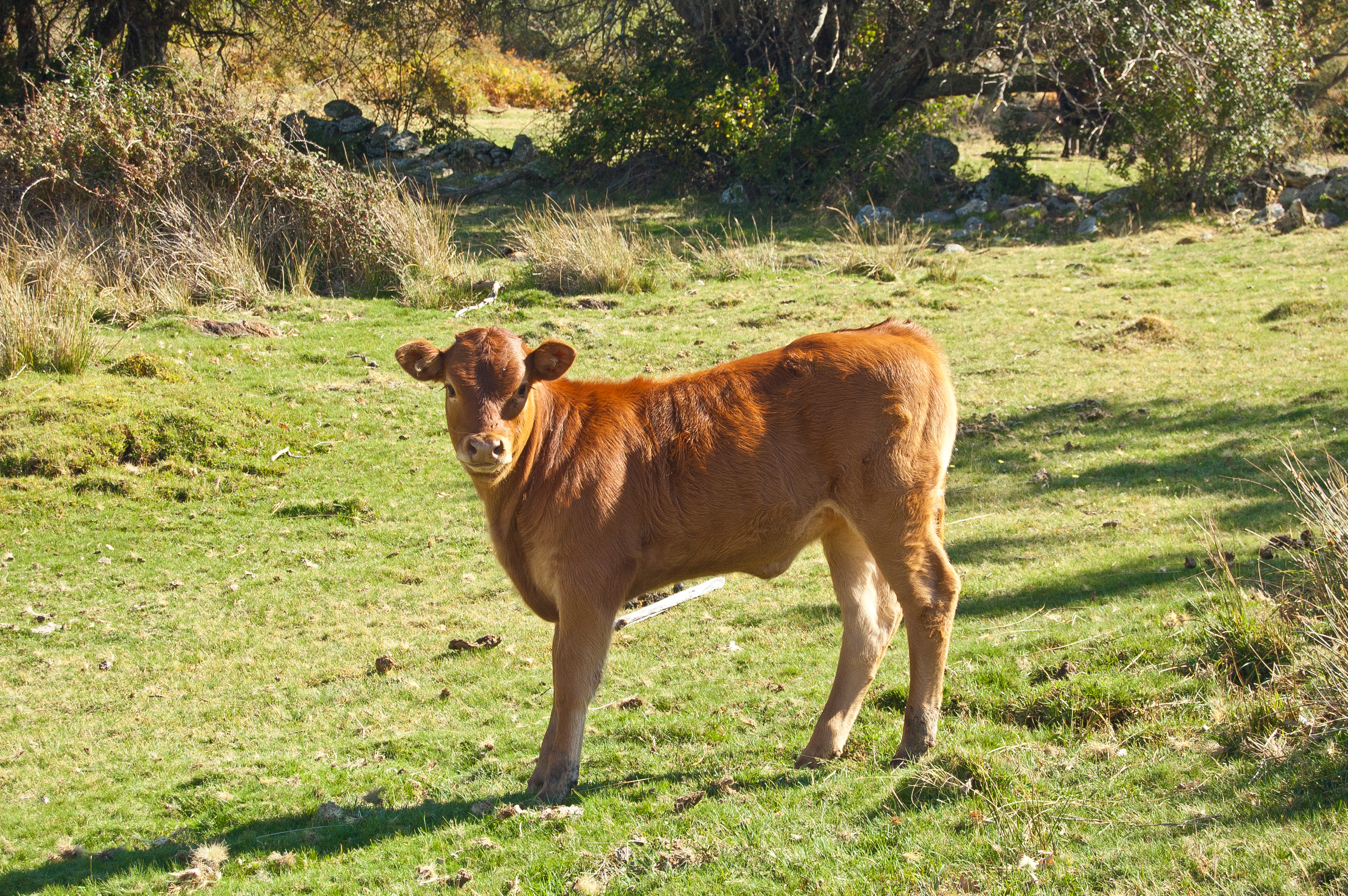
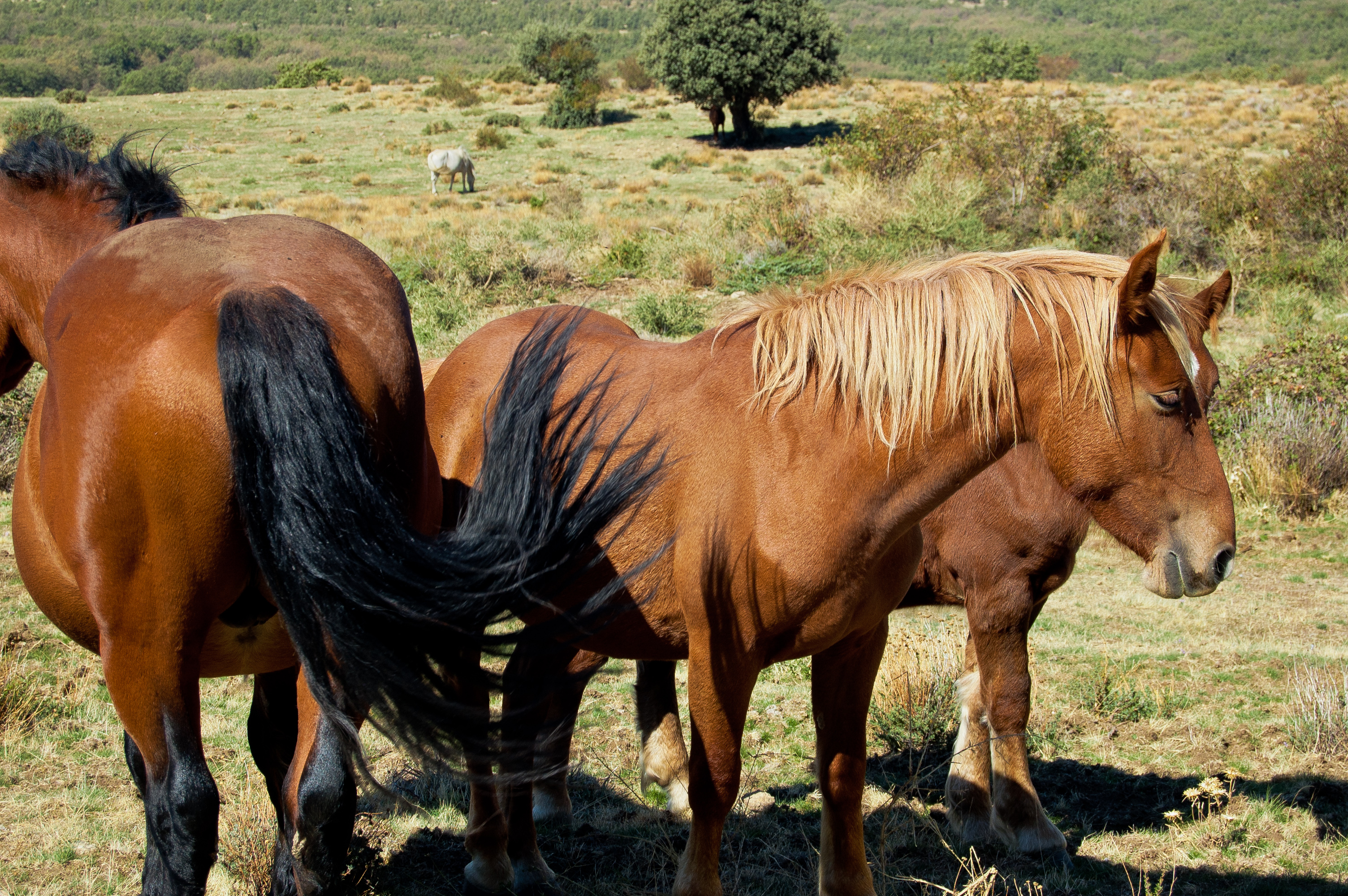
A small patch of black poplar (Populus nigra) surprises the traveller. A few metres down the road, the trail turns left and goes up again to a new gate with a revolving door for pedestrians that leads to the subterranean pass that crosses the old railway line. Once the steepest part of the uphill section has been left behind, the trail goes again softly uphill and downhill, allowing to enjoy the company of the true protagonist of this Nature Trail, that is, the sheep and cattle grazing in the pastures surrounding the Cañada Real Soriana Occidental drover's way.

A few metres after kilometre point 104, the ruins of the old station of Santo Tomé del Puerto may be seen to the left. After crossing a ford, the trail turns left and a section shared by the sixth and seventh stage (which marks the end of the sixth stage and the seventh stage) beings.
The trail returns to the tracing corresponding to the sixth stage and, after the aforementioned turn left, goes down to cross the railway line by a subterranean pass, and to cross a gate with a revolving door for pedestrians afterwards. In this section, Pyrenean oak is the dominant species, and its presence is only interrupted by poplar patch by the banks of the Chorrón creek, to the left of the trail. Shortly afterwards, before entering the village of Villarejo, the traveller shall find the information panel that marks the end of this sixth stage between Arcones and Villarejo, a small village in the municipality of Santo Tomé del Puerto.
Map
Puntos de Interés
Hidrografía
Infraestructura
Orografía
Vegetación
Profile
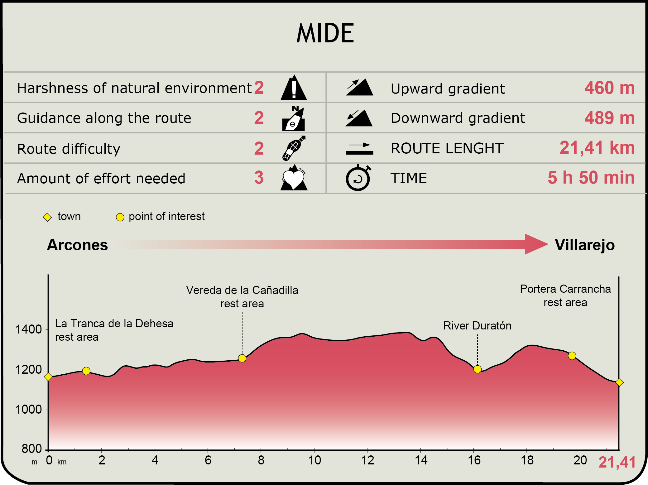
MIDE (Method for the Information of Excursions)
 Harshness of natural environment
- 1. The environment is not risk-free
- 2. There are more than one risk factors
- 3. There are various risk factors
- 4. There are quite a lot of risk factors
- 5. There are many risk factors
 Guidance along the route
- 1. Well defined trails and crossings
- 2. There is a clearly marked trail and signage
- 3. Requires the identification of geographic features and cardinal points
- 4. Requires off-path navigation
- 5. The trail is interrupted by obstacles that have to be gone around
 Route difficulty
- 1. Walking on a flat surface
- 2. Trails with different types of path
- 3. Walking on stepped paths or irregular terrain
- 4. The use of hands or jumping over the terrain is necessary
- 5. The use of hands is required to progress
 Amount of effort needed
- 1. Up to 1 hour of continuous walking
- 2. Between 1 and 3 hours of continuous walking
- 3. Between 3 and 6 hours of continuous walking
- 4. Between 6 and 10 hours of actual walking
- 5. More than 10 hours of continuous walking
Featured
Further information
Santo Tomé del Puerto (Villarejo)
A municipality in the province of Segovia located at the foot of the mountain pass of Somosierra, at the intersection of the A-1 highway and the N-110 road. The municipality is made up of six villages; curiously, the municipality was not named after any of them. Those are Villarejo, Sigueruelo, Siguero, Rosuero, and La Rades.
The medieval origin of the municipality is obvious. Its first building was a shrine which consolidated and grew into an important convent. Located in a strategic area, it was always been a trading station though which goods passed. It is also the site of the Somosierra battle against the Napoleonic troops.
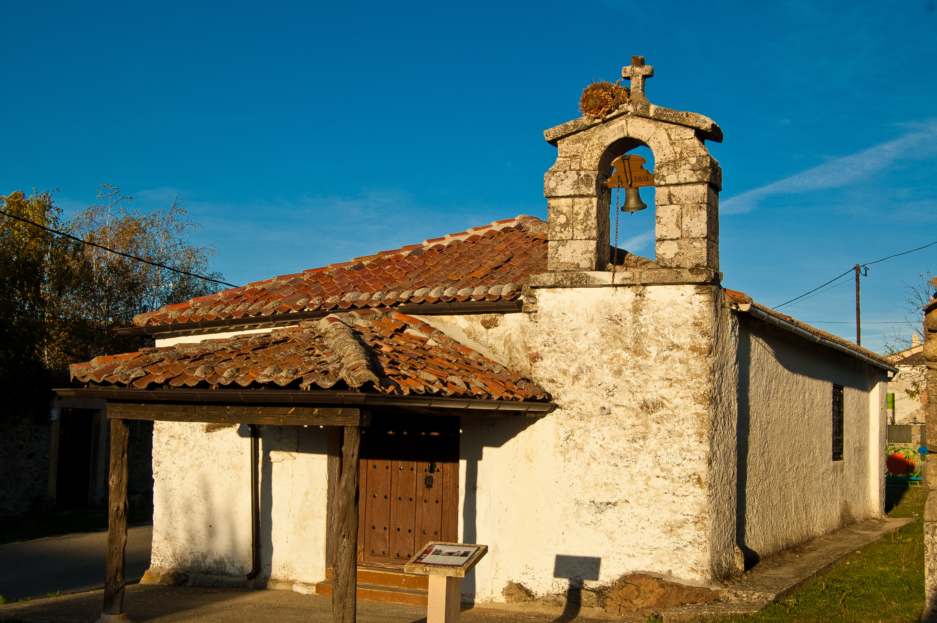
The architectural heritage of the villages that make up the municipality consists mainly in religious buildings, among which the Romanesque church of San Martín de Tour in Siguero, the shrine of San Juan Bautista in Rosuero, the Natividad church in Villarejo and the ruins of the aforementioned convent stand out. The natural landscape is breathtaking, since most of its municipality is included in the Sierra Norte de Guadarrama Natural Park.
Holly forest of Prádena
The Cañada Real Soriana Occidental Nature Trail passes less than a kilometer far from the holly forest of Prádena, one of the most important holly woods in Spain, and probably the southernmost in Europe.
This holly forest is in a good conservation status and, with more than 60 ha, is one of the larger in the Iberian Peninsula, with specimens of great age and size. It stands out for its frondosity, and although it is an almost monospecific forest, there is presence of other species such as common juniperus, privets or rowans. Nevertheless it is in winter when the forest reaches its greatest splendor, when the red brilliant colour of the holly bellies inundates it. This winter fruition has also a great ecological significance as it provides food for many animal species.
Multimedia
Downloads
GPS Downloads
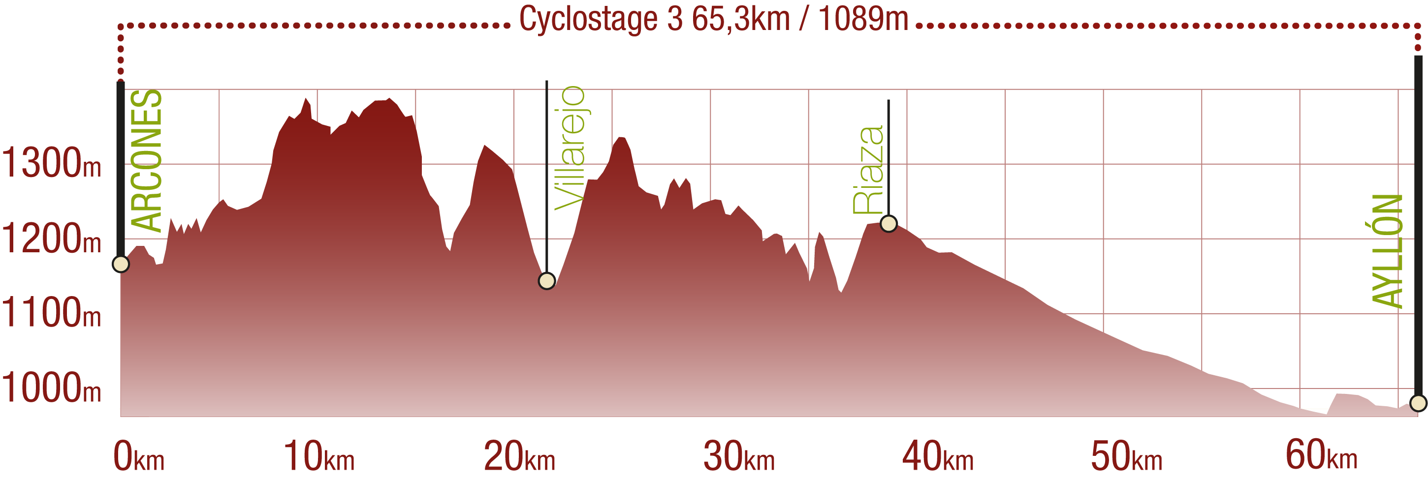
Cyclability
This Cyclostage corresponds to stages 6, 7 & 8 of the Nature Trail
PROFILE
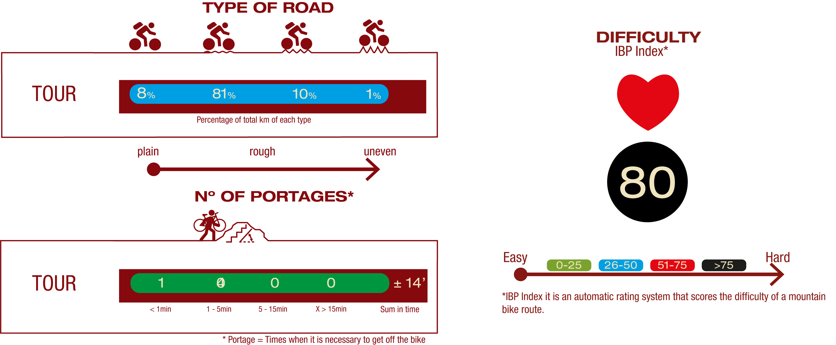
TYPE OF ROAD, PORTAGES & DIFFICULTY
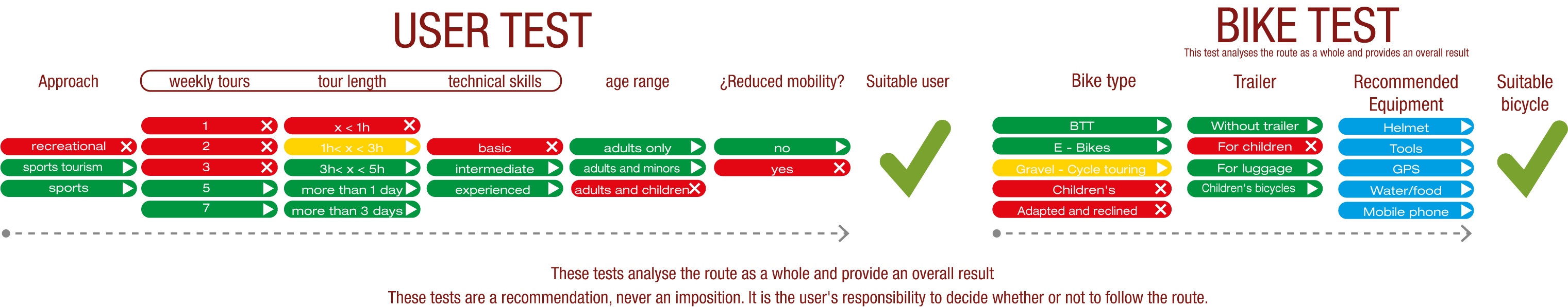
TEST
SAFETY RECOMMENDATIONS
- Sections shared with hikers.
- Transit through the centre of some population centres.
- The Nature Trail presents, in stage 3, the crossing of a paved road across a solid line. Although there is enough visibility, extreme caution, and crossing dismounted, is advised.
GENERAL RECOMMENDATIONS
- Find out about the technical aspects of the route and the weather on the day.
- Take care of the environment. Take care not to disturb animals or damage vegetation. Respect private areas.
- You must give priority to pedestrians and comply with general traffic rules.
- The environment in which you will be riding is open, free to move around and an area where many activities are carried out (sporting, forestry, livestock and agricultural activities). Always have an understanding, prudent, responsible and respectful attitude.