
- Home
- Rural Development
- Nature Trails
- Nature Trails
- Central Sector
- Cañada Real Soriana Occidental
Stage 3: Embalse del Pontón Alto – Collado Hermoso
Description
This stage runs entirely along the Cañada Real Soriana Occidental, between the Merinas bridge and the traditional resting areas close to shearing houses.
From the beginning of this stage, tokens of the traditional use of the Cañada Real Soriana Occidental dot the way. An evidence of this is that the route crosses, among others, the narrow Merinas bridge, used for counting sheep, the Rancho de la Marquesa ranch and the resting area called Descansadero de Torrecaballeros. Besides, the trail is crossed by many creeks and at all moments the line of peaks of Sierra del Guadarrama is seen to the right and to the left several villages are encountered as the trail progresses: Palazuelos de Eresma, San Cristóbal de Segovia and Torrecaballeros. In the last section, the trail crosses the pretty village of Sotosalbos before reaching the end of the stage in Collado Hermoso.
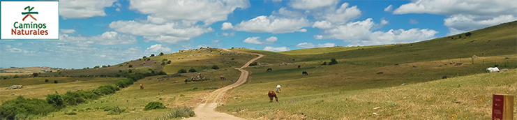
The third stage on the Cañada Real Soriana Occidental Nature Trails starts in the interpretation panel which marks the start of the stage, and is located next to the service building of the dam of the Pontón reservoir. This stage runs for almost 20 km between the dam and the town of Collado Hermoso.
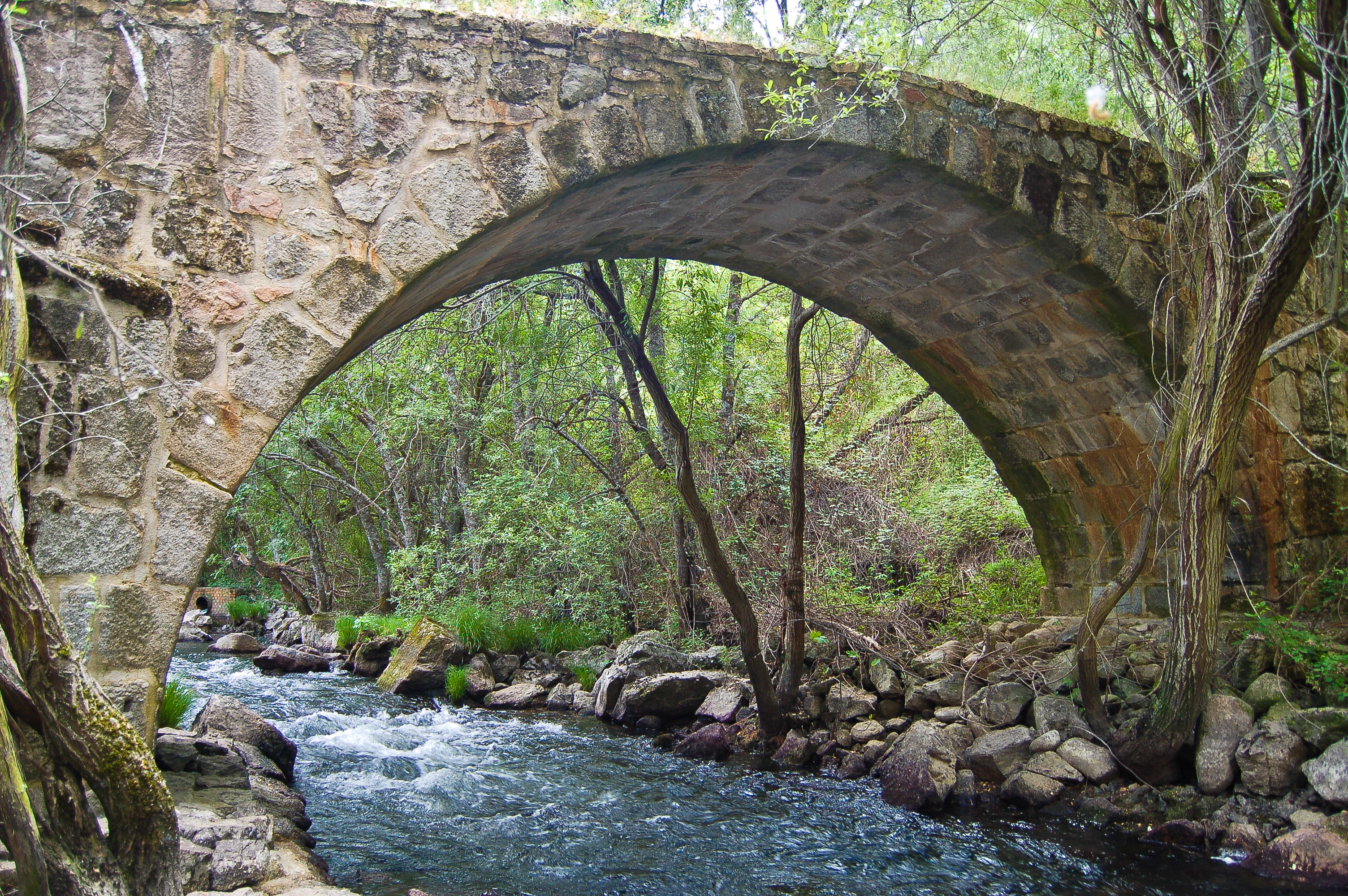
The traveller begins by descending, under the steady eye of the dam, to the banks of the River Eresma, downstream of the reservoir. When it reaches the river, a short path leads them to the Merinas bridge, used in the past by countless sheep and today by trekkers and bikers to cross the river. After the bridge, the trail zigzags up to kilometre point 42, and shares the tracing with the Alto Eresma Greenway until the information panel which signals this route.
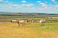
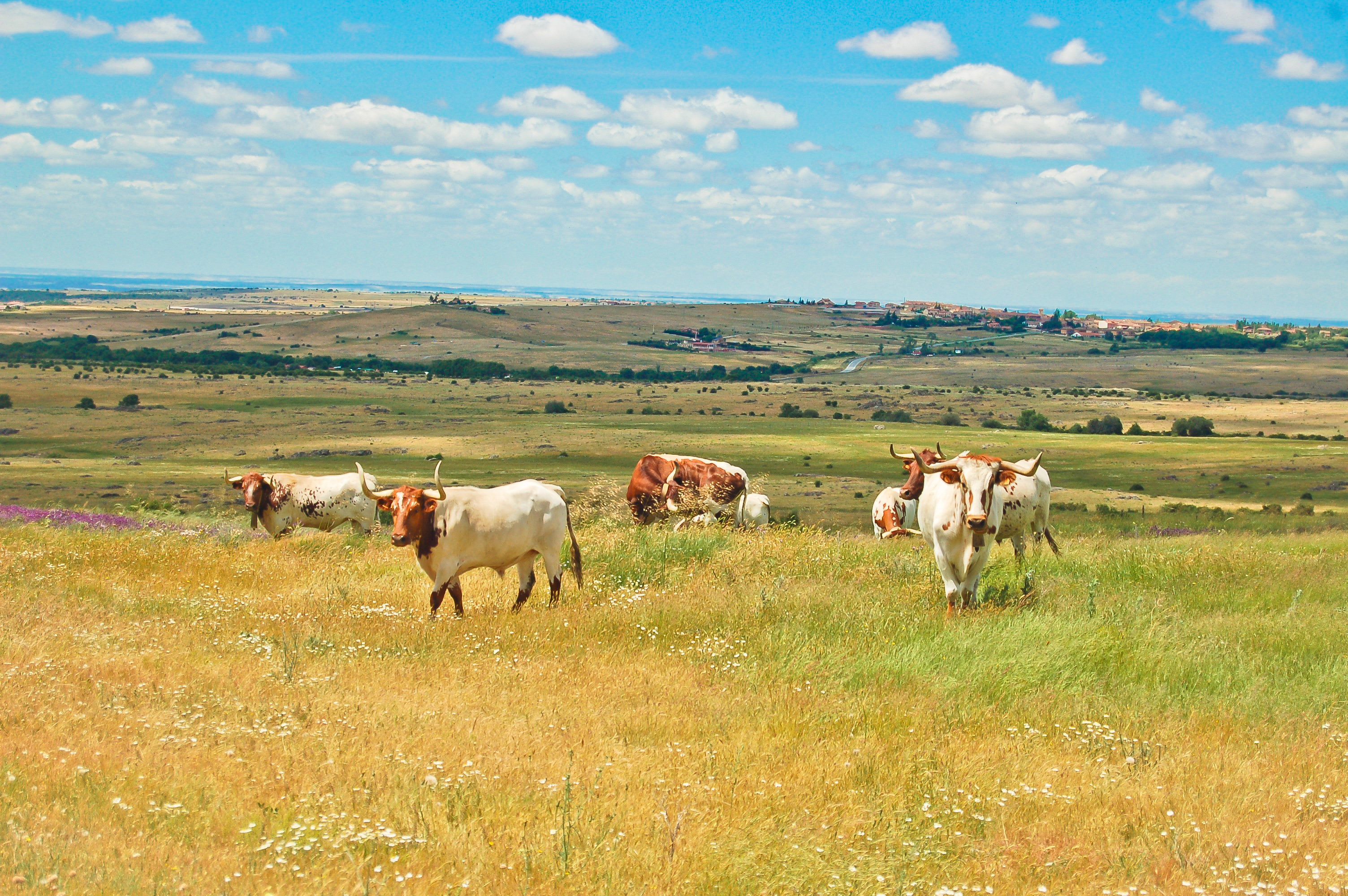
The Nature Trail continues along this wide path along a succession of ups and downs to the point where it crosses the SG-P-6121 road (please proceed with utmost care). The tracing goes across pastures where livestock, cattle mainly, graze. The Sierra de Guadarrama provides a magnificent backdrop to the right, and to the left, panoramic views of San Cristóbal de Segovia, Palazuelos de Eresma and even the monumental city of Segovia may be admired.
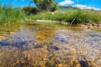
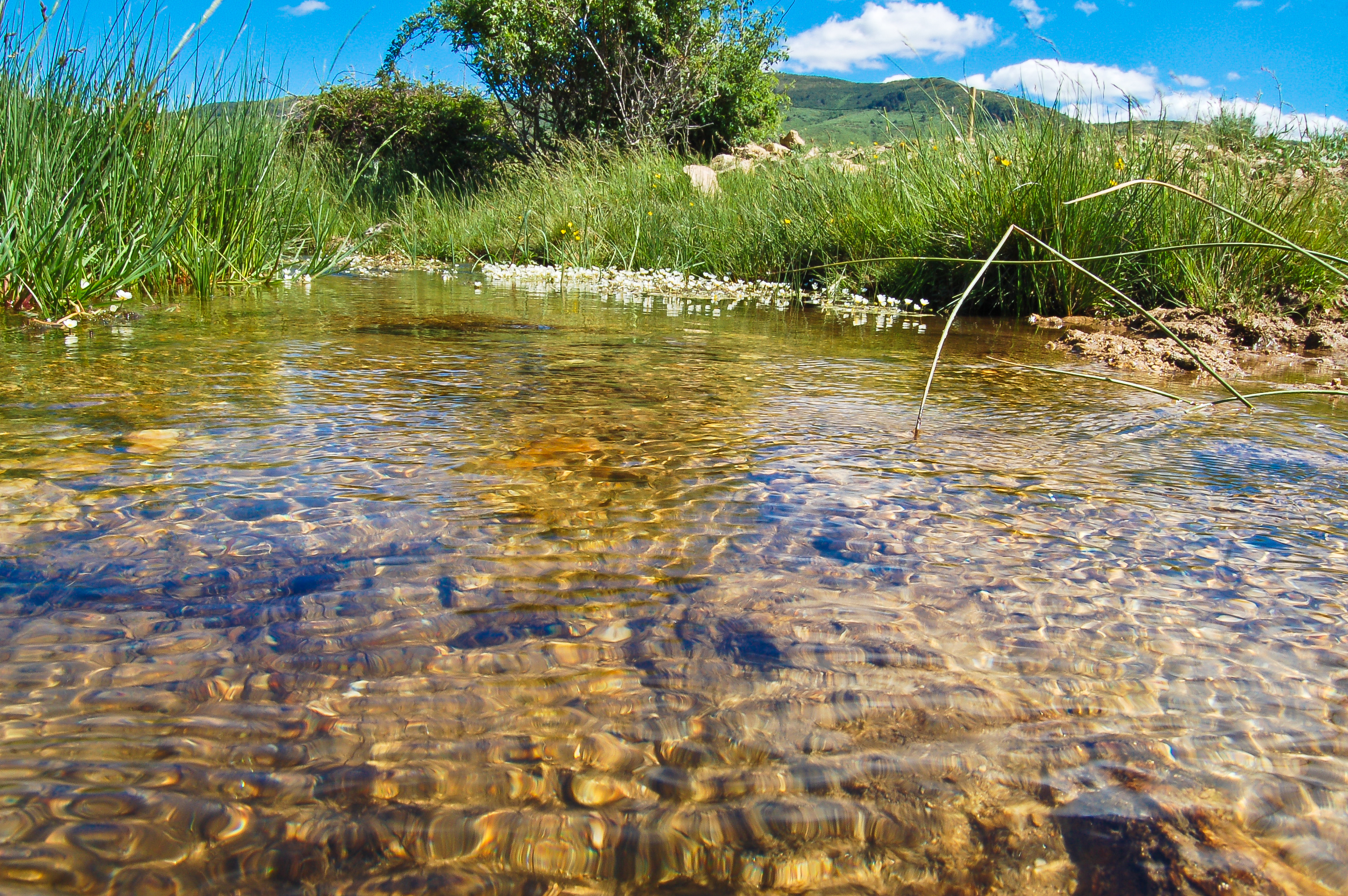
After passing kilometre point 46, the road crosses the Torreiniesta creek, a tributary of the river Eresma, and afterwards the Peñas Lisas creek. Meanwhile, the traveller leaves to their left small patches of Scots pine (Pinus sylvestris) and the town of Trescasas hidden behind them.
Evidence of livestock farming dot the way, such as the Rancho de la Marquesa by the Miguel Bueno creek, which was used to keep the sheep that were to be sheared in the Cabanillas del Monte shearing house.
The following sections of the road alternate uphill and downhill sections until reaching kilometre point 50, where the road leaves the town of Torrecaballeros to its left. In this region, spring brings an explosion of colours, and the abundance and diversity of vegetation turn the hills of Sierra de Guadarrama into veritable carpets full of different colours and smells.
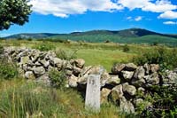
To the left of the road, at a crossroads, stands the traditional resting area called Descansadero de Torrecaballeros, still used today. The trail leaves behind kilometre point 52 and again goes uphill and downhill crossing many small creeks that come down from the mountains. After crossing a creek in the area known as Peña del Gato, the road hits kilometre point 53.
One kilometre after, the trail is crossed by a wide path and shortly afterwards arrives at a gate; to the right of this gate, a revolving door for pedestrians precedes the wooden bridge over the Pirón river, where it is not uncommon to see cattle drinking from the river. The trail, marked by the milestones of the cattle road, goes up, and after kilometre point 55, several crossroads are found; one of them, to the left of the trail, leads to the town of Santo Domingo de Pirón.
The trail continues, leaving one of the resting areas of the Cañada Real, today dotted with Scots pines to the right. The trail continues northbound, and crosses the N-110 road after passing through cattle grids and gates at both sides of the road, designed to prevent livestock to reach the road; consequently, the gates must be perfectly closed at all times.
By the wide path, the trail goes slightly east, where the Garganta creek provides sufficient water for ash trees (Fraxinus angustifolia) to grow health and green. When the creek banks are left behind, the Pyrenean oak (Quercus pyrenaica) becomes the dominant species. The trail zigzags, crosses the cattle grids and crosses the river over the Sotosalbos river, before entering the town of the same name.
The trail continues by an asphalt road by the Camino Segovia, turns right by Calle de las Eras and crosses the road SG-V-2366 by the zebra crossing. Once the road has been crossed, the trail continues along Camino Segovia, leaves the town sports court and finally leaves the town behind. After crossing a cattle grid the trail becomes a dirt path again and shortly afterwards (after crossing a new cattle grid) runs parallel to the road N-110-.
The river Viejo is crossed by means of a short wooden bridge and shortly after leaving behind kilometre point 61 the trail crosses again the road N-110 (please proceed with utmost care) to arrive to the town of Collado Hermoso. Shortly afterwards, leaving the church of San Nicolás de Bari to the right and a small pretty park to the left, the road arrives to the information panel that marks the end of this third stage of the Cañada Real Soriana Occidental Nature Trail between the Pontón Alto reservoir and Collado Hermoso.
Map
Puntos de Interés
Información
Orografía
Profile
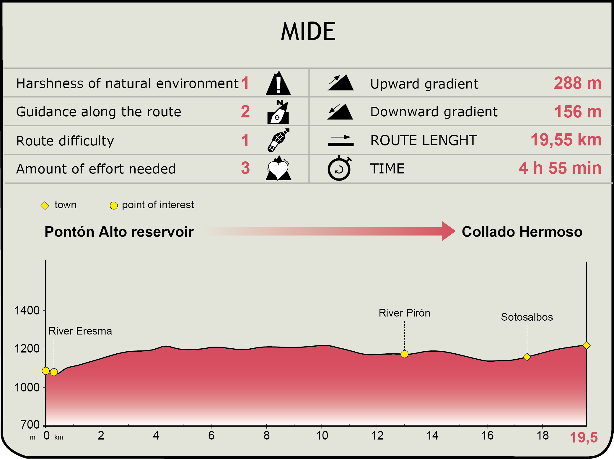
MIDE (Method for the Information of Excursions)
 Harshness of natural environment
- 1. The environment is not risk-free
- 2. There are more than one risk factors
- 3. There are various risk factors
- 4. There are quite a lot of risk factors
- 5. There are many risk factors
 Guidance along the route
- 1. Well defined trails and crossings
- 2. There is a clearly marked trail and signage
- 3. Requires the identification of geographic features and cardinal points
- 4. Requires off-path navigation
- 5. The trail is interrupted by obstacles that have to be gone around
 Route difficulty
- 1. Walking on a flat surface
- 2. Trails with different types of path
- 3. Walking on stepped paths or irregular terrain
- 4. The use of hands or jumping over the terrain is necessary
- 5. The use of hands is required to progress
 Amount of effort needed
- 1. Up to 1 hour of continuous walking
- 2. Between 1 and 3 hours of continuous walking
- 3. Between 3 and 6 hours of continuous walking
- 4. Between 6 and 10 hours of actual walking
- 5. More than 10 hours of continuous walking
Featured
Further information
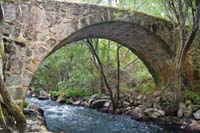
Merinas bridge
The Merinas bridge was named after the Merino sheep breed which used this bridge to cross the river Eresma. Besides, the bridge was used as a counting station for counting the number of sheep crossing it, for the purposes of levying the appropriate taxes. Built in stone, with a single arch design, it is narrower at its centre than at its edges. When the Pontón Alto reservoir was built, the Merinas bridge was dismantled stone by stone and re-built as it originally was.
Sotosalbos
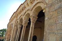
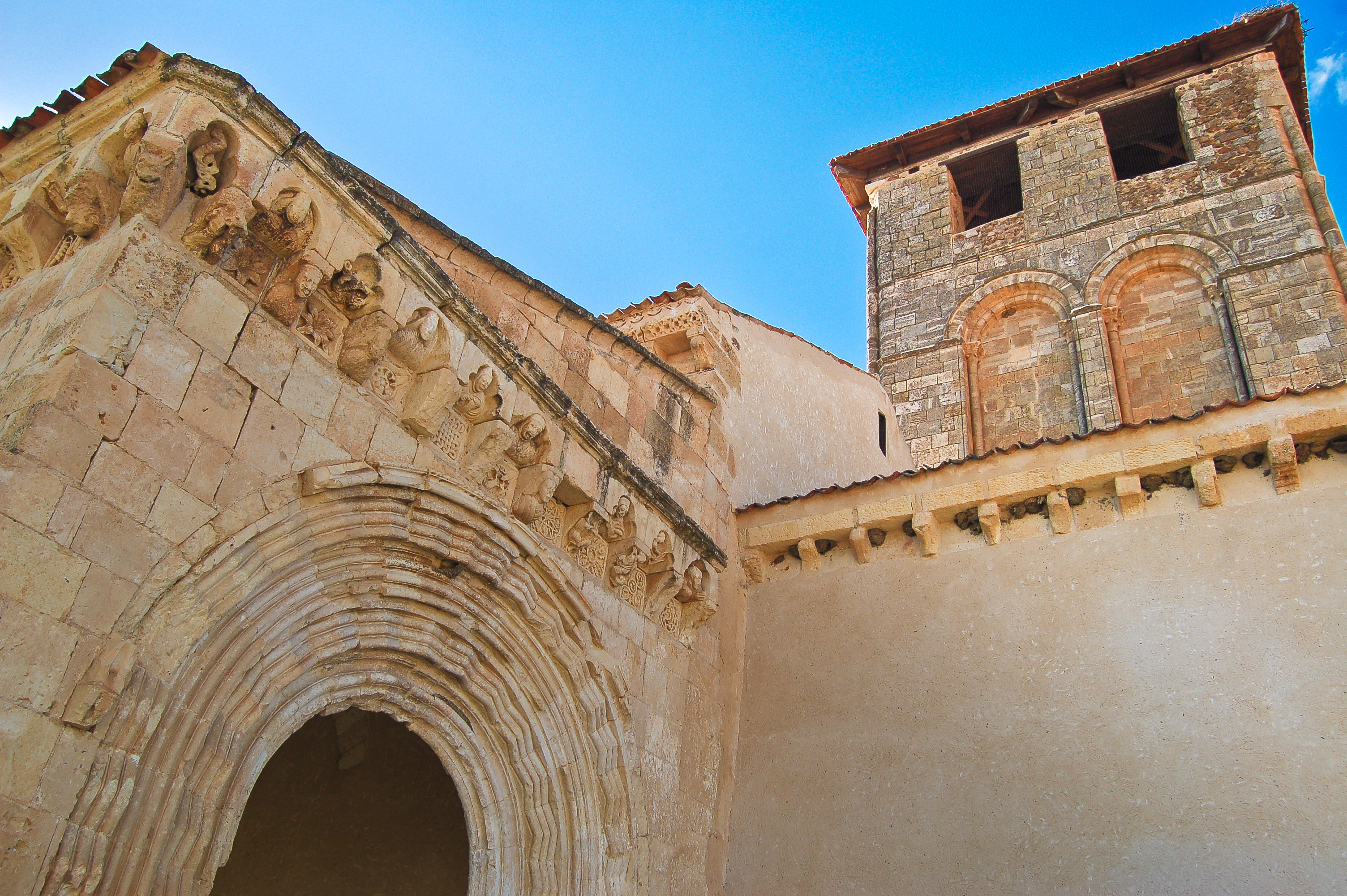
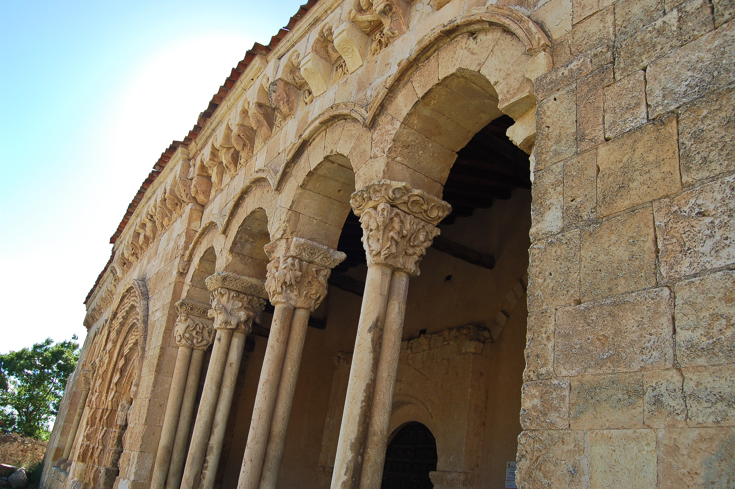
Small pretty town in the province of Segovia named after its location: a riverside landscape (or "soto", in Spanish) crossed by several streams and springs and dotted since ancient times by white poplars ("albo" meaning white in Spanish). Among its architectural heritage, the church of San Miguel is especially noteworthy, built in the XII century in Romanesque style, the church boasts a portico with columns finished in chapiters of different decorations and spectacular beauty. The town's economy is based on tourism and livestock farming. Evidence of this livestock farming tradition is, for example, an ancient and well preserved shoeing crush. The patron saint festivities are held forty days after Easter in honours of Nuestra Señora de la Sierra and on the 29th September in honour of San Miguel Arcángel.
Multimedia

Downloads
GPS Downloads
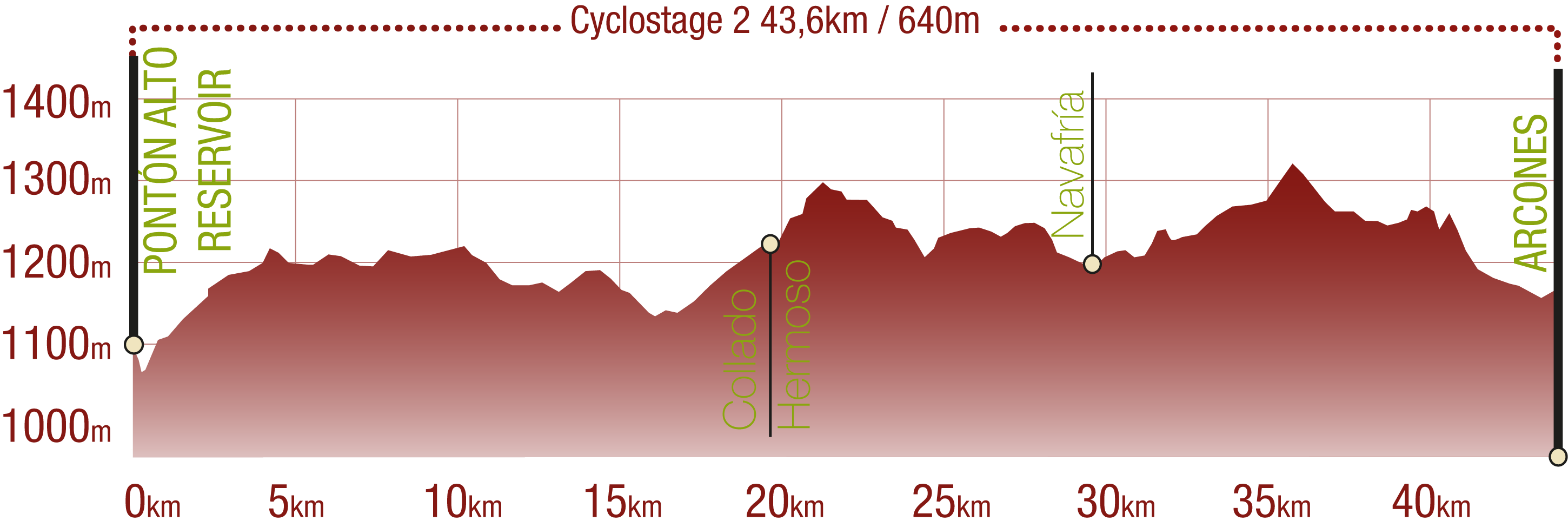
Cyclability
This Cyclostage corresponds to stages 3, 4 & 5 of the Nature Trail
PROFILE
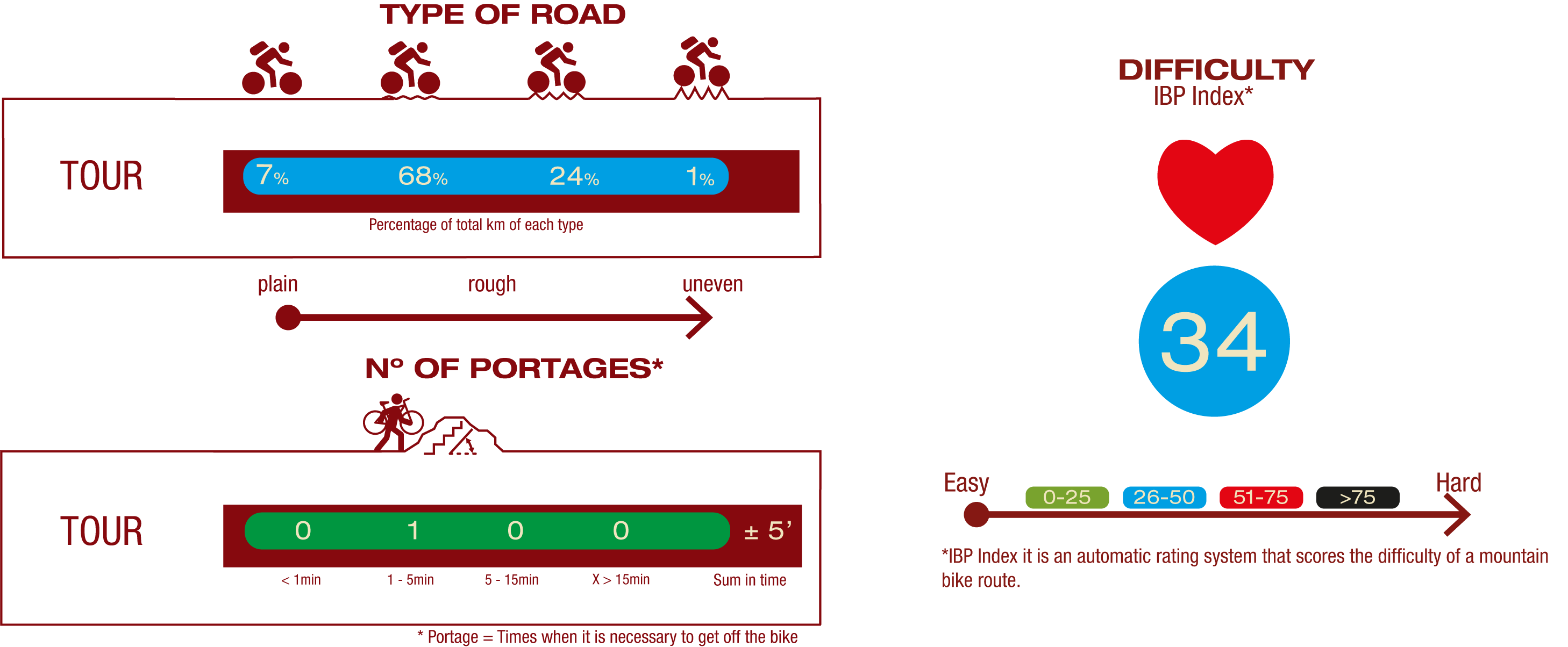
TYPE OF ROAD, PORTAGES & DIFFICULTY
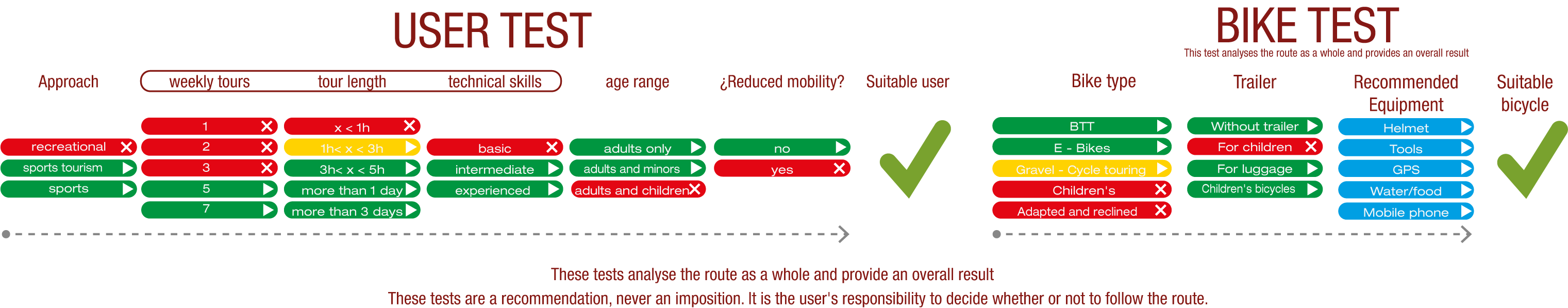
TEST
SAFETY RECOMMENDATIONS
- Sections shared with hikers.
- Transit through the centre of some population centres.
- The Nature Trail presents, in stage 3, the crossing of a paved road across a solid line. Although there is enough visibility, extreme caution, and crossing dismounted, is advised.
GENERAL RECOMMENDATIONS
- Find out about the technical aspects of the route and the weather on the day.
- Take care of the environment. Take care not to disturb animals or damage vegetation. Respect private areas.
- You must give priority to pedestrians and comply with general traffic rules.
- The environment in which you will be riding is open, free to move around and an area where many activities are carried out (sporting, forestry, livestock and agricultural activities). Always have an understanding, prudent, responsible and respectful attitude.