
- Home
- Rural Development
- Nature Trails
- Nature Trails
- Central Sector
- Cañada Real Soriana Occidental
Stage 2: Otero de Herreros-Embalse del Pontón Alto
Description
Rivers and creeks flow down from the Sierra de Guadarrama to the monumental city of Segovia.
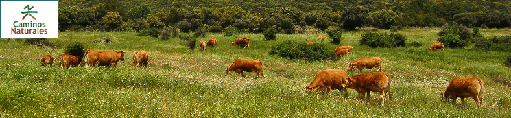
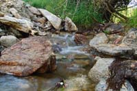
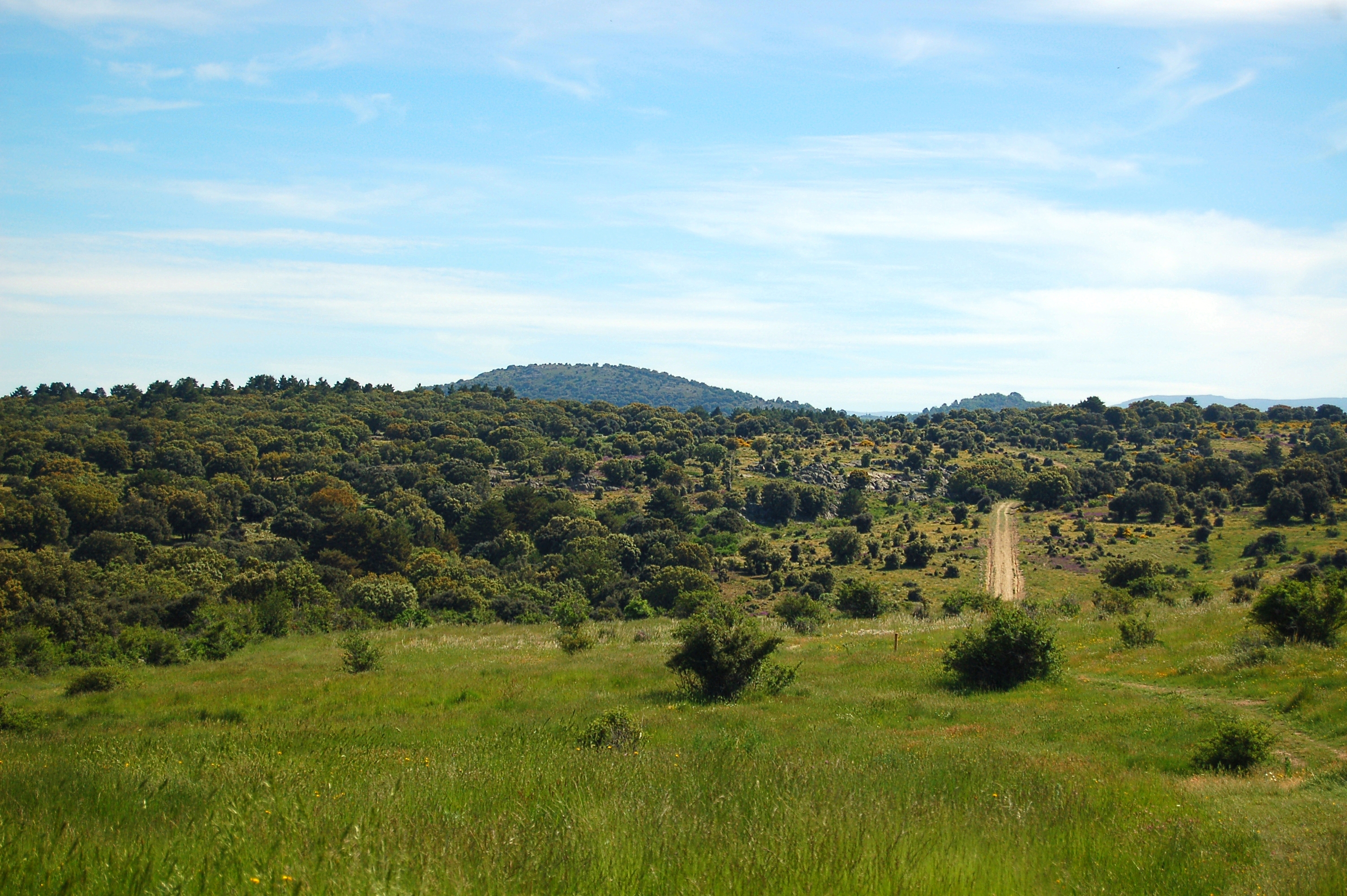
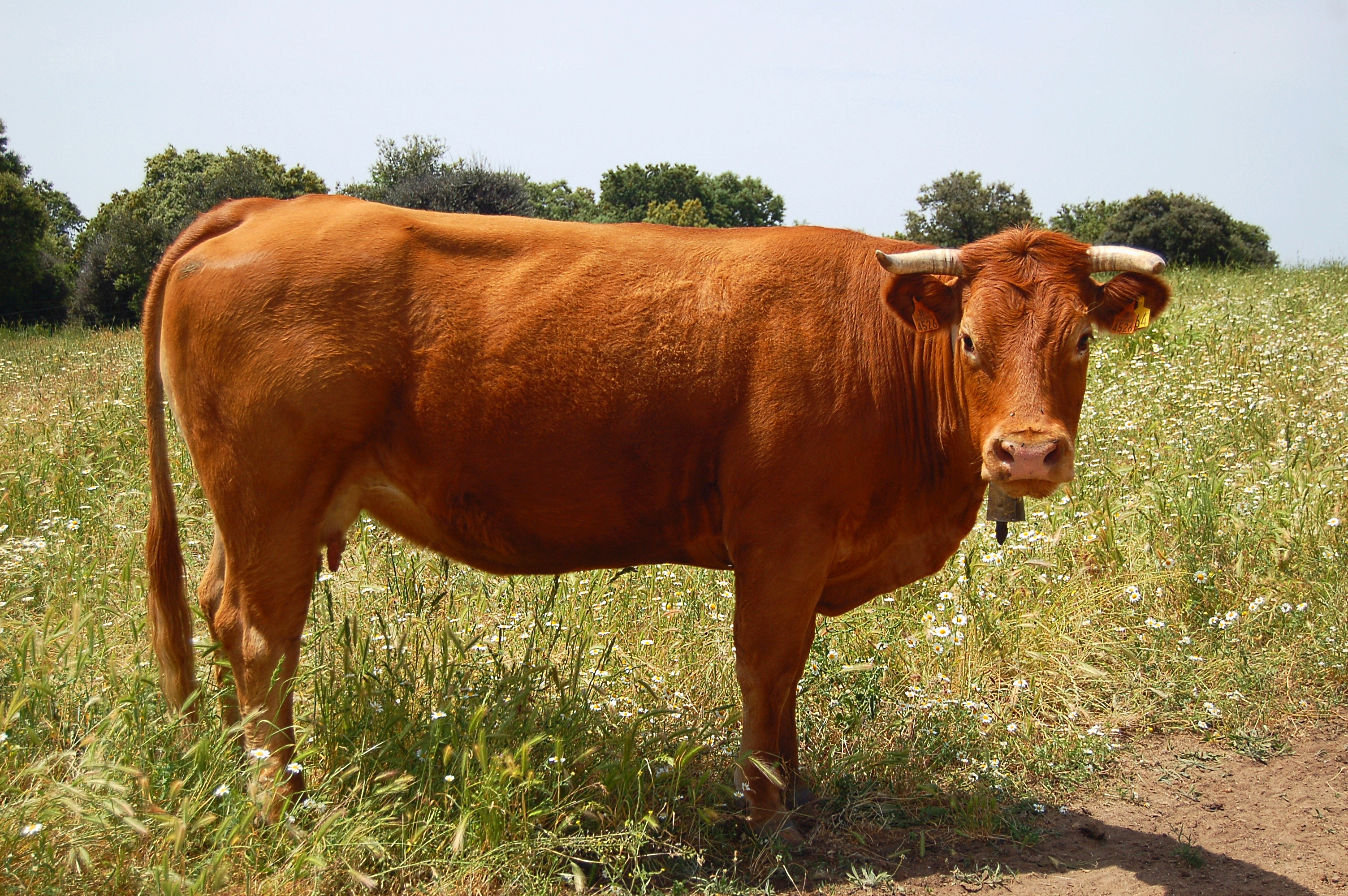
The drovers’ road, and therefore the trail, runs at mid-slope level across the Sierra de Guadarrama. In this section, a succession of rivers (Milanillos, Peces and Acebeda) and creeks (Víboras, Pedrona, Pedriza, Fuentecillas,…) cross the trail. The lush vegetation includes masses of Scots pines and passes of oaks with high-quality pastures, dotted with many aromatic plant species, on which livestock feeds.
The second stage of the Cañada Real Soriana Occidental Nature Trails runs between the town of Otero de Herreros and the Pontón reservoir. This stage, over 21 km long, starts at the same information panel where the previous stage ended, at kilometre point 20 of the trail.
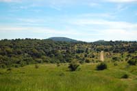
The stage starts by leaving to the railway tracks to the line and the suburban area of Otero de Herreros to the left. Once the last houses are left behind, the road travels between the aforementioned railway line and the AP-61 highway, a pleasant downhill section from where the traveller may admire, to their left, the monumental city of Segovia.
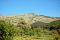
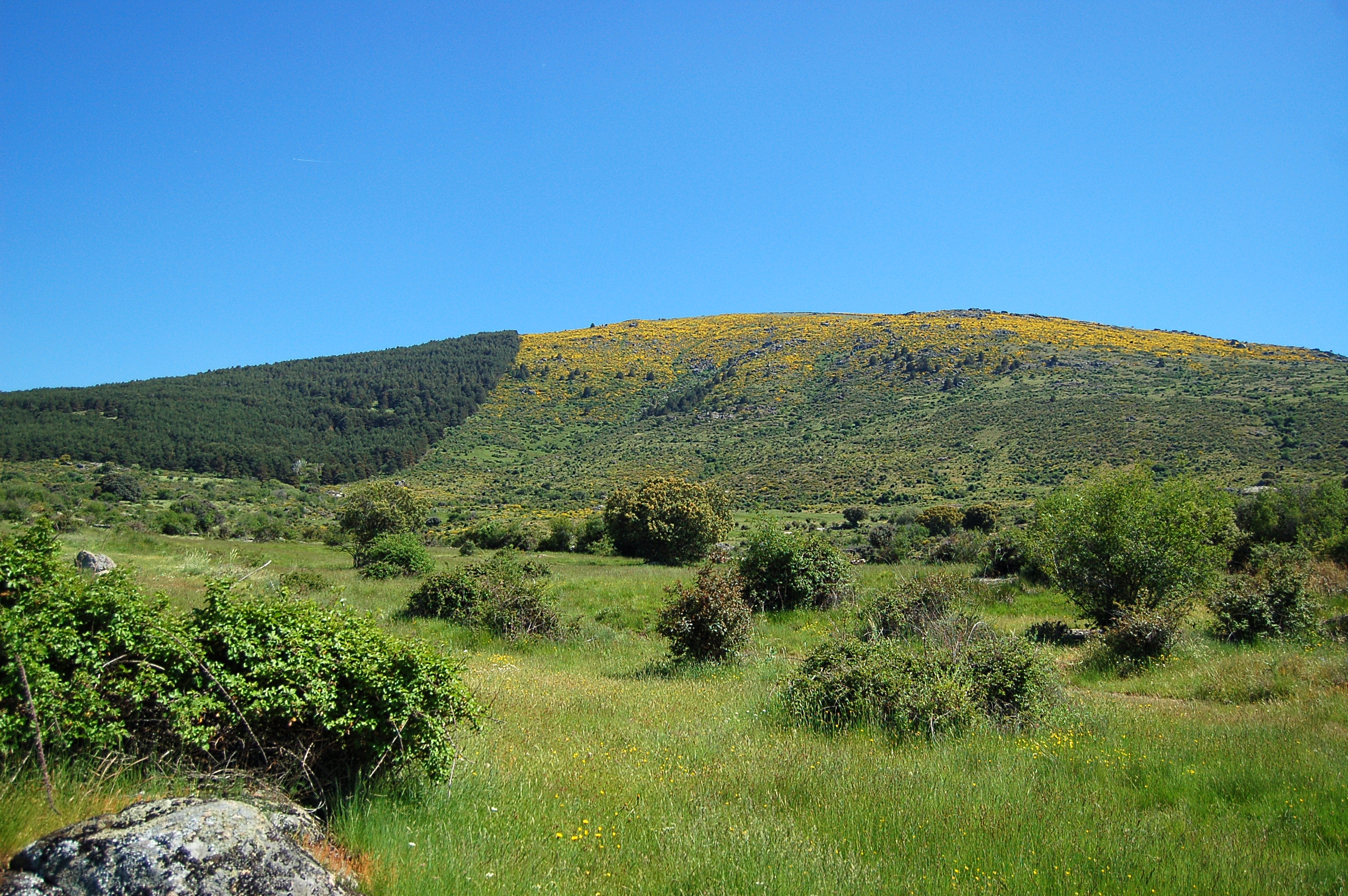
Shortly after leaving behind, to the left, the highway's toll booth, the trail crosses the railway tracks by means of a subterranean pass and starts rgoing up a hill to kilometre point 24, where the traveller may enjoy the landscape known as Ladera Pelada.
The trail continues, alternating mild ups and downs, along the Cañada Real Soriana Occidental drover's way, where the presence of cattle accompanies the traveller almost permanently. The trail crosses the Milanillos river and finds a resting area where the traveller can recover their strength in a pretty environment surrounded by riverside vegetation.
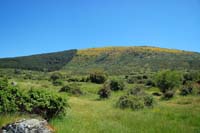
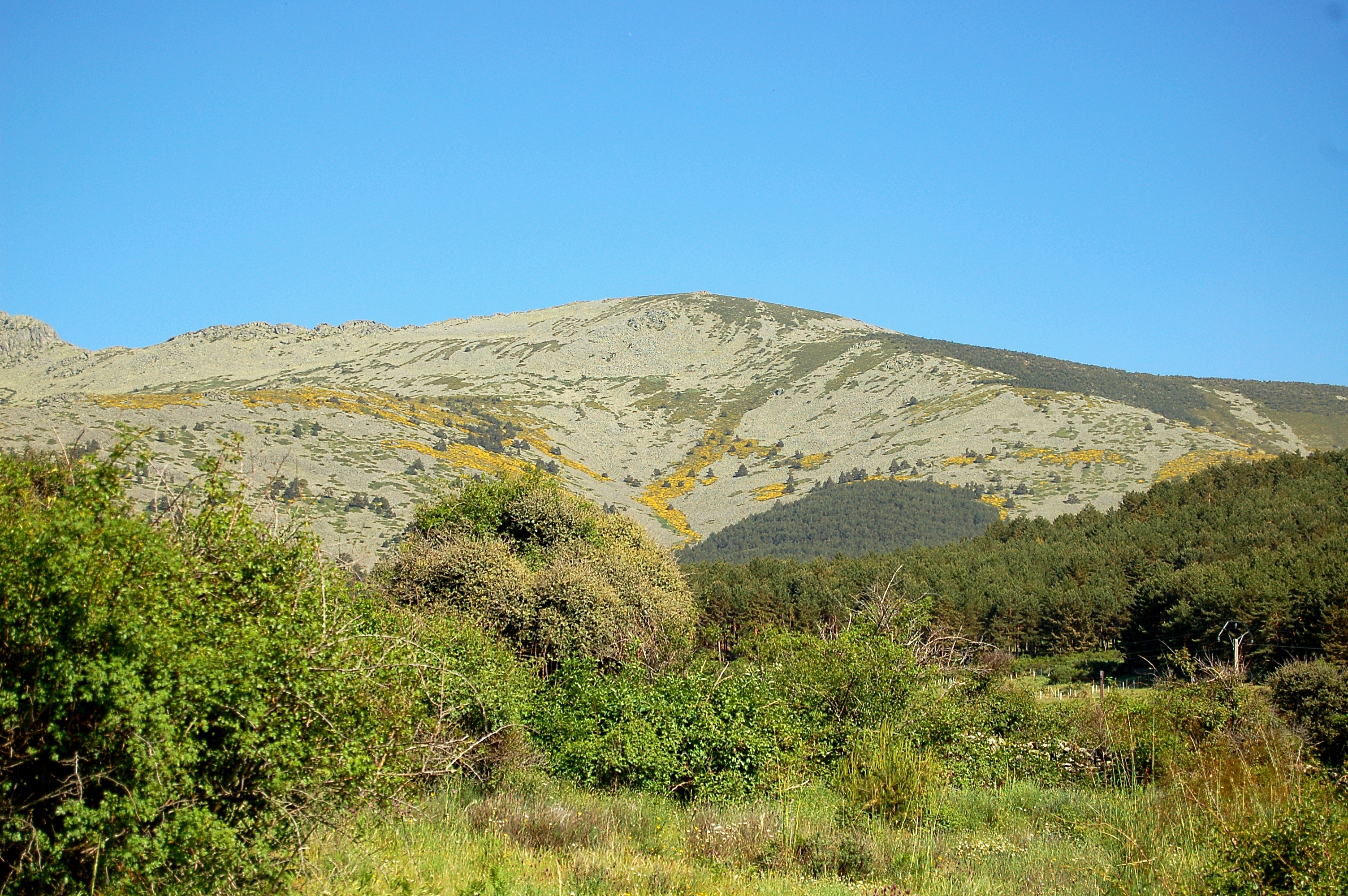
The route continues until reaching kilometre point 27, allowing the travellers to enjoy the beautiful landscape known as La Mujer Muerta. Walking along the drover's way allows to see, to the left of the road, villages such as Ortigosa del Monte and La Losa.
The trail crosses the Víboras creek and shortly afterwards comes to a crossroads with other trails: Puerto de Pasapán – Peña del Oso Route and Hills of La Mujer Muerta. Masses of Scots pines (Pinus sylvestris) become more abundant, especially in the upper part of the slope.
To the left of the tracing and after passing kilometre point 28, there is a granite fountain paying homage to a farmer, Paco Hombre Campero, who, years back, while he was taking care of his cattle, was trapped in a bog from where he almost couldn't get out. From that time, a spring appeared in the place, over which the granite fountain was built.
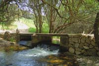
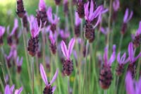
After crossing the Pedrona creek the trail reaches kilometre point 29, after which a gate with a revolving door to its right for pedestrians can be found. The trail continues until reaching the reservoir on the river Peces, a place from which a change in vegetation may be observed: the dominant pastures become now an oak (Quercus ilex) forest accompanied by aromatic flower species such as lavender or Spanish lavender (Lavandula stoechas subsp. pedunculata).
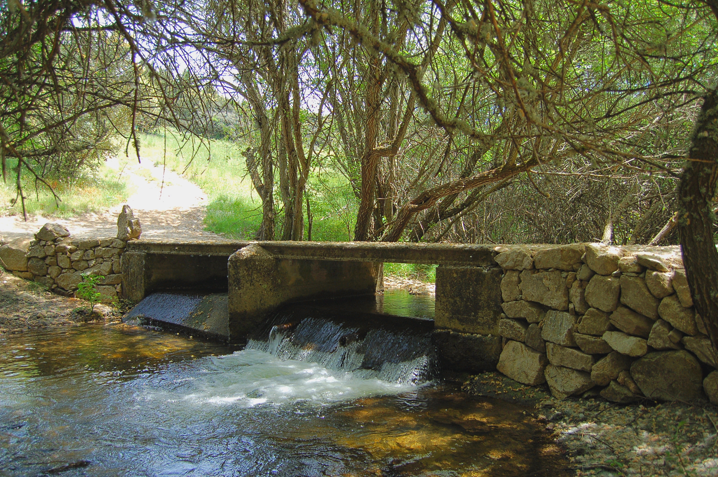
The drover's way crosses a new creek, the Pedriza creek, and shortly afterwards the river Peces, both of which discharge in the aforementioned reservoir. Once kilometre point 31 has been left behind, the road comes to a new gate after which the road goes down and slowly becomes a narrow path. The descent increases its slope, among specimens of Scots pines (Pinus sylvestris). After passing through a new gate and, shortly afterwards, hitting kilometre point 33, the Puente Alta reservoir can be seen. The slope ends at the bridge which crosses over the La Acebeda river.
From this point, the road goes up to a parking lot and continues by an asphalt road, from which the reservoir that lies on the left may be admired. The route continues by taking the first path to the right, which starts by a short, very steep climb. Then, it descends to the Hontoria canal and goes up again, under the gaze of the grazing cattle, until it reaches kilometre point 34 and a new gate.
In a little over a kilometre the tracing of the Roman Way intersects with that of the Cañada Real Soriana Occidental drover's way. After crossing a new gate, the trail goes through a dense oak patch, which dwindles by kilometre point 36. The oak branches make natural frames for the spectacular panoramic views of the city of Segovia.
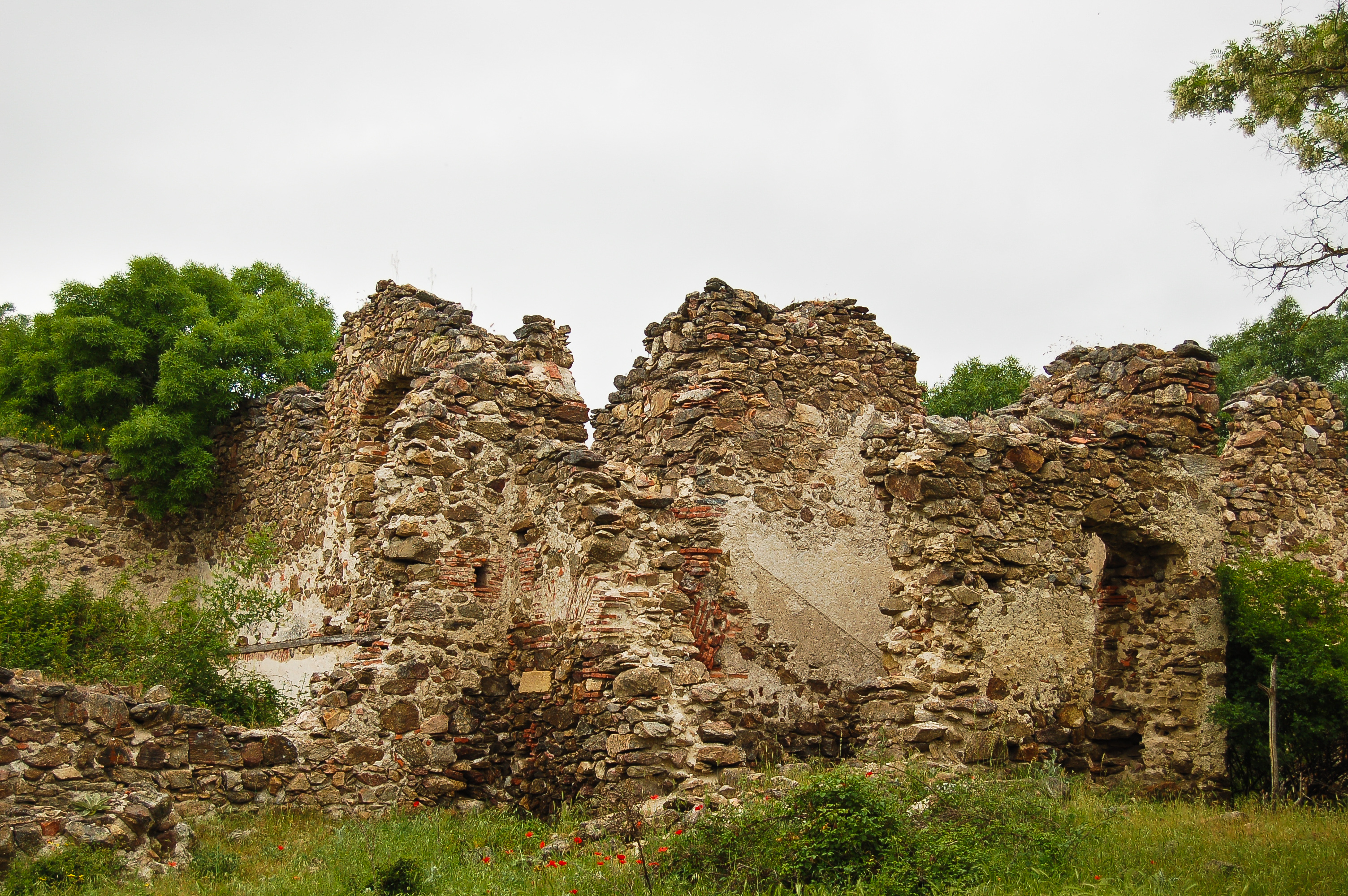
The road zigzags down the slope so that it is not so steep. The descending section ends when the trial arrives to the Fuentecillas creek, after which it goes up to a livestock stable. Back on a wide dirt path, the Cañada Real Soriana Occidental crosses the cattle road called Cordel de Santillana, where the ruins of the most important shearing house that was ever built in Segovia, the Santillana shearing house, remain. Besides, the Way of Saint James crosses the drover's way at this same point, as evidenced by a granite milestone carved with the traditional scallop indicates that there are still 586 km to go before reaching Santiago.

The road goes down again, passes kilometre point 38 and crosses a small creek. After a slight slope, a new gate with a revolving door for pedestrians, meets the traveller. Trees become gradually more sparse and the traveller, with utmost care, must cross the road called as Ruta de los Reales Sitios (Route of Royal Sites). After this crossing, kilometre point 39 is reached, and, shortly afterwards, the suburban area of Parque Robledo. The trail continues, leaving the houses to the left and crossing a new gate and the road CL-601, again with utmost care.
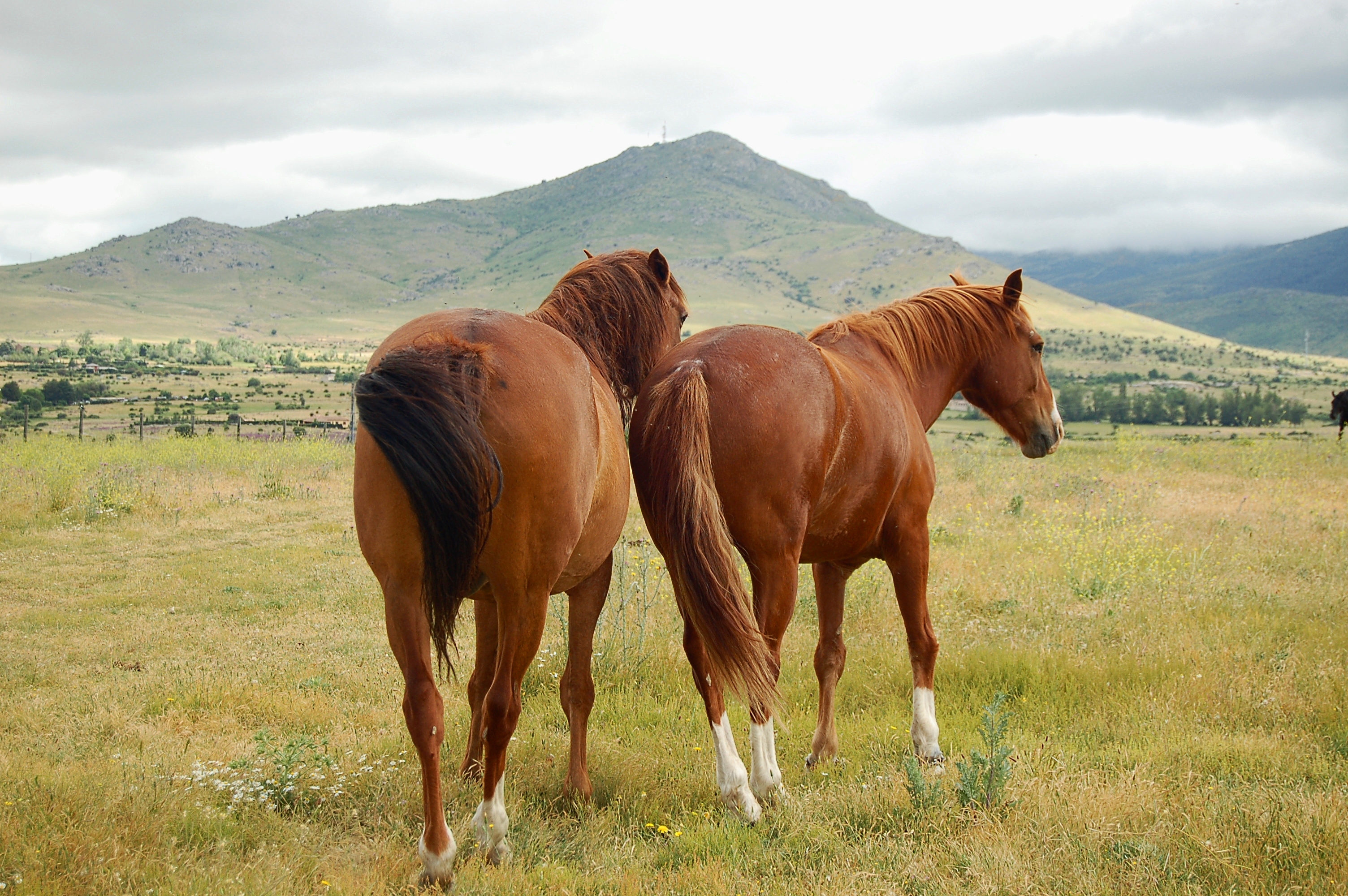
Shortly afterwards, the road hits a new gate and afterwards a meadow where sometimes beautiful horses graze and rest. The trail becomes a narrow path, leaves behind kilometre point 41, crosses a small creek, climbs a slope and arrives at the interpretation panel which signals the end of the second stage of the Cañada Real Soriana Occidental Nature Trails, which is located next to the service buildings of the Pontón Alto reservoir, from where the dam of the reservoir can be seen.
Map
Puntos de Interés
Vegetación
Profile
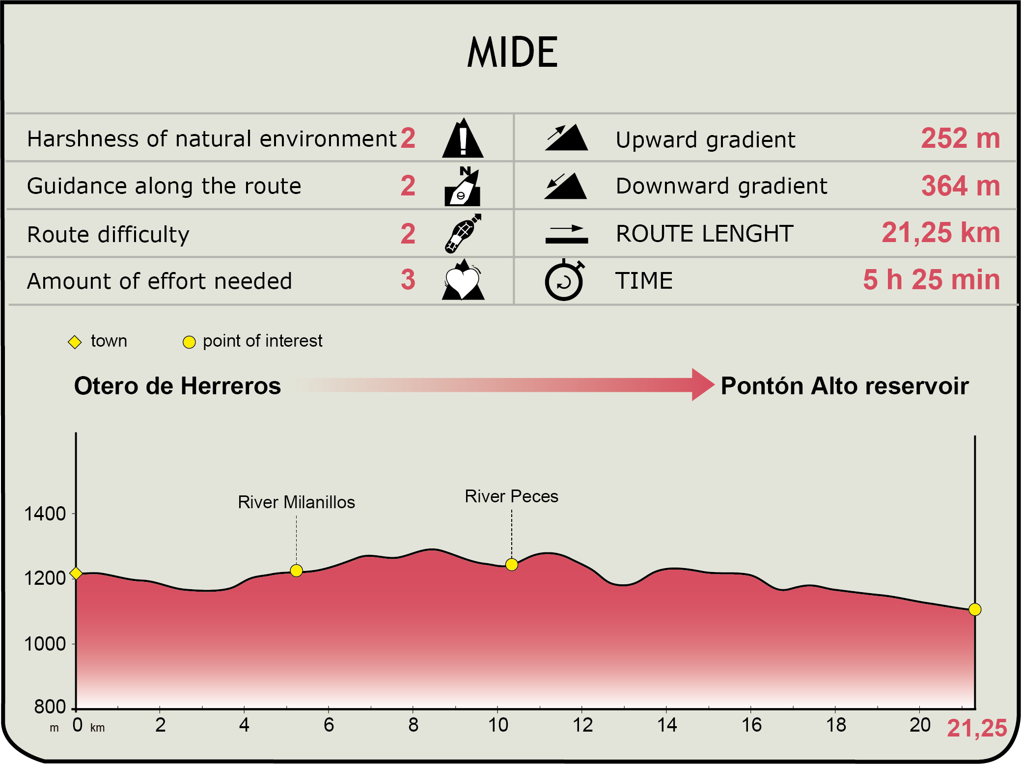
MIDE (Method for the Information of Excursions)
 Harshness of natural environment
- 1. The environment is not risk-free
- 2. There are more than one risk factors
- 3. There are various risk factors
- 4. There are quite a lot of risk factors
- 5. There are many risk factors
 Guidance along the route
- 1. Well defined trails and crossings
- 2. There is a clearly marked trail and signage
- 3. Requires the identification of geographic features and cardinal points
- 4. Requires off-path navigation
- 5. The trail is interrupted by obstacles that have to be gone around
 Route difficulty
- 1. Walking on a flat surface
- 2. Trails with different types of path
- 3. Walking on stepped paths or irregular terrain
- 4. The use of hands or jumping over the terrain is necessary
- 5. The use of hands is required to progress
 Amount of effort needed
- 1. Up to 1 hour of continuous walking
- 2. Between 1 and 3 hours of continuous walking
- 3. Between 3 and 6 hours of continuous walking
- 4. Between 6 and 10 hours of actual walking
- 5. More than 10 hours of continuous walking
Featured
Further information
Santillana Shearing House
Built in mid-18th century by the Marquis of Iturbieta, takes its name of Santillana from the fact of being close to the important inn which stood there until 1808. The shearing house was formed by a central court, the shearing parlour (were livestock were sheared), the residence of the lord of the house (upstairs) the kitchen, the bakery, the large communal sleeping hall (where the workers slept). the sweating room (were animals were kept packed tightly so they sweated before being sheared), the barn (were wool was kept), the lavoir and the room where the sheep were branded after shearing. This complex could see the shearing of about 70.000 sheep per year, and, at the peak of the season, employed over 300 persons.
Multimedia

Downloads
GPS Downloads
Cyclability
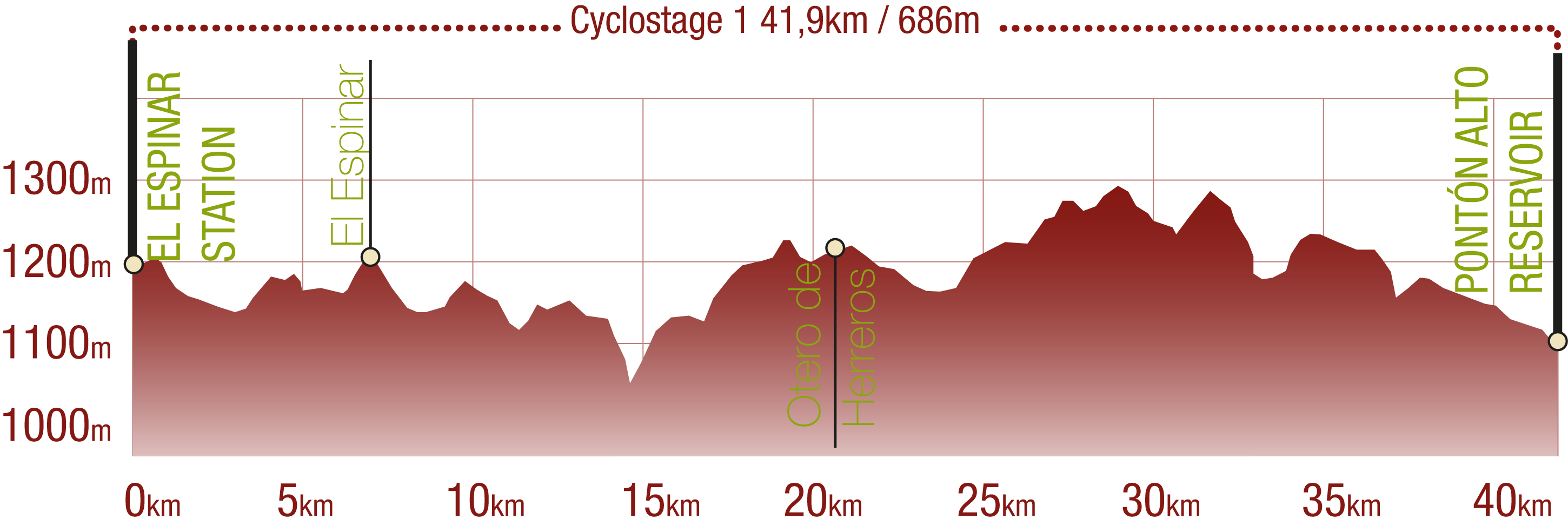
This Cyclostage corresponds to stages 0, 1 & 2 of the Nature Trail
PROFILE
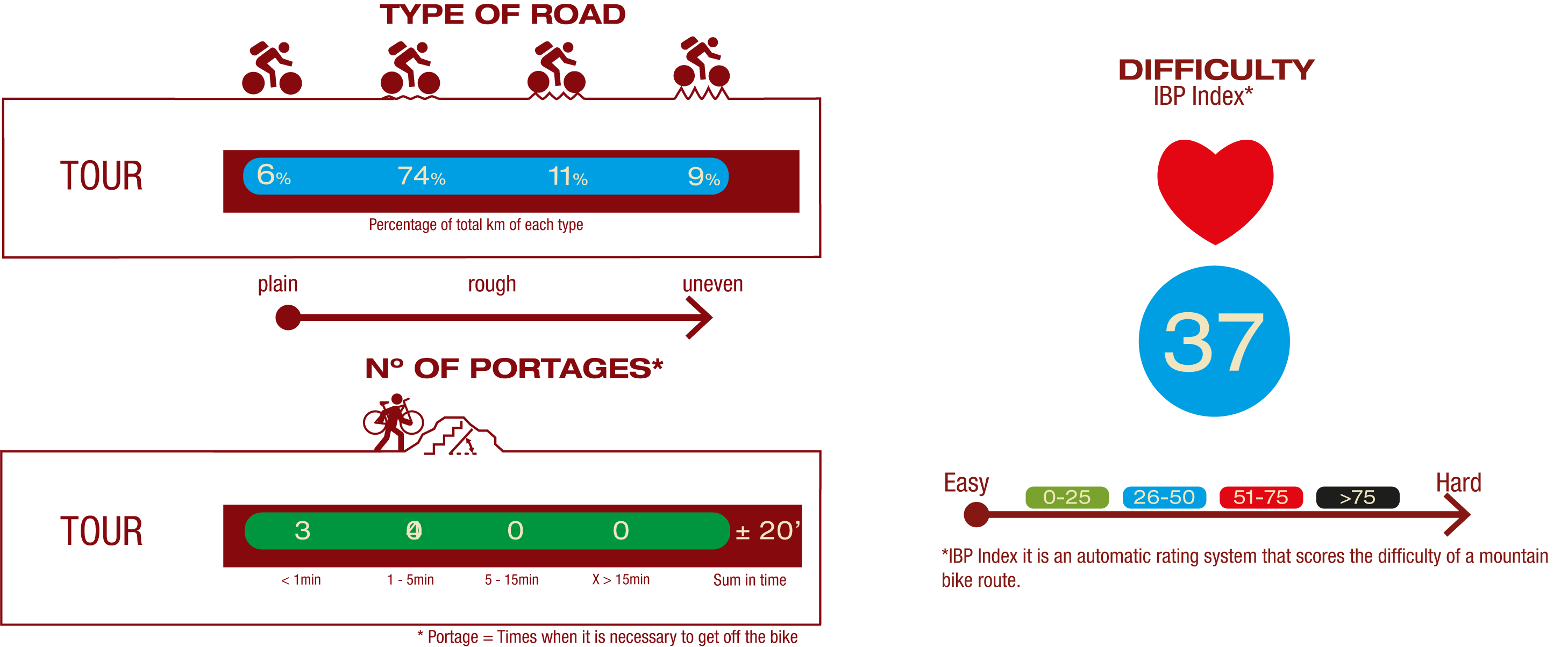
TYPE OF ROAD, PORTAGES & DIFFICULTY
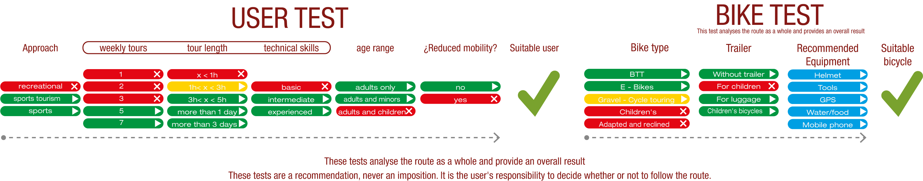
TEST
SAFETY RECOMMENDATIONS
- Sections shared with hikers.
- Transit through the centre of some population centres.
- The Nature Trail presents, in stage 3, the crossing of a paved road across a solid line. Although there is enough visibility, extreme caution, and crossing dismounted, is advised.
GENERAL RECOMMENDATIONS
- Find out about the technical aspects of the route and the weather on the day.
- Take care of the environment. Take care not to disturb animals or damage vegetation. Respect private areas.
- You must give priority to pedestrians and comply with general traffic rules.
- The environment in which you will be riding is open, free to move around and an area where many activities are carried out (sporting, forestry, livestock and agricultural activities). Always have an understanding, prudent, responsible and respectful attitude.