
- Home
- Rural Development
- Nature Trails
- Nature Trails
- Central Sector
- Agua Soriano. Camino Antonino
Stage 3: Masegoso - Muro
Description
Sierra del Madero
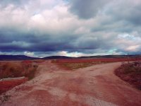
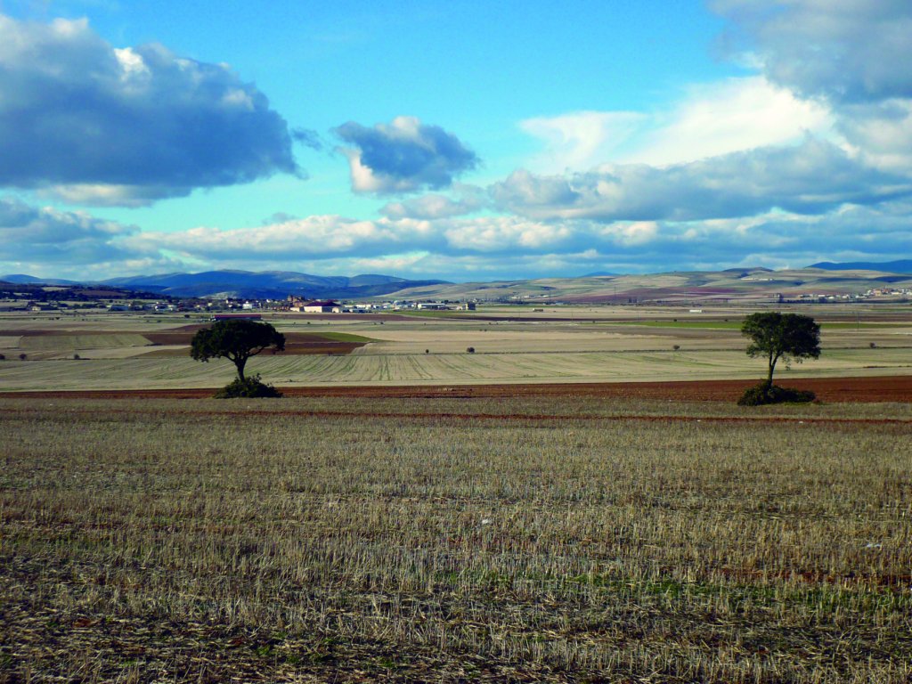
The third stage of the Agua Soriana Nature Trail is 17 km long and leads to Muro, the ancient Roman city of Augustobriga, passing through the town of Pozalmuro. It then crosses Sierra del Madero, a natural area of high ecological value designated a Site of Community Importance.
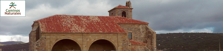
Leaving behind Masegoso Tower and the church of San Esteban, the route follows the Antonine Itinerary to ancient Augustobriga, present-day Muro, and the endpoint of the Roman road through Soria. In this third section, the route runs, whenever possible, along various stretches of Iter XXVII. However, the course is not as discernible as elsewhere.
Just outside the uninhabited town of Masegoso, there is another Roman fountain-well near a wetland, an almost constant feature in this part of the Nature Trail. In this case, it is surrounded by rivulets channelled into various irrigation ditches.
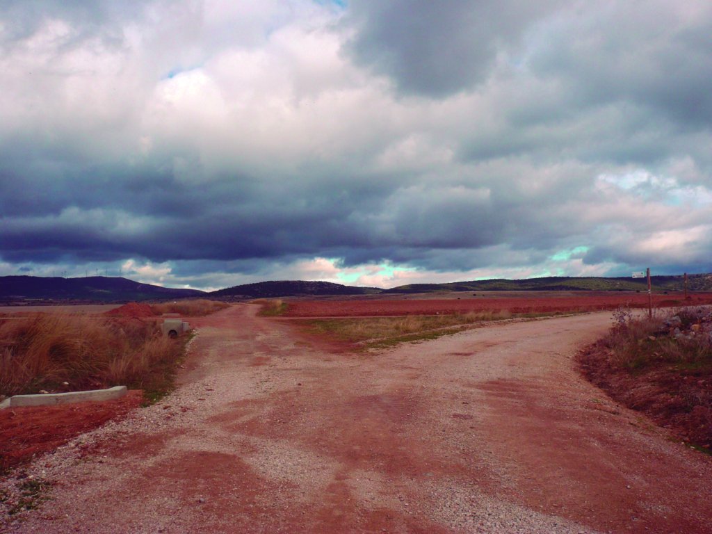
The route heads northeast from Masegoso via the Pozalmuro road. There is a crossroads at about 300 m, where the trail forks eastward to the right. The town of Pozalmuro is located at about 2.6 km.
Pozalmuro
In the western foothills of Sierra del Madero, in the area known as Los Santos, sits Pozalmuro, a town situated in the fertile plain of the River Rituerto. Archaeological remains found in the centre of the village indicate the existence of an earlier settlement. The municipality is traversed by Iter XXVII. A milestone in perfect conditions, indicating the distance to Tarazona (22 mi), attests to this. Another vestige of Roman presence in Pozalmuro is Fuente Vieja, a fountain that supplied drinking water to the village, and was also used for washing laundry and watering animals. The Roman milestone can be found in the landscaped area near the fountain.
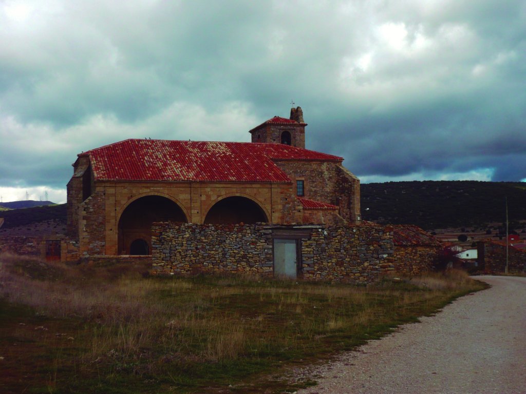
The church of Santa María la Mayor, a temple dating from 1623 with elements of baroque style, is the most important monument in Pozalmuro. However, the simple elegance of the façade and its single tower bespeak of its Romanesque origin. The church boasts an exceptional piece of Romanesque liturgical stone furnishing. A 12th century rectangular seat of honour, made from a single block of sandstone carved with axe. Its location within the temple and the role it played is unknown. It may be that the seat was used by the Bishop during his pastoral visits or by the priest during the liturgy. The temple also contains a baroque altarpiece and high altar sculpted by Pedro del Cerro.

The remains of an ancient fortress lie along the east wall of the parish church. A masonry wall that encloses the eastern side of the church, and serves as the tower base. Next to the church is a cemetery whose portico door has a medieval stela.
A little further on, in a huge meadow in the back of the church, is the so-called "Huerto de Becquer", a simple house surrounded by a vegetable garden where Gustavo Adolfo Becquer, the poet and romantic writer, spent long periods of his life. The property belonged to the paternal grandparents of his wife, Casta Esteban Soriano, the daughter of a doctor whose family was originally from Pozalmuro. To the southeast of the village is the shrine of San Roque.
Sierra del Madero
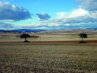
Past the centre of Pozalmuro towards the northeast, the route crosses the SO-P 2003 and continues along the road to Muro, straying into Sierra del Madero through a copse of holm oaks (Quercus ilex), Pyrenean oaks (Quercus pyrenaica) and abundant bushes of thyme (Thymus vulgaris) and lavender (Lavandula angustifolia), as well as other plants. The trail climbs through Sierra del Madero to Valhondo, a viewpoint located at 1,229 m in altitude, with excellent views of the natural surroundings.
High quality (hematite) has been mined in Sierra del Madero since Roman times. The mining activity introduced a narrow gauge railway for transporting the ore to the town of Castejón (Navarre) through the so-called Via Vieja (Old Track). Mina Petra, located about 1,200 m up Sierra del Madero, was a very rich hematite mine. Nowadays, the open pit mine is a beautiful lake that is naturally fed by spring water.

The strong wind from the Moncayo drives the turbines of the numerous wind farms that abound in the northern mountainous areas of the province of Soria, like the one in Sierra del Madero, and others located in other mountain ranges like Toranzo, Tablado, Almuerzo, Rodadero, Alcarama and Cortado.
From Valhondo, the trail descends to meet the Camino del Hito, which crosses the old Soria-Castejón railway and the SO-P 2001. After crossing this road, the route continues northeast along Camino de la Carretera Vieja Alta during two kilometres until it reaches the Cañada Real between Tudela and Soria. From there, it heads to the Caladizo cattle track, which crosses the local road SO-380.

Muro
After crossing the Madre irrigation ditch, the route follows the Camino de la Vega de Conejares, and passes next to a Roman fountain and stone basin. After about 2.2 km from the trail head, the route reaches Muro.
Present-day Muro, with deep historical roots, was the Roman Augustobriga. It has traditionally been accepted that it was founded by the Emperor Octavian Augustus as a support camp in the Cantabrian wars. However, based on the suffix "briga" and the discovery of ancient materials, recent studies have raised the possibility that an older settlement may have existed on this site, which was relocated and renamed during imperial times.
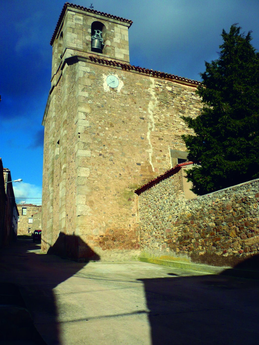
The town of Muro is named after its ancient wall. Little remains of a settlement that in its heyday was an important town, straddling communication lines between the Douro and Ebro valleys. One of the most important remains is the stretch of Roman road that runs alongside the walls, as well as its castle, which probably dates from the eleventh century, a period in which King Alphonse the Battler reconquered the lands of Agreda. Part of the church of San Pedro Apóstol, a single-nave temple with a barrel vault and a Romanesque door, is from those days. The chapel was added between the sixteenth and seventeenth centuries, and the sacristy was incorporated in the late eighteenth century.
To the east, at about 300 m from the Antonine Itinerary, is the allegedly Roman Fuente de Saz, which consists of a well, a shed and a watering trough.
Profile
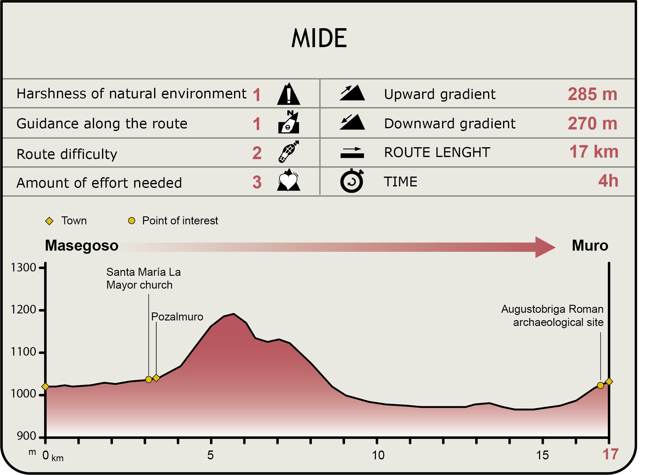
MIDE (Method for the Information of Excursions)
 Harshness of natural environment
- 1. The environment is not risk-free
- 2. There are more than one risk factors
- 3. There are various risk factors
- 4. There are quite a lot of risk factors
- 5. There are many risk factors
 Guidance along the route
- 1. Well defined trails and crossings
- 2. There is a clearly marked trail and signage
- 3. Requires the identification of geographic features and cardinal points
- 4. Requires off-path navigation
- 5. The trail is interrupted by obstacles that have to be gone around
 Route difficulty
- 1. Walking on a flat surface
- 2. Trails with different types of path
- 3. Walking on stepped paths or irregular terrain
- 4. The use of hands or jumping over the terrain is necessary
- 5. The use of hands is required to progress
 Amount of effort needed
- 1. Up to 1 hour of continuous walking
- 2. Between 1 and 3 hours of continuous walking
- 3. Between 3 and 6 hours of continuous walking
- 4. Between 6 and 10 hours of actual walking
- 5. More than 10 hours of continuous walking
Featured
Further information
SCI Sierra del Madero
The gall and holm oak forests of Sierra del Madero have been designated a Site of Community Importance (SCI) within the Natura 2000 network. These forests, barely disturbed by a few fields of crops, constitute one of the best-preserved and largely uninterrupted mass of trees of the Iberian System in Soria, with ancient trees over six metres in diameter.
The Sierra del Madero Site of Community Importance has an area of 3,829.59 ha and encompasses the towns of Valdegeña, Villar del Campo and Pozalmuro. The SCI straddles two areas separated by a narrow strip of land that communicates Soria and Saragossa. Its highest peaks rise to about 1,600 m.
The forest cover consists of 48% sclerophyllous forests, 29% shrubland, and 10% wet meadows. Mixed forests occupy 4% of the land and extensive cereal crops about cereal 3%. Non-forest croplands under woody plants, including trees, vegetable gardens and vineyards, account for 3%.
The main natural habitats in Sierra del Madero are composed of Quercus ilex and Quercus rotundifolia forests (70%), and to a lesser extent, Iberian gall oaks Quercus faginea and Quercus canariensis. One percent (1%) of these forests is Galician-Portuguese oak woods Quercus robur and Quercus pyrenaica, with few stands of Montpellier maple (Acer monspessulanum) and reforestation pine. Heather (Erica vagans) and juniper bushes (Juniperus spp.) are the dominant shrub species. This is an area where the presence wolves(Canis lupus) is particularly significant.
Roman Augustobriga
The archaeological remains of what was once the important Roman city of Augustobriga, founded in the first century B.C. along the Roman road that linkedAsturica Augusta (Astorga) and Caesaraugusta (Saragossa), were found in the town of Muro. During his study of Iter XXVII, Eduardo Saavedra identified present-day Muro as Augustobriga. This important Roman city had a wall with a perimeter length of over 3,000 metres. It was classified as a "mansio", i.e., endpoint of the Antonine Itinerary.
Augustobriga was destroyed by fire at the hands of Vandals and Alans in 409. After the fire, and facing the danger of further attacks, the city was abandoned by its inhabitants and forgotten for centuries. Its people dispersed and relocated to safer places. The nearby village of Olvega, six kilometres removed from the Roman road, was one of these places. In fact, the town council of Muro still meets there today.
Olvega Town Council and the Association Friends of Muro, together with the local residents, have pushed to disseminate the knowledge of ancient Augustobriga through an interpretation centre that seeks to spread its historical legacy. Two thematic sections in the centre explain in a didactic manner the evolution of the city from its origins to the present day.
Muro is also the end point of Numantobriga, a hiking event organised since 2006. During an August weekend, and starting in the city of Soria, hikers trek along Iter XXVII, following the Roman road between Numantia (Garray) and Augustobriga (Muro). Throughout the hike, various historical events are recreated by the residents of these municipalities.
Multimedia

Downloads
GPS Downloads
Maps
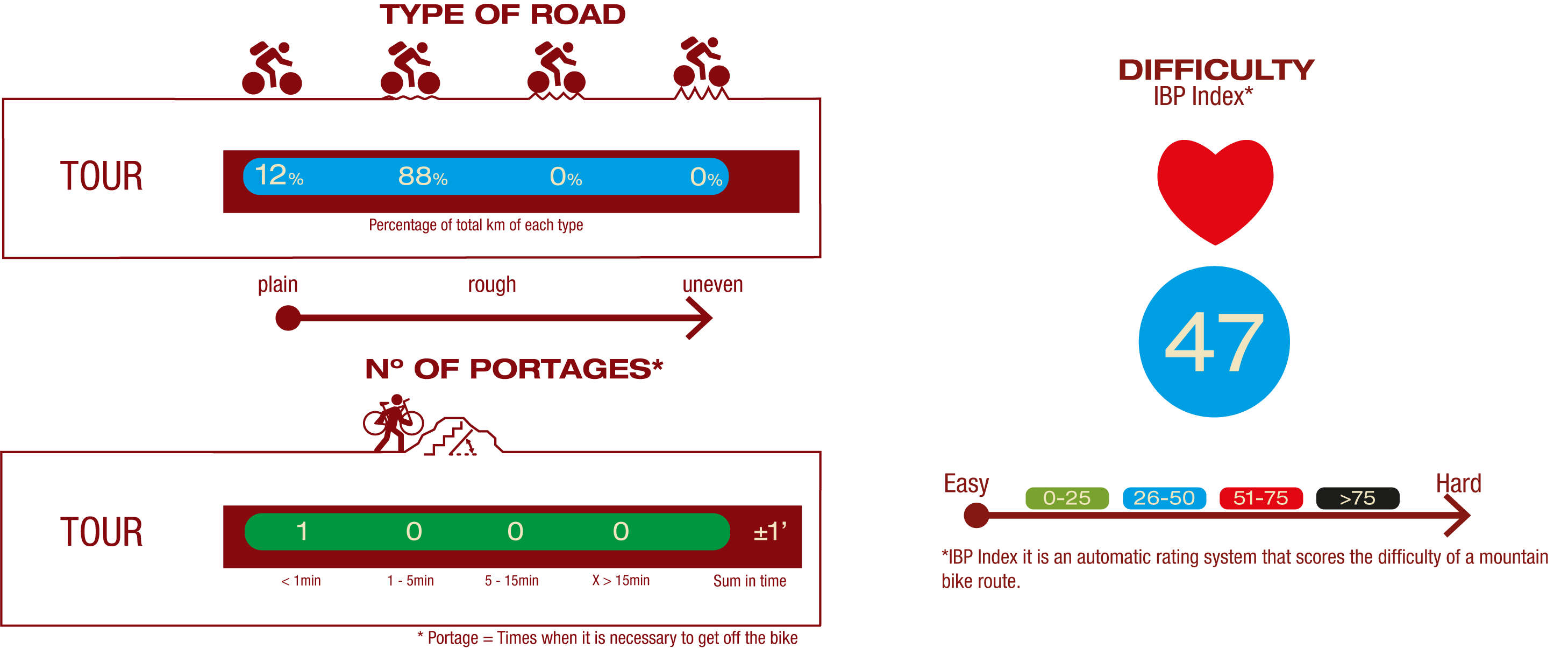
Cyclability
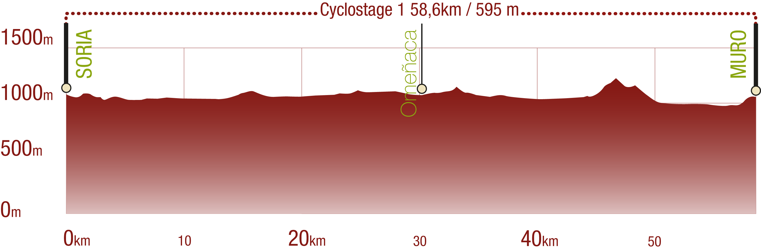
This Cyclostage corresponds to stages 1 to 3 of the Nature Trail
PROFILE
TYPE OF ROADS, PORTAGES & DIFFICULTY
TEST
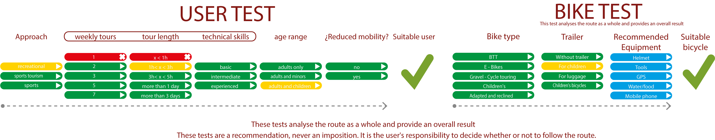
SAFETY RECOMMENDATIONS
- Sections shared with hikers and agricultural vehicles.
- Transit through the centre of some population centres.
GENERAL RECOMMENDATIONS
- Find out about the technical aspects of the route and the weather on the day.
- Take care of the environment. Take care not to disturb animals or damage vegetation. Respect private areas.
- You must give priority to pedestrians and comply with general traffic rules.
- The environment in which you will be riding is open, free to move around and an area where many activities are carried out (sporting, forestry, livestock and agricultural activities). Always have an understanding, prudent, responsible and respectful attitude.