
- Home
- Rural Development
- Nature Trails
- Nature Trails
- Central Sector
- Agua Soriano. Camino Antonino
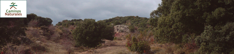
Stage 2: Arancón - Masegoso
Description
The Antonine Itinerary
The second stage of the Agua Soriano Nature Trail follows the Antonine Itinerary Iter XXVII for 20 km between Arancón and Omeñaca and the uninhabited villages of La Pica and Masegoso. It primarily runs over the stretch that linked Augustobriga and Numantia.

Arancón's Roman milestones, which once belonged to Iter XXVII, or the Antonine Itinerary, mark the trail head of the second section, which is closely linked to the Roman road that crossed the province of Soria, and connected the towns of Uxama (Osma), Voluce (Calatañazor), Numantia and Augustobriga (Muro).
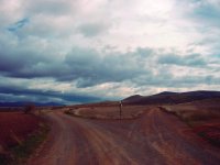
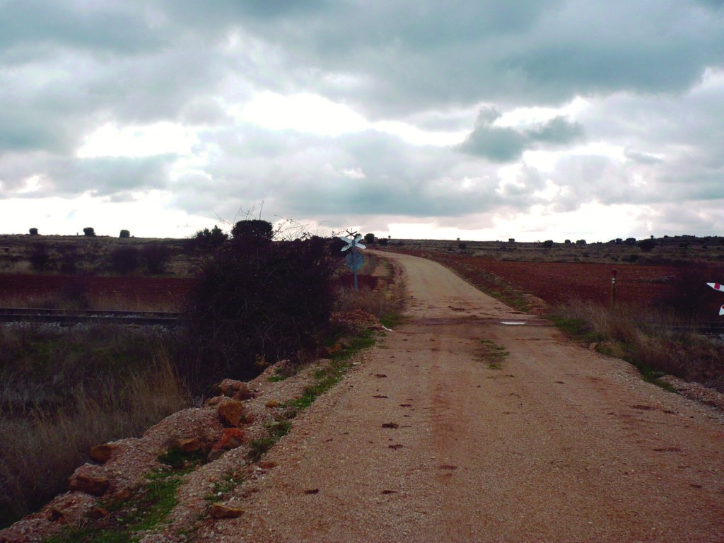
Leaving Arancón behind, the route heads down the road to Carramediana towards Omeñaca, the next stop in the Agua Soriano Trail. This section of the Trail runs almost parallel to the now closed Castejón-Soria railway line, and very close to the old Roman road, over which it runs occasionally.
After leaving Arancón, the route heads along the road to Carramediana during about 1.5 km, crossing a railway line before returning again to the former Roman road. The Trail continues east, parallel to the railway line. It first runs along the southern side of the railway until it reaches the Cañada Real Soriana Oriental (East Soria Drover's Road). Then, it crosses the railway again to the north, continues in parallel for a little over a kilometre, and crosses back to the south, following a cattle track.
The route reaches the road to Calderuela, where it turns south onto a track that leads to N-122 national road. It crosses the N-122 and continues south towards V-3613, along which it runs for 1.3 km. Here, the Trail forks into two branches: to the left, the Camino del Conejo leading to La Pica, and, straight ahead, to Omeñaca, barely 500 m down the road.
Located south of Sierra del Almuerzo, and in the foothills of Sierra de la Pica, Omeñaca is a small village of Campo de Gomara County, in the municipality Alarcón. Omeñaca is home to the 12th century Romanesque church of Nuestra Señora de la Concepción with a remarkable portico, mentioned in the legend of the Siete Infantes de Lara. The original Romanesque building has been added to and rebuilt over the centuries.

Retracing our steps to the point where the Nature Trail forked near Omeñaca, the route continues another 3.8 km towards La Pica, an uninhabited village on a ridge overlooking the River Rituerto plain, on the northeast slope of Sierra de la Pica, where the landscape is dotted with thyme (Thymus vulgaris) and lavender (Lavandula angustifolia), and an occasional holm oak (Quercus ilex).
The municipality of La Pica was officially declared uninhabited in 1496. The properties were placed in the hands of the heirs of Alderman Juan de Saravia. In 1684, the uninhabited area was granted a title of nobility, the Marquisate of La Pica, and thenceforth it has been held by a Chilean family, Bravo de Saravia, descendants of the lineage of the Salvador.

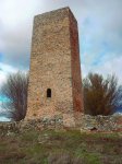
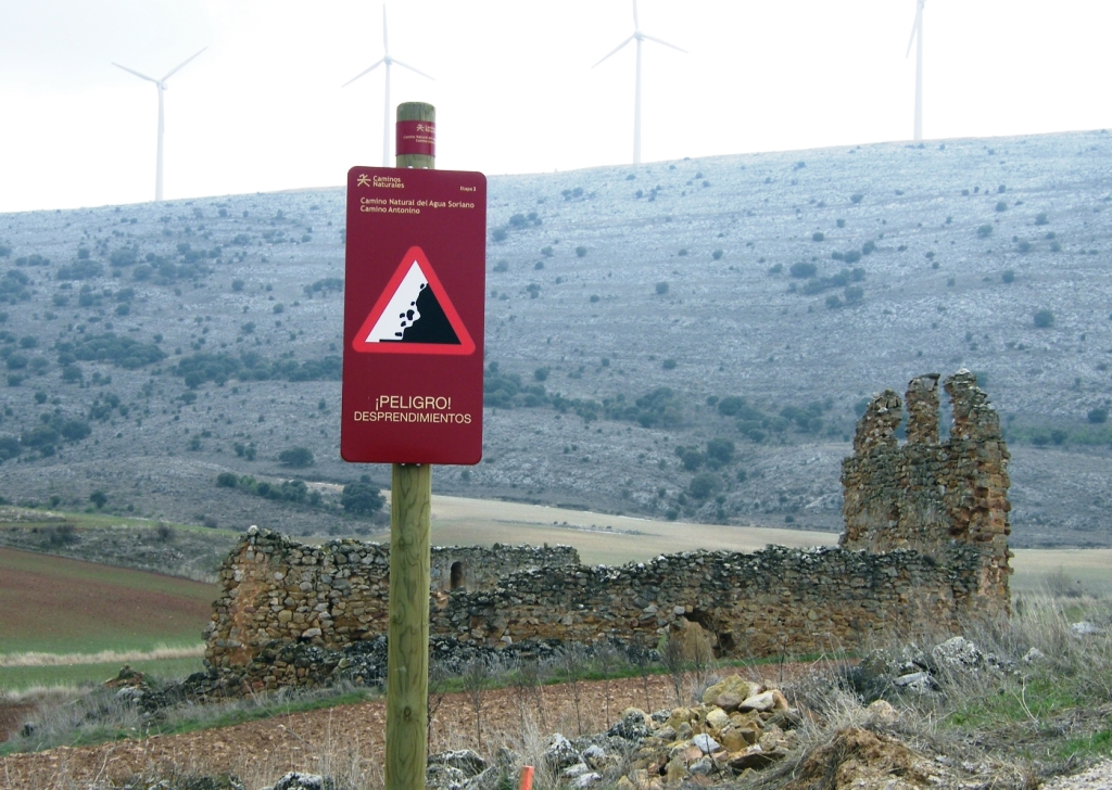
Today, La Pica belongs to the municipality of Tajahuerce. It has a defence tower known as Torre de la Pica or Torre de los Salvadores, which once was part of a network of watchtowers that also included the towers at Aldealpozo, Castellanos del Campo and Masegoso.
The last inhabitants of La Pica abandoned the village in the eighteenth century. The remains of the Bravo de Saravia palace still stand. Nearby are also the ruins of a small Romanesque church, a recently restored water well-fountain and a small rest area.
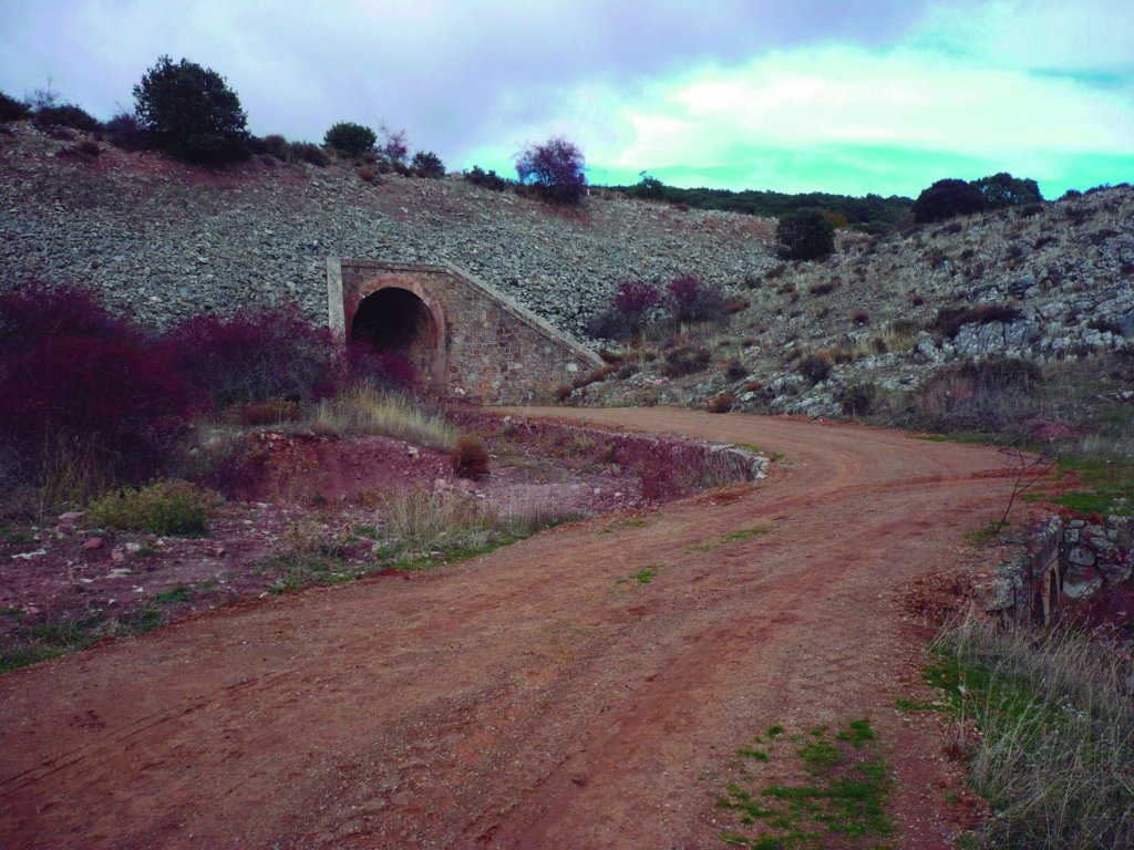
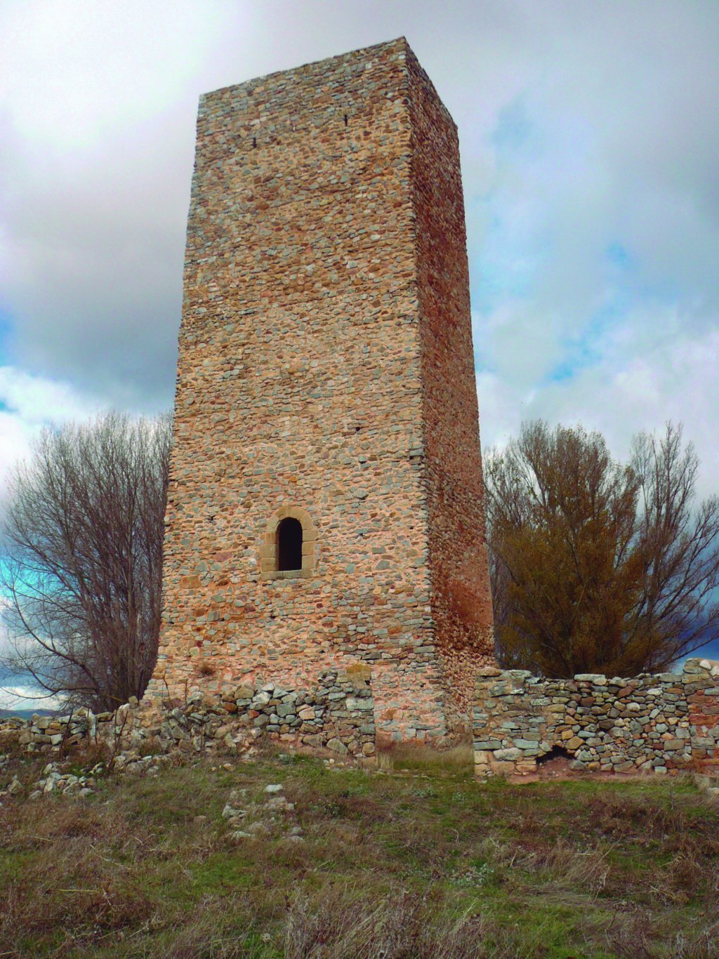
The Trail continues north from La Pica for about 1.5 km to the milestone for Aldealpozo, via a path on the right of the road, skirting around El Cerrillo. The route heads along the track to Tajahuerce for about 1 km, then turns left onto a path leading to Masegoso. The famous tower of this uninhabited village lies at the foot of the Roman road, soaring high over the vast plain.
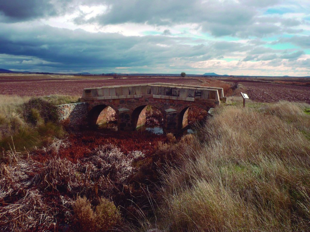
This section, which runs over part of Iter XXVII, also passes next to the Roman bridge of Masegoso, over the River Rituerto. Masegoso Bridge is over 10 m long with three symmetrical barrel vaults. The structure is built of excellent ashlar and masonry.
Sites of interest
Profile
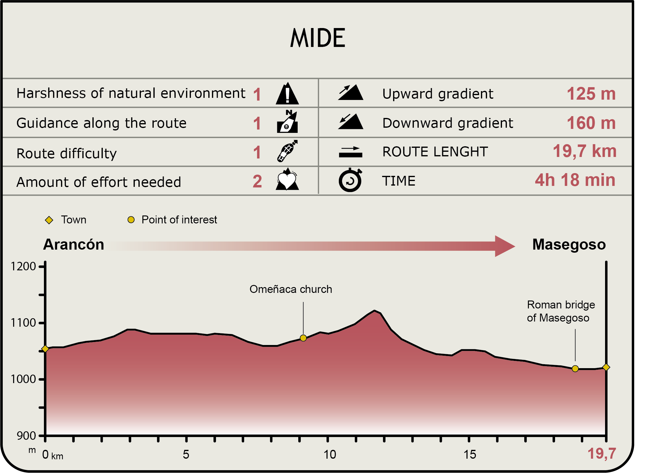
MIDE (Method for the Information of Excursions)
 Harshness of natural environment
- 1. The environment is not risk-free
- 2. There are more than one risk factors
- 3. There are various risk factors
- 4. There are quite a lot of risk factors
- 5. There are many risk factors
 Guidance along the route
- 1. Well defined trails and crossings
- 2. There is a clearly marked trail and signage
- 3. Requires the identification of geographic features and cardinal points
- 4. Requires off-path navigation
- 5. The trail is interrupted by obstacles that have to be gone around
 Route difficulty
- 1. Walking on a flat surface
- 2. Trails with different types of path
- 3. Walking on stepped paths or irregular terrain
- 4. The use of hands or jumping over the terrain is necessary
- 5. The use of hands is required to progress
 Amount of effort needed
- 1. Up to 1 hour of continuous walking
- 2. Between 1 and 3 hours of continuous walking
- 3. Between 3 and 6 hours of continuous walking
- 4. Between 6 and 10 hours of actual walking
- 5. More than 10 hours of continuous walking
Featured
Further information
The Antonine Itinerary
The so-called Antonine Itinerary, which dates from the third century, is a number of routes along the roads of the Roman Empire, of which there remains only a 4th century copy assigned to the time of Diocletian. It does not show all Roman roads, but it does include the 372 roads contained in the Register of Praetor, i.e. road routes covering every part of the Empire, including the 34 listed for Hispania.
The document recorded the mileage, equivalent measurements and “mansiones” (stopping places on Roman roads for those travelling the Empire on official business) for each route. The excellent work by surveyors of the time, who not only measured the distance between urban centres, but also provided proper road signage, information on obstacles, bridges, etc., laid the foundation for future maps.
Scholars have been intrigued by the uneven sections and sudden changes of direction of the Roman roads listed in the Antonine Itinerary. This has led to various theories about the true nature of the document, which as a "road map" would seem often confusing to the traveller.
Iter XXVII
The Roman road 27 of the Antonine Itinerary was called “Via Asturica per Cantabria Caesaraugusta”, and connected the present-day cities of Astorga and Saragossa located in the Douro Valley. Iter XXVII, attributed to the emperor Octavian Augustus, has been dated to the first century B.C. It already existed in times of Tiberius and Nero, and was rebuilt by Trajan. The Soria section winded through Uxama (Osma), Voluce (Calatañazor), Numantia (Numancia) and Augustobriga (Muro). It then entered into Aragón, passed through Turiasso (Tarazona) and continued to Caesaraugusta (Zaragoza).
Jerónimo Zurita, a 16th century Aragonese chronicler, already mentions this section of the road. However, it was Eduardo Saavedra (1829-1912), civil engineer and member of the Royal Academy of History, who discovered in the 19th century the section of Iter XXVII between Uxama and Augustobriga. The finding took place when the Burgo de Osma-Soria railway line was being built by the Compañía del Ferrócarril de Noroeste, of which he was the head engineer.
Saavedra provides a physical description of the road and of the antiquities found in his book “Descripción de la vía romana entre Uxama y Augustóbriga” (Description of the Roman road between Uxama and Augustobriga), published by the Royal Academy of History in 1879. This research was based on his knowledge of geography and the descriptions and itineraries of Roman writers, as well as information gleaned from epigraphic remains found in his excavations, in particular, numerous milestones and other inscriptions.
The Way of St. James through Soria
Omeñaca is located along the Way of St. James, also called the Castilian-Aragonese Way, an alternative route to the Way of St. James along the River Ebro. The Way of St. James through Soria was originally linked to Iter XXVII. Legend has it that James the Elder, after preaching in Galicia, travelled to Saragossa evangelising the towns scattered along this section of the Roman road, which for many centuries had been one of the branches used by pilgrims to reach Galicia.
This branch of the Way of St. James, between the rivers Ebro and Douro, climbs from the estuary in Amposta to Saragossa, and from there to Gallur, located on the right bank of the Ebro, in the so-called Somontano del Moncayo. In Gallur, the route veered west, passing through Soria, and connected Santo Domingo de Silos (Burgos) with the Ruta de la Lana (Wool Road), which originated in Valencia and traversed through Cuenca. The pilgrims from the Sagunto area also used an alternative route that passed through Teruel and Catalayud to the city of Soria, and from there as described above.
The present-day Castilian-Aragonese Way of St. James runs in part over the Roman road from Asturica to Caesaraugusta and along the Agua Soriano-Camino Antonino Nature Trail. The route passes through several places of enormous cultural and landscape value, including the towns of Borja, Tarazona, Agreda and the city of Soria, and natural spaces like Moncayo Nature Park, Sierra del Madero, Cañón del Rio Lobos or Picos de Urbión.
Uninhabited villages
During the Middle Ages, many small mountain villages in the Sistema Ibérico became uninhabited. This phenomenon had the most impact in Soria and Agreda in the fifteenth century, leading to conflicts over agricultural use of the land in these small abandoned villages.
A town or village did not have to be completely abandoned to lose its charter. If it had less than 5 inhabitants, it could be declared uninhabited (derraygado). The town then became a Crown property, although the titleholder could retain the property, provided the person could produce evidence and said right was recognised.
In many cases, the members of the oligarchy took advantage of this depopulation to expand their estate, misappropriating communal and waste lands owned by the uninhabited village in order to increase their agricultural land.
The Watchtowers
Rituerto Valley and Campo de Gomara are strewn with remains of Arab buildings that once were part of the Christian-Muslim border defence system. In the early tenth century, the Christians pushed the border to the River Douro, and the Caliphate of Cordoba built various defensive structures to strengthen their position.
Towers like La Pica, Aldealpozo, Castellanos del Campo, Noviercas or Masegoso belonged to that defensive system. Most are of Berber origin and have been included in the so-called Route of the Towers, which runs through Moncayo.
In case of a siege, these towers served as a refuge for the local population. They usually had chamber cum granary and a spring-fed well to be able to withstand a prolonged siege.
All the towers were robust, isolated and tall. They were rectangular, with a high entrance accessible by a staircase that could be removed in case of siege. Most have few windows and, in some cases, like the Masegoso tower, the walls are tapered at the top.
Multimedia

Downloads
GPS Downloads
Cyclability
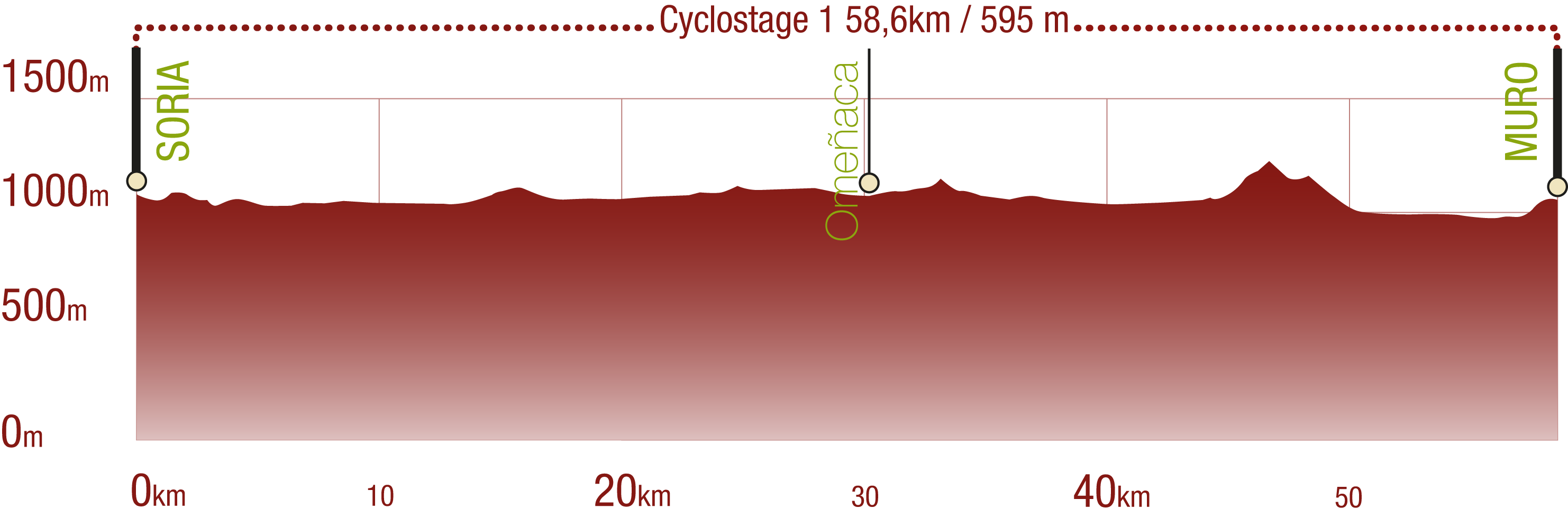
This Cyclostage corresponds to stages 1 to 3 of the Nature Trail
PROFILE
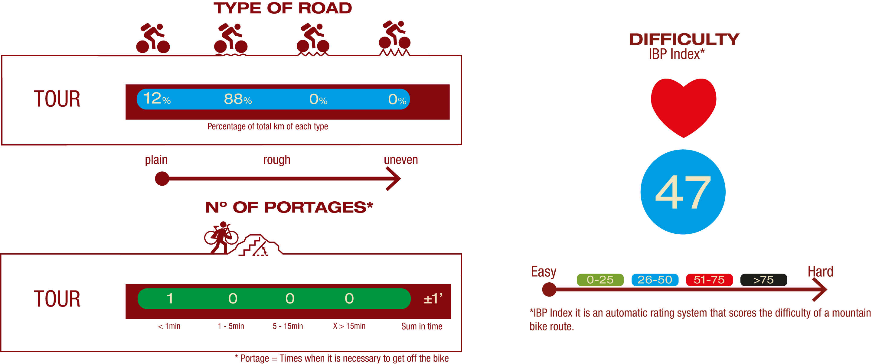
TYPE OF ROADS, PORTAGES & DIFFICULTY
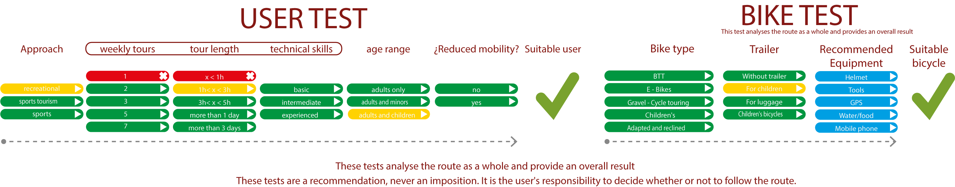
TEST
SAFETY RECOMMENDATIONS
- Sections shared with hikers and agricultural vehicles.
- Transit through the centre of some population centres.
GENERAL RECOMMENDATIONS
- Find out about the technical aspects of the route and the weather on the day.
- Take care of the environment. Take care not to disturb animals or damage vegetation. Respect private areas.
- You must give priority to pedestrians and comply with general traffic rules.
- The environment in which you will be riding is open, free to move around and an area where many activities are carried out (sporting, forestry, livestock and agricultural activities). Always have an understanding, prudent, responsible and respectful attitude.