
- Home
- Rural Development
- Nature Trails
- Nature Trails
- Central Sector
- Agua Soriano. Camino Antonino
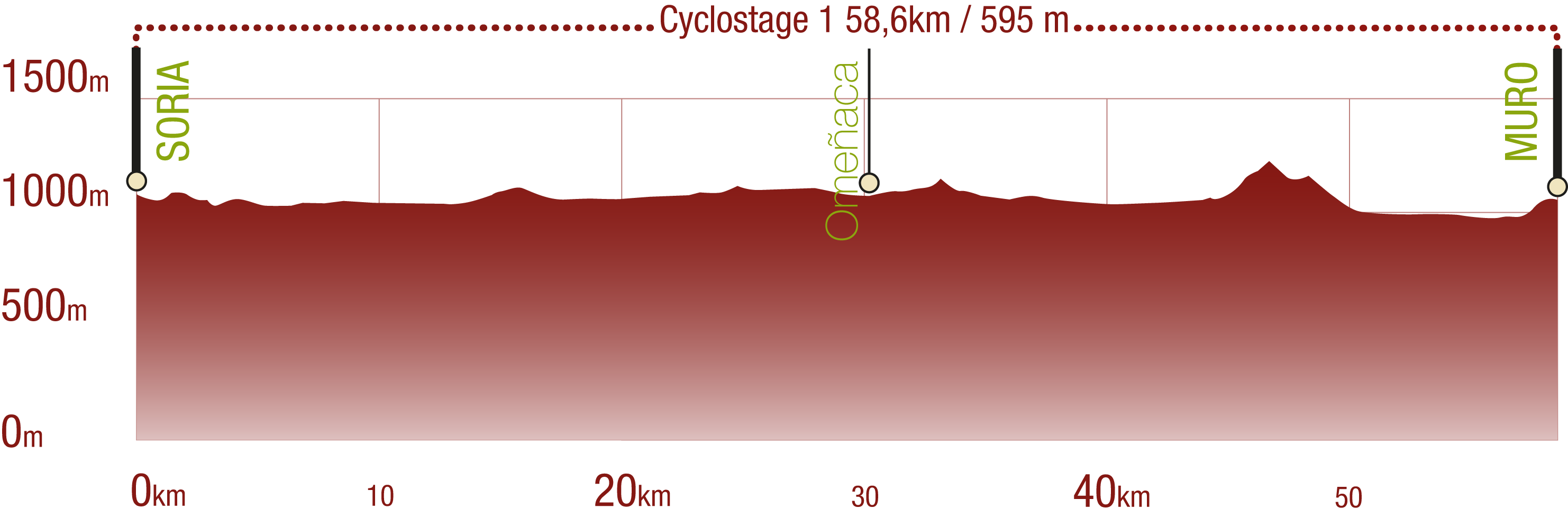
Stage 1: Soria - Arancón
Description
Numantia and the Roman Road
The mythical Celtiberian city of Numantia, which played an epic role in the history of the Iberian Peninsula, is one of the great attractions of the first section of the Agua Soriano-Camino Antonino Nature Trail. This journey begins in the city of Soria, follows in the footsteps of the Roman conquest, and passes through Garray, Renieblas, Aldehuela de Periañez and Arancón.
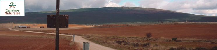
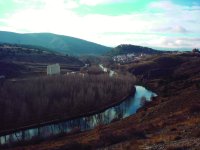
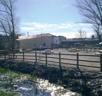
The city of Soria, a rich source of inspiration for the great Spanish authors, is the trail head of the first section of the Agua Soriana Trail, which runs over nearly 23 km, along the river Douro, through the peaceful, beautiful landscape of Soria.
Writers and poets alike have sung the glories of this city and its surroundings, drawn to its quiet streets and the unwavering presence of the river. Located in the upper reaches of the Douro, Soria was, from its early days, a strategic location in the Castilian landscape. As early as the twelfth century, King Alphonse I the Warrior granted a city charter to Soria. In the Middle Ages, the city was the designated "head city" for several drover's roads. Not surprisingly, the first stretch of this first section of the Nature Trail runs along the East Soria Drover's Road (Cañada Real Soriana Oriental), one of many controlled by the Mesta (sheep-farmers guild) that led to Seville.
Countless religious monuments, which may be visited before leaving Soria, are witness to this historic past. Among these are the Romanesque churches of Santo Domingo, San Juan de Rabanera and San Juan de Duero, the Gothic procathedral of San Pedro and its beautiful Romanesque cloister, designated National Monument, the church of San Polo, , thought to be Templar, the sixteenth century church of Santa María la Mayor with remains of a former Romanesque temple, the fourteenth century church of Espino, dedicated to the patroness of the city, and the ruins of the church of San Nicolás, a thirteenth century building whose door was moved to San Juan de Rabanera.
Other equally important religious buildings are the convents of La Merced, San Agustín and Santa Clara, the Carmelite church and convent, founded by St. Theresa, the churches of San Francisco and El Salvador, and countless shrines, including La Soledad, Mirón, and Santa Bárbara. Most noteworthy is the iconic shrine of San Saturio, perched on a rock over the river Douro. Built in a natural cave, the famous hermit, and patron saint of Soria, supposedly lived here.
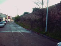
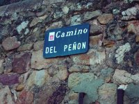
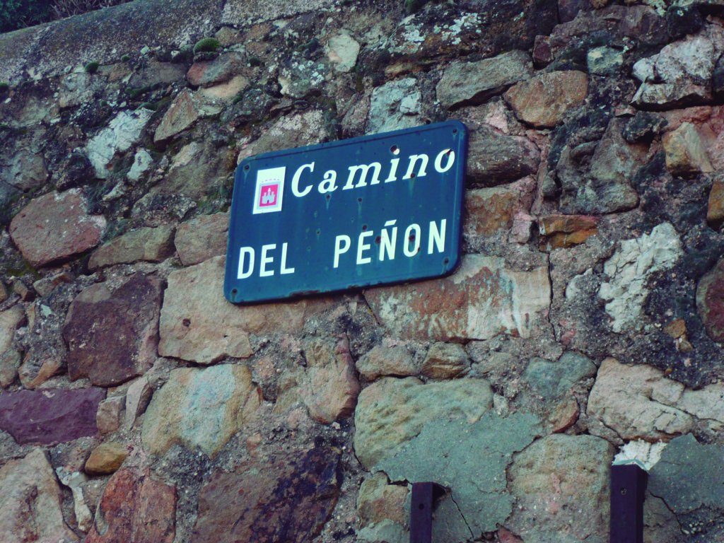
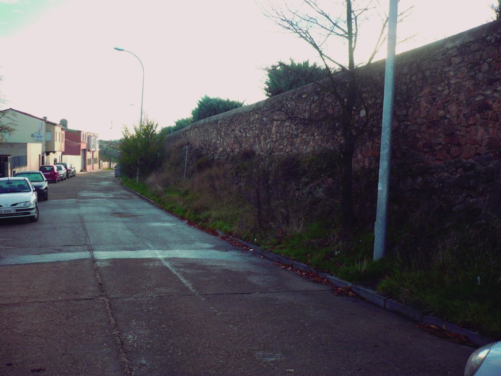
The route starts on the outskirts of Soria, where the Camino del Peñón begins. Shortly after, the trail turns onto a dirt road behind a walled church. This section of the trail crosses under the northern access road to Soria, and continues almost parallel to N-111, through El Arenalejo estate, leaving Cerro Bellosillo to the west.
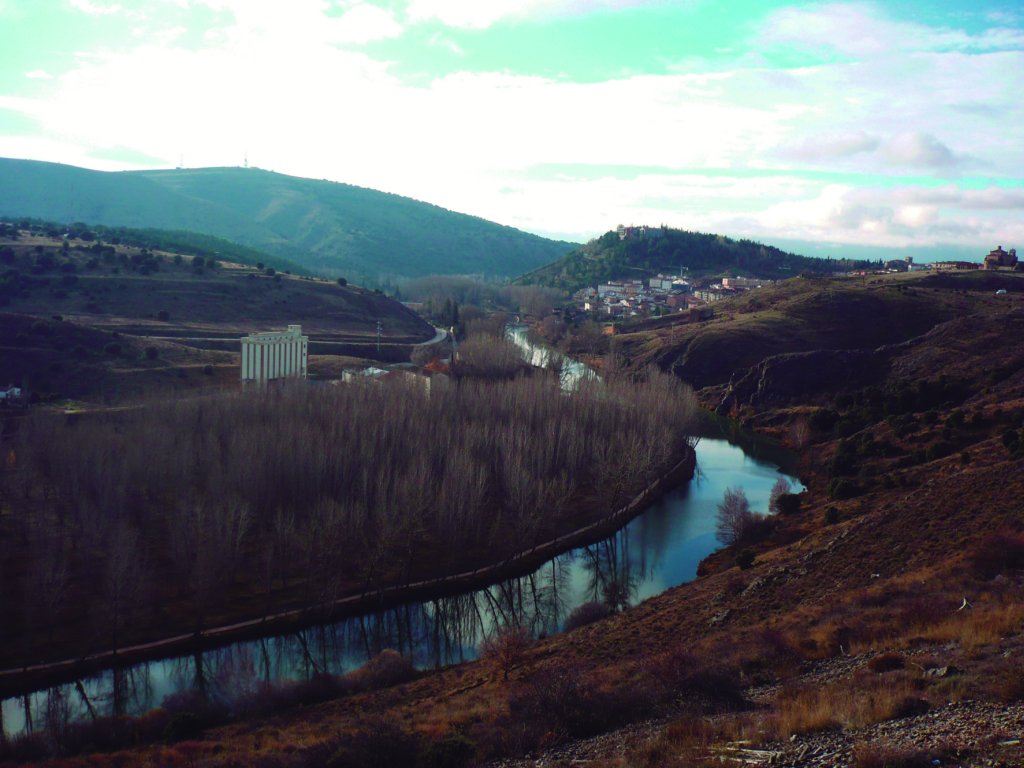
The first stretch of the Agua Soriana-Camino Antonino Nature Trail follows the course of the River Douro to the north, towards the nearby town of Garray, only seven kilometres from the capital. At the foot of Mount Valonsadero, and on its way to Soria, the Douro crosses Soto de Garray, a gravel and sand floodplain that covers a vast swath of riverbank.
Soto de Garray is an area of great ornithological importance with over 140 bird species, including grey herons (Ardea cinerea) and kingfishers (Alcedo atthis). The banks of Soto de Garray are lined with birches (Betula sp.), willows (Salix sp.), poplars (Populus sp.), common ashes (Fraxinus excelsior L.) and common hawthorns (Crataegus monogyna), among others tree species.
Road to Numantia
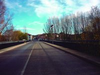
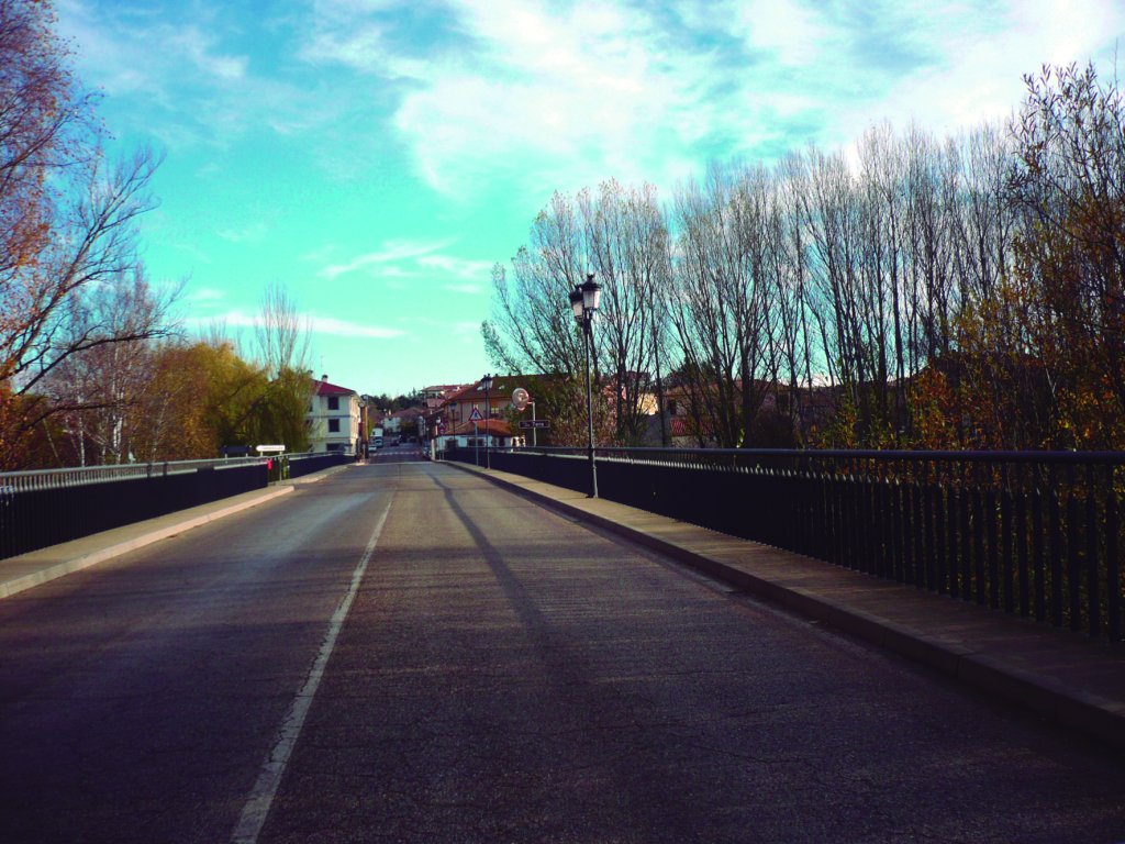
EOn the way to Garray, the trail crosses a poplar grove, leaving to the right a waste collection and recycling centre under construction. At the flour mill, the Nature Trail continues along a side-track to the N-111 intersection, where a bridge over the River Douro gives access to Garray. The rivers Douro and Tera, which rises at the foot of Piqueras Mountain Pass, meet under the 16 arches of this sixteenth century bridge.
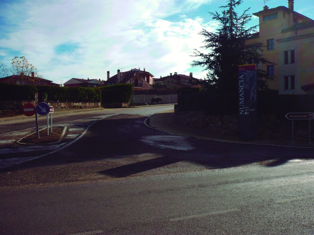
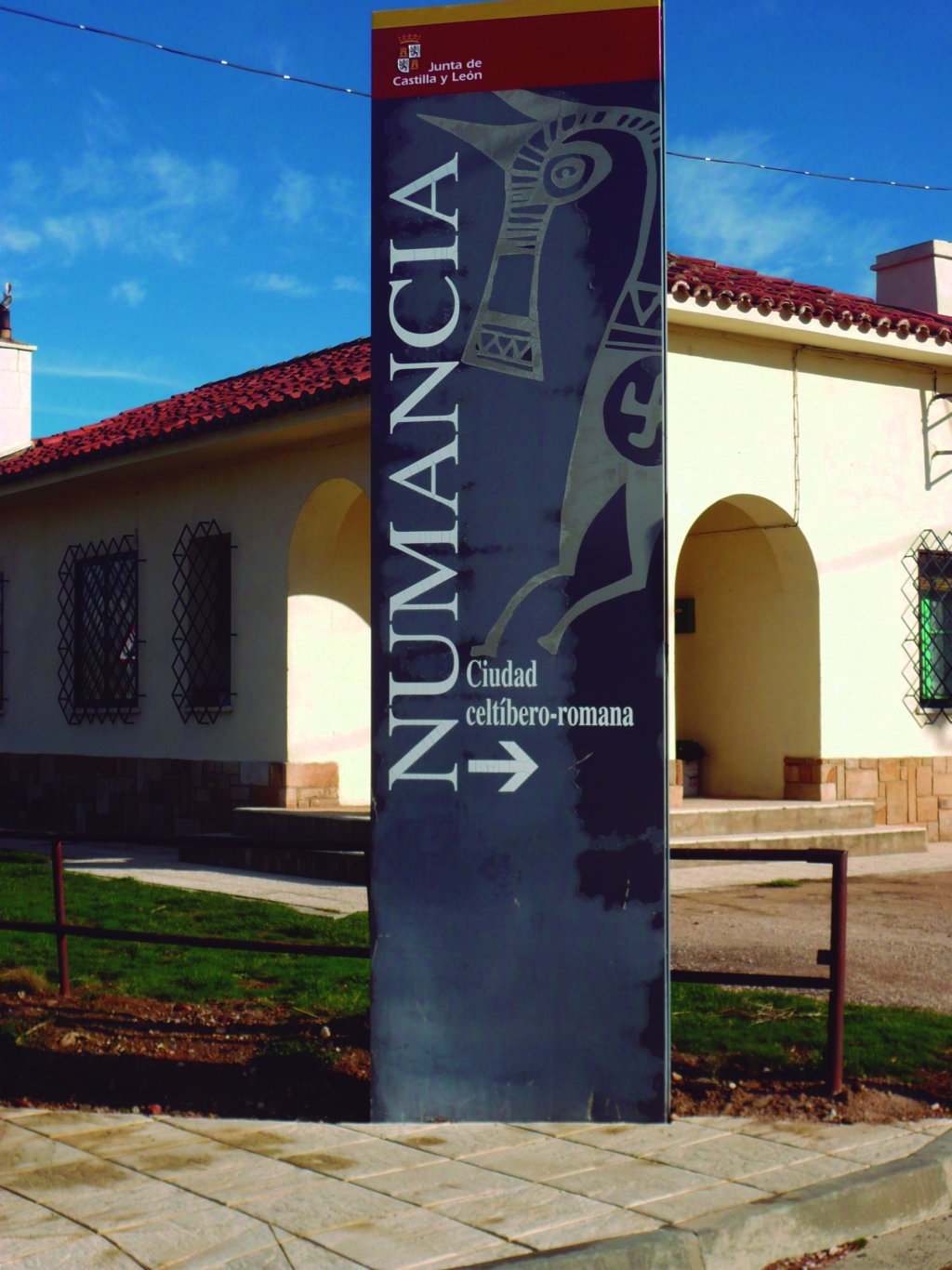
After crossing the bridge, in the centre of Garray, is a side-track that leads to the archaeological site of Numantia and an Archaeology Centre dedicated to the Siege of Numantia.
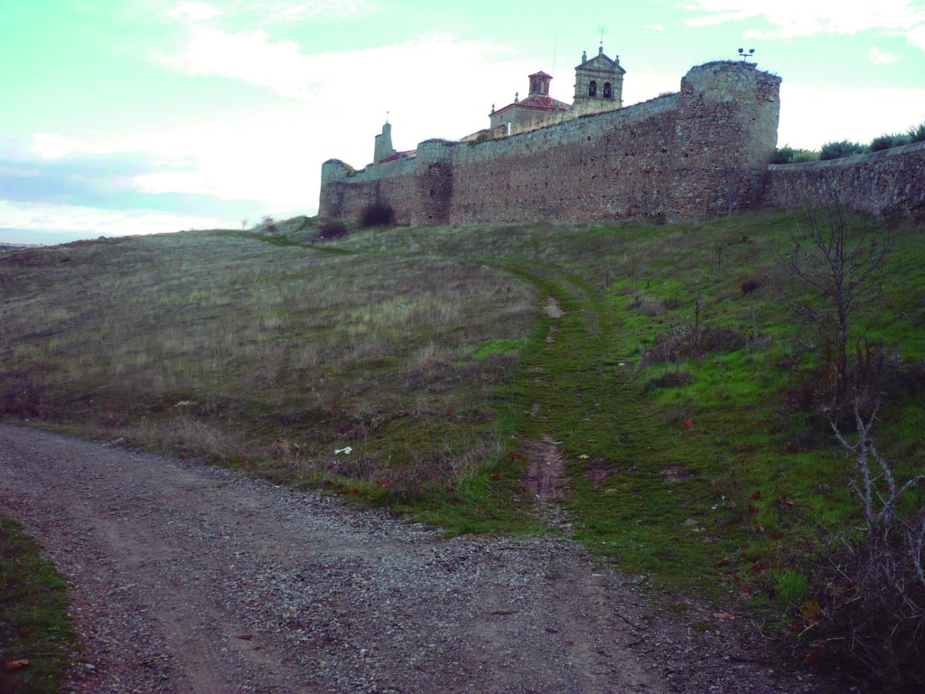
The mythical city of Numantia, Celtiberian symbol of resistance against Roman occupation, was situated on a hill overlooking the vast surrounding plains, at the confluence of the rivers Tera and Merdancho with the Douro. This important archaeological site is a must-see when visiting Garray.
It was at this strategic point that Numantia wrote one of the most memorable chapters in the history of the Iberian Peninsula, when it stoically endured the siege of Roman troops behind a sturdy 5-metre wall.
Archaeological excavations of the ruins of Numantia revealed the existence of two cities at Cerro de la Muela: the oldest from the Celtiberian period, and the other Roman, built over the first. The local council has renovated the former school of Garray to house an Archaeology Centre dedicated to the Siege of Numantia, and complement the visit to the archaeological site. The Archaeology Centre consists of two rooms, each dedicated to two opposing worlds - Celtiberian and Roman - separated by a model of the wall that withstood the siege.
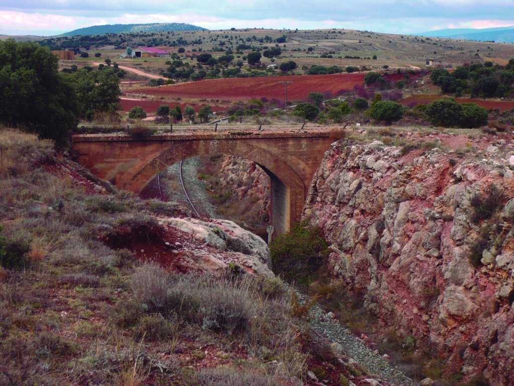
The Roman world left its mark not only on Numantia. Present-day Garray was traversed by the Antonine Itinerary Iter XXVII, a Roman road that connected the town of Asturica Augusta (Astorga) and Caesaraugusta (Saragossa). This road was one of two Roman roads that crossed present-day Soria province, linking the major Celtiberian towns of Uxama (Osma), Voluce (Calatañazor), Numancia and Augustobriga (present-day Muro). In recent years the remembrance of this past has taken the form of an annual march called "Numantóbriga", with historical dramatisations at different points along the former Roman Iter XXVII.
Renieblas and the Gran Atalaya
Past Garray, the route leaves the town centre via the road to Calahorra (SO-615). At the municipal sports centre, the Trail turns right onto a dirt track to Renieblas that passes between irrigation ditches and vast farmlands. The hill to the northwest of the town contains archaeological remains of several Roman military camps built during the siege of Numantia. Its discoverer, Adolf Schulten, named the site La Atalaya (The Great Watchtower).
At about 1,138 m above the confluence of the rivers Moñigón and Merdancho, the Roman army built five military camps over successive periods at La Atalaya Hill. The location was unrivalled, with an unhindered view of Numantia, some five kilometres away as the crow flies. Camps I and II were built around 195 B.C., Camp III, erected during the Nobilior attack, is the best preserved. At one point, it had 27 towers. Schulten dated Camps IV and V to 75 or 74 B.C. The Roman road also reached the Gran Atalaya.
The hilly terrain is undoubtedly the main feature of Renieblas' landscape, in particular, Mount Tiñoso, with excellent views over Campo de Gomara, Puerto del Madero, Sierra de Cabrejas and, even distant Moncayo. The people of Renieblas climb Alto del Tiñoso once a year for a picnic. Wetlands are also common in this natural environment populated with black elders (Sambucus nigra), elms (Ulmus sp.), poplars, willows and hawthorns.
Further on, the route turns right onto a path that traverses the town of Velilla de la Sierra. It then heads east to Renieblas along a stretch that runs over the Roman road. Water is still the main protagonist.
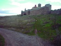
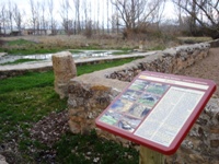
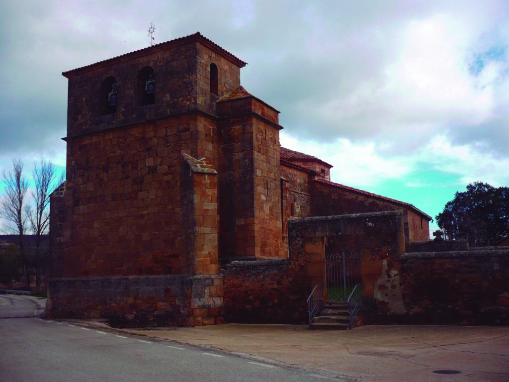
On entering Renieblas, there is a footpath leading to the Gothic church of Nuestra Señora de la Cruz, which still preserves some Romanesque remains. On the northeast side of the church are several medieval stelas which appear to indicate the existence of a necropolis, near which a fragment of Roman milestone was found. Milestones were stone mile markers placed on Roman roads to mark distances in Roman miles (1,481 m). Renieblas also boasts the ruins of Luzones palace and three stone sundials made by Don Jose de Vera.
From the church of Nuestra Señora de la Cruz, the route continues through Renieblas onto the road to Canos. Near this town, the route takes an eastbound side-track to the right, which connects with the road that links Almajano and Aldehuela de Periañez. Further down this road, toward the east, is Aldehuela.
Aldehuela de Periañez
Following in the footsteps of the Roman road that linked Uxama and Augustobriga is Aldehuela de Periañez, a town located in Campo de Gomara County, an area also traversed by Iter XXVII. The remains of several Roman villas near the town are testaments to its past. Prehistoric settlements have also been discovered in this area.
The largest body of water in Aldehuela is the River Chavalindo, a tributary of the rivers Moñigón and Merdancho, which runs through the municipality. There are other streams such as Las Navas and Valle. The town is situated on the slopes of Sierra del Almuerzo, in a steppe-like environment where a large oak grove (Quercus ilex) once existed, although there are now only a few dozen trees left.
Aldehuela de Periañez is home to the church of San Juan Bautista, a sixteenth century Gothic building, with baroque chancel and transept. Inside are several beautiful 17th century altarpieces and various Romanesque statues. Next to the church is an ashlar fountain and stone basin typical of the villages in the area.
Aldehuela de Periañez is home to the church of San Juan Bautista, a sixteenth century Gothic building, with baroque chancel and transept. Inside are several beautiful 17th century altarpieces and various Romanesque statues. Next to the church is an ashlar fountain and stone basin typical of the villages in the area.
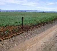
In the foothills of Sierra del Almuerzo and Cerro Cencejo, at an average altitude of 1,065 m, lies the town of Arancón, which borders with Narro to the north, Tozalmuro to the south, Aldealpozo to the east, and Aldehuela de Periañez to the west. The two major rivers in the municipality are Chavalindo and Cañuelo, also known as Trascastillejos. Arancón is primarily an agriculture-based town with vast fields of wheat, barley, rye and sunflower.

Arancón also has water resources, with two fountains, Fuente Vieja and Fuente Rana, and a stone basin. The most important remains of the Roman road that connected Uxama and Augustobriga can be found in Arancón. Very close to the church of Nuestra Señora de la Asunción, in the recreation area next to the temple, are two large milestones dated to between 132 and 131 BC. Behind the church, in the area known as Las Eras, are three additional milestones, which will soon be moved to place where the other two are exhibited.
Arancon’s parish church is its main artistic monument. Romanesque in origin, the church of Nuestra Señora de la Asunción was substantially altered during the eighteenth century. Inside, under the choir, is the alleged baptismal stone font of the original temple. There are also various baroque statues. The sturdy square tower attached to the building is Romanesque. The remains of an Iron Age fortified village have been found in nearby Cerro de San Bartolomé, where the ruins of a small chapel also exist.
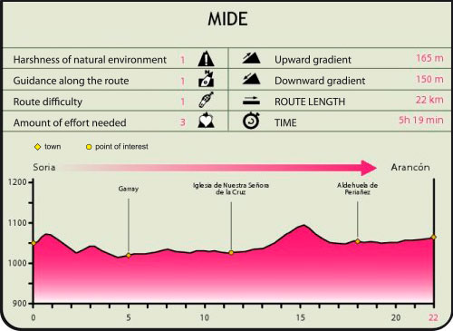
Profile
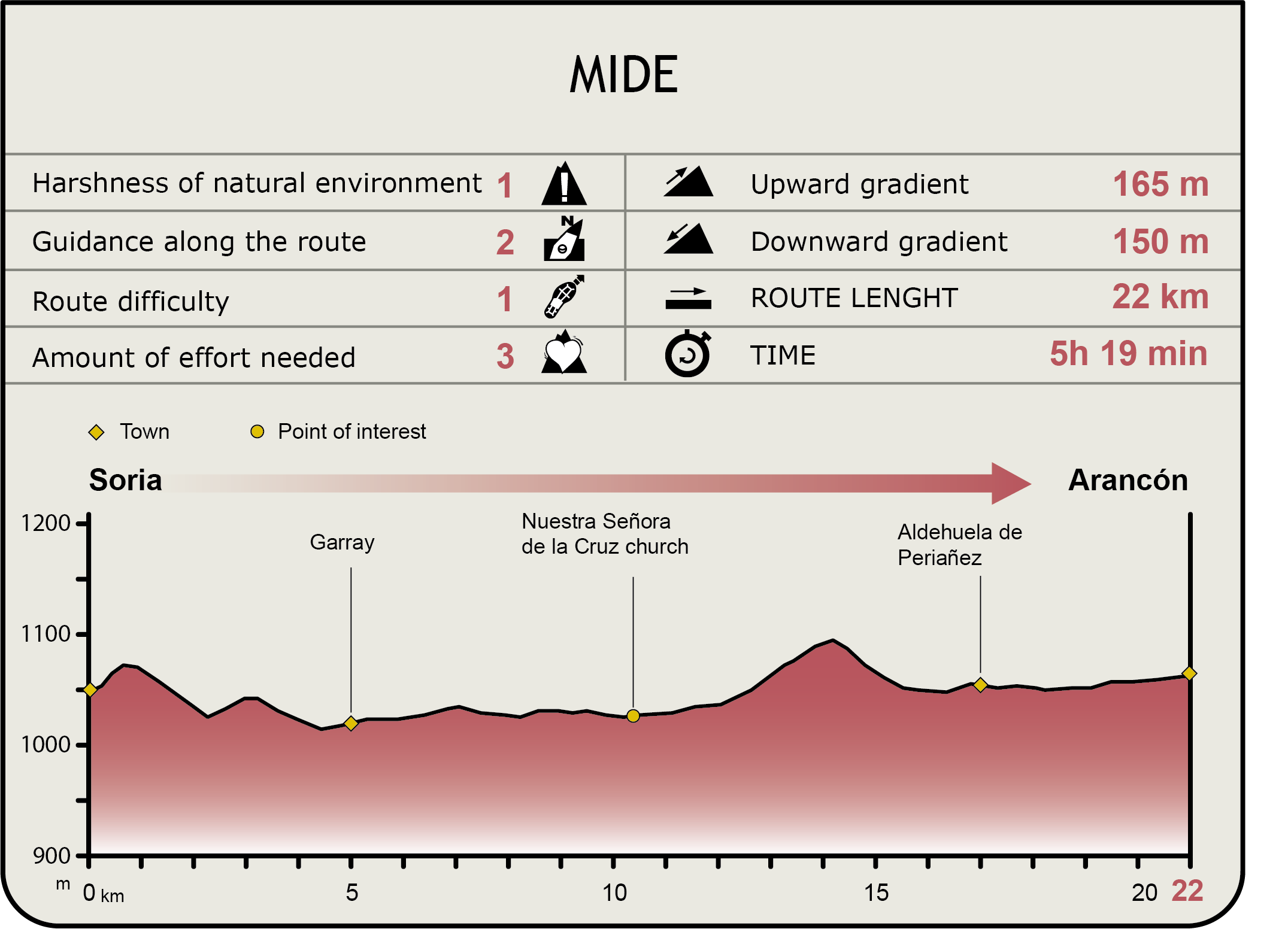
MIDE (Method for the Information of Excursions)
 Harshness of natural environment
- 1. The environment is not risk-free
- 2. There are more than one risk factors
- 3. There are various risk factors
- 4. There are quite a lot of risk factors
- 5. There are many risk factors
 Guidance along the route
- 1. Well defined trails and crossings
- 2. There is a clearly marked trail and signage
- 3. Requires the identification of geographic features and cardinal points
- 4. Requires off-path navigation
- 5. The trail is interrupted by obstacles that have to be gone around
 Route difficulty
- 1. Walking on a flat surface
- 2. Trails with different types of path
- 3. Walking on stepped paths or irregular terrain
- 4. The use of hands or jumping over the terrain is necessary
- 5. The use of hands is required to progress
 Amount of effort needed
- 1. Up to 1 hour of continuous walking
- 2. Between 1 and 3 hours of continuous walking
- 3. Between 3 and 6 hours of continuous walking
- 4. Between 6 and 10 hours of actual walking
- 5. More than 10 hours of continuous walking
Featured
Further information
San Saturio
Legend has it that San Saturio, a son of a sixth century Sorian noble family, abandoned his princely life and gave his wealth to the poor to lead an austere life in a cave on the banks of the Douro. The remains of the hermit saint have been kept since the sixteenth century in this beautiful octagonal shrine, built in his honour on an outcrop over the river, surrounded by a stunning natural landscape.
The present-day shrine dates back to the seventeenth century. Inside are interesting frescoes illustrating the saint's life. One fresco in the chapel depicts one of San Saturio's miracles. It shows him spreading his cloak over the river Douro so his disciple, San Prudencio, could cross the river without getting wet. San Saturio was granted sainthood by Benedict XIV in 1743. Soria has since celebrated the feast of its patron saint on October 2nd.
The Siege of Numantia
Located atop Cerro de la Muela, seven kilometres from the city of Soria, the heroic resistance of the ancient Celtiberian town of Numantia against Rome gave rise to a myth. In fact, the Royal Spanish Academy of Language has accepted the term "numantino" to define stubborn resistance taken to the limit.
Numantia stoically endured 20 years of siege by the Roman legions, defeating one Roman general after another, until the Empire eventually commanded its most famous general, Publius Cornelius Scipio, to subdue the city. The city finally succumbed to starvation in the summer of 133 B.C.
The so-called Battle of the Elephants was one of the most memorable chapters of the siege of Numantia. After the troops commanded by Nobilior were defeated by Numantines and "Segendeses", Nobilior sought help from his ally King Masinissa of Numidia, who sent 300 horsemen and ten elephants that were kept in the rearguard. Their presence came as a horrible surprise to the Celtiberians, who had never before seen this animal.
The Roman charge drove the Celtiberians back to Numantia, where they sought refuge behind its walls. Once there, they turned the elephants against their handlers, thwarting the attack of the Roman troops and setting out in pursuit of the retreating enemy.
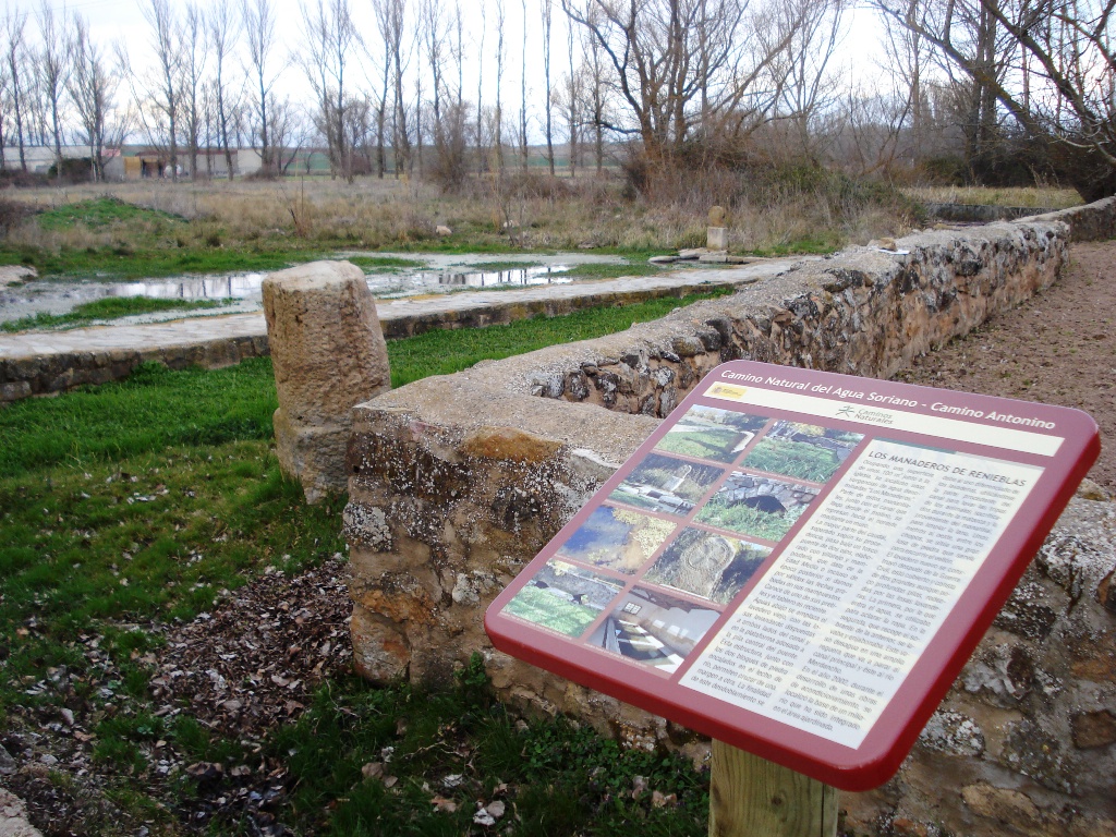
Los Manaderos
Near the medieval cemetery of Renieblas' church is a place, about 100 m2 wide, where water flows to the surface. This is Los Manaderos, various springs that also contain several funerary stelas. These springs feed the river Merdancho that flows through the town. A watercourse that may have been a Roman canal, judging by the masonry remains found upstream.
The stream runs under a small medieval bridge with two arches. These arches divide the water from the canal from the water from the spring before it reached the washhouse located downstream. Spring water was used for washing clothes, and the channel water for washing gut and wool.
A dam was built upstream. This area is now covered with lush aquatic vegetation and provides safe haven to diverse birdlife. The base of a Roman milestone, rescued from the waters and placed in a landscaped area near the buildings, bears testament to the Roman occupation of the town.
Sierra del Almuerzo
Sierra del Almuerzo, the natural boundary between the Douro and Ebro basins, is also known as Sierra de los Siete Infantes de Lara. Legend has it that the Seven Princes of Lara had lunch on the mountain summit before being betrayed by their uncle Ruy Velázquez in the battle against the Saracens in Araviana valley. A rock art at the site, known as the "Piedro de los Siete Infantes", commemorates this episode.
The East Soria Drover's Road also winds through Sierra del Almuerzo. Its highest peak, Cerro del Almuerzo, is 1,556 m high. In a rich forest inhabited by different game species, the dominant plant species in Sierra del Almuerzo are holm oak(Quercus ilex), common oak (Quercus robur), heather (Erica vagans), chamomile (Chamaemelum nobile), gorse (Genista scorpius) and lavender (Lavandula latifolia).
Multimedia
Downloads
GPS Downloads
Cyclability
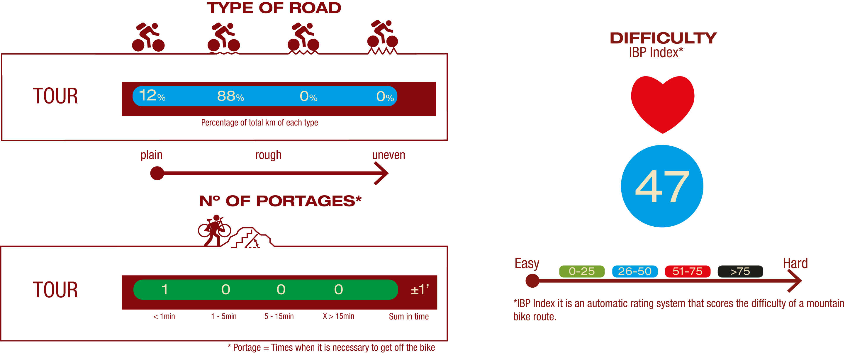
This Cyclostage corresponds to stages 1 to 3 of the Nature Trail
PROFILE
TYPE OF ROADS, PORTAGES & DIFFICULTY
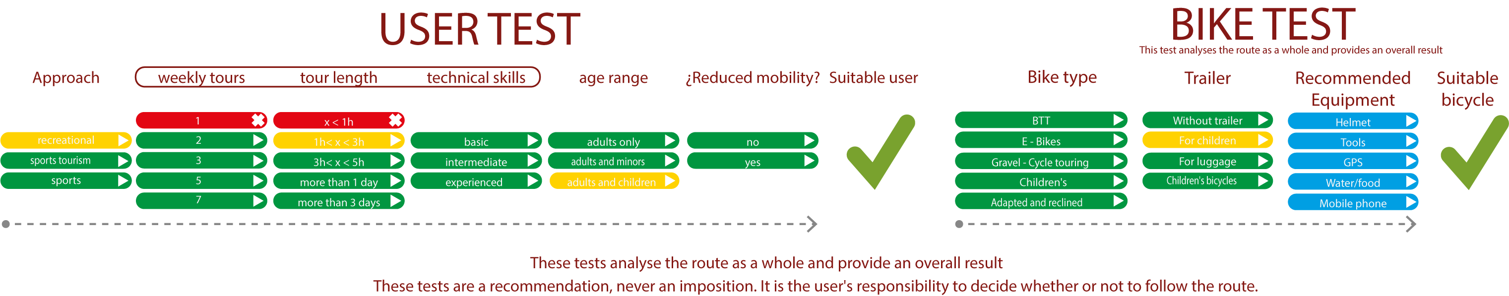
TEST
SAFETY RECOMMENDATIONS
- Sections shared with hikers and agricultural vehicles.
- Transit through the centre of some population centres.
GENERAL RECOMMENDATIONS
- Find out about the technical aspects of the route and the weather on the day.
- Take care of the environment. Take care not to disturb animals or damage vegetation. Respect private areas.
- You must give priority to pedestrians and comply with general traffic rules.
- The environment in which you will be riding is open, free to move around and an area where many activities are carried out (sporting, forestry, livestock and agricultural activities). Always have an understanding, prudent, responsible and respectful attitude.