- Home
- Rural Development
- Nature Trails
- Nature Trails
- Canary Islands Sector
- Órzola a Playa Blanca
Stage 4: San Bartolomé-Yaiza
Description
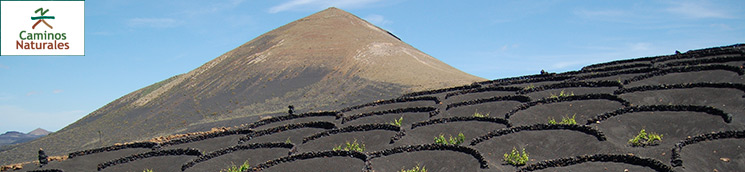
This stage winds through Monte Guatisea and Montaña Blanca. The traveller will then be able to admire the spectacular nature of La Geria
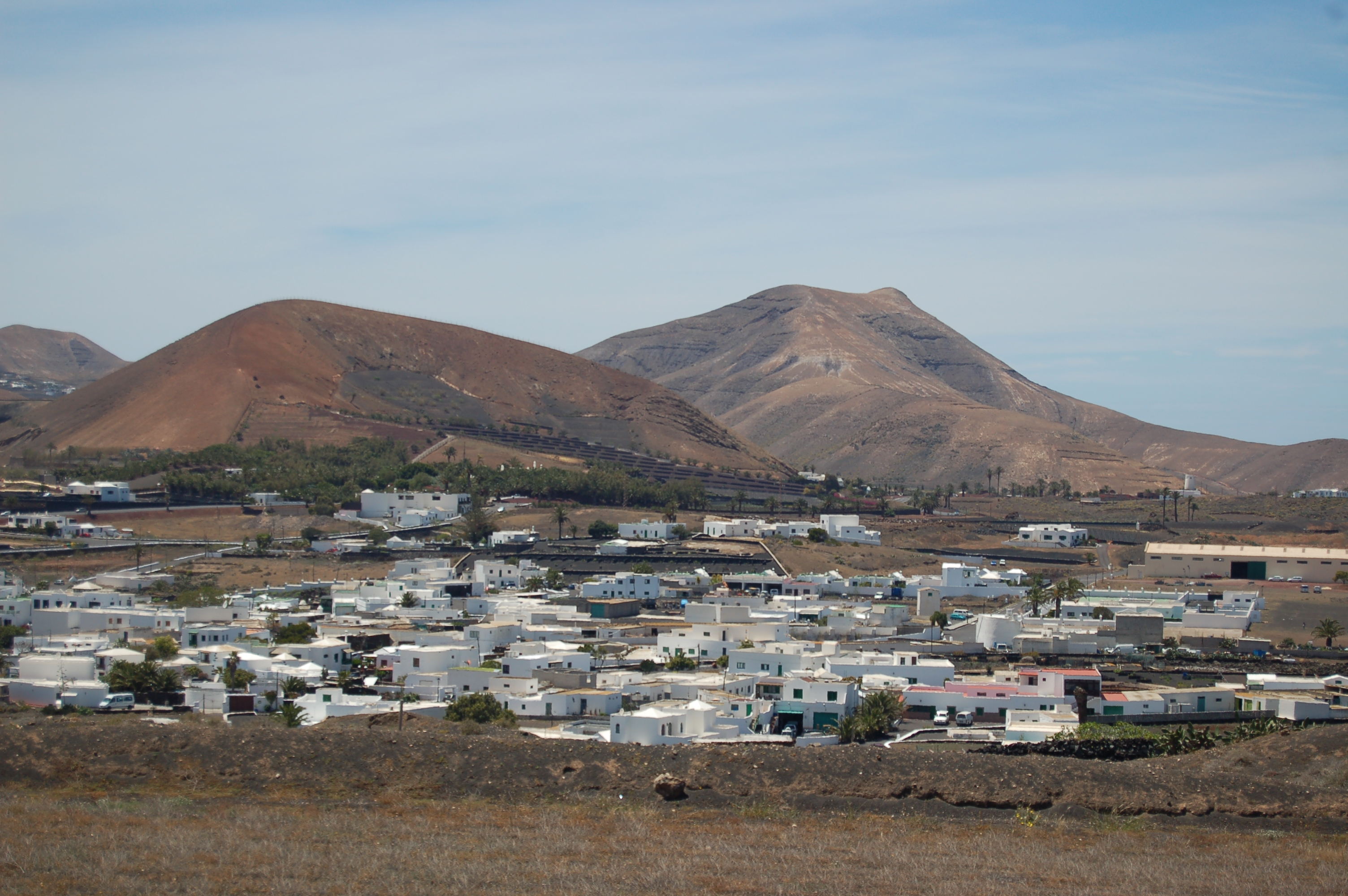
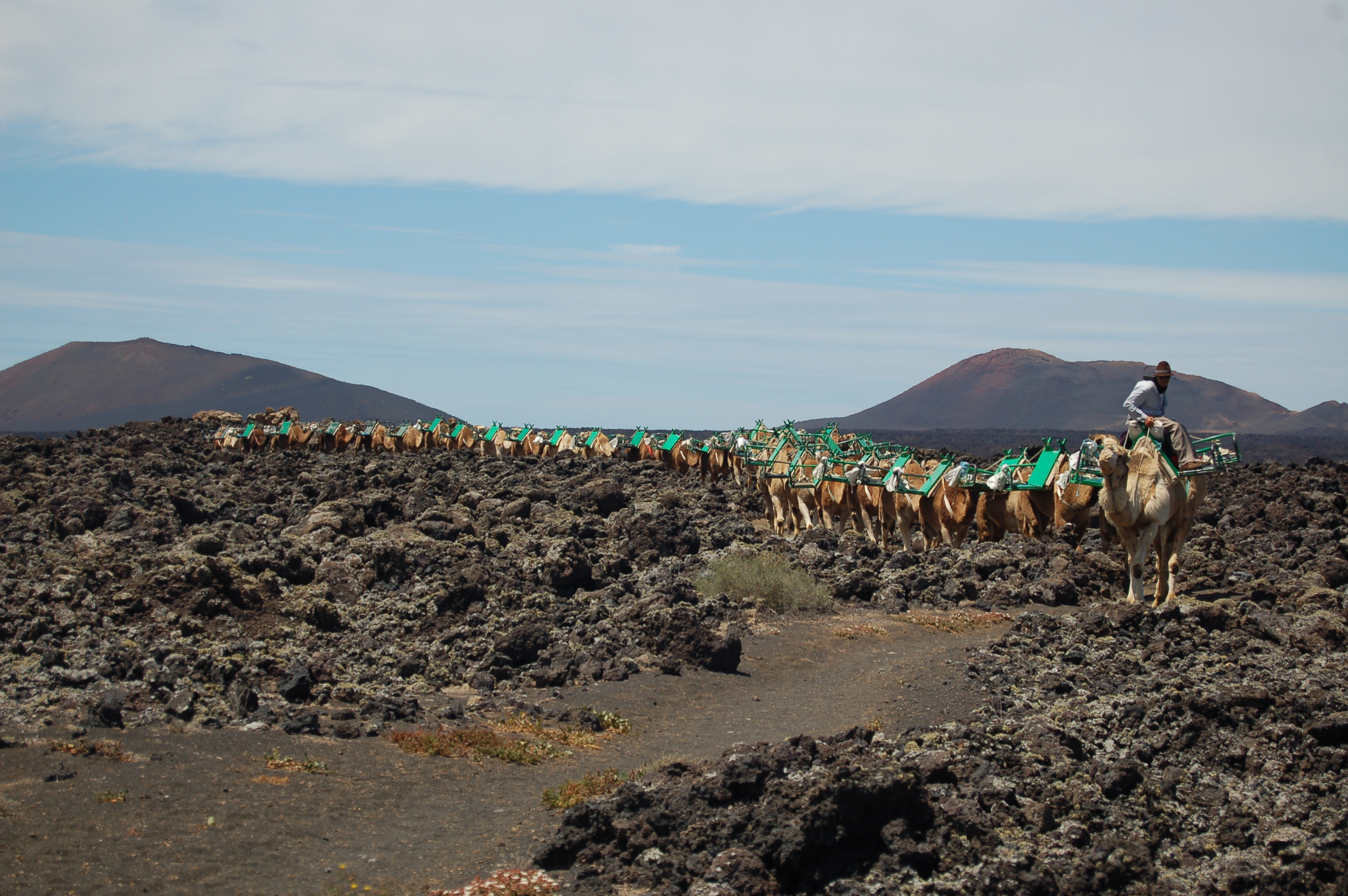
This fourth stage is the longest one in the Órzola-Playa Blanca Nature Trail. Its starting point is the town of San Bartolomé. Before leaving the town centre, the traveller can admire most of its architectural heritage, particularly the house of Mayor Guerra. The trail goes around Caldera Honda and Monte Guatisea all the way to the town of Montaña Blanca, leaving then its namesake peak on your left. The town centre of Conil is half-way to the end of the stage. After going through the town of La Asomada, the trail goes deeper into the Protected Landscape of La Geria. The traveller is welcomed to the town of Uga with rows of dromedaries walking back and forth Uga and Yaiza, endpoint of this fourth stage in the Órzola-Playa Blanca Nature Trail.
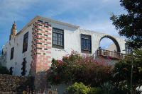
The longest stage of the Órzola-Playa Blanca Nature Trail begins in the town of San Bartolomé, at kilometre 34. The trail goes down Rubicón Street past the house and mill of Don Juan Armas Perdomo -municipal Site of Cultural Interest-, and, shortly after, past the house Don Sebastián Martín Perdomo -included in the Municipal Architectural Catalogue-. Before leaving the town centre, turn right onto Serpiente Street and take the stone pedestrian road at the roundabout. This road will lead you to the Mayor Guerra house, also a Site of Culture Interest.
Having admired the rich architectural heritage of San Bartolomé, leave the town centre at kilometre 35. Then go up a dirt path, leaving the Caldera Honda on your left and getting into the Protected Landscape of La Geria. Shortly after, the trail takes a light downhill slope that ends at the last houses of Timanfaya Street, again in the town centre of San Bartolomé. At this spot, the trail turns left onto a paved track. After a stretch that goes up and down, the trail turns left once again onto a wide dirt track. It goes around the Caldera Honda almost entirely, leaving the Monte Guatisea on your left.
A few metres after going closely past the LZ-35 road, you will reach kilometre 39. You will then go into the town of Montaña Blanca via San Bartolomé Street, leaving behind the Protected Landscape of La Geria. After crossing the LZ-301 road that goes through town, continue straight down and past kilometre 40. Take then El Especiero Street to leave this town. The paved path turns into a dirt path that keeps going up and once again into the Protected Landscape of La Geria.
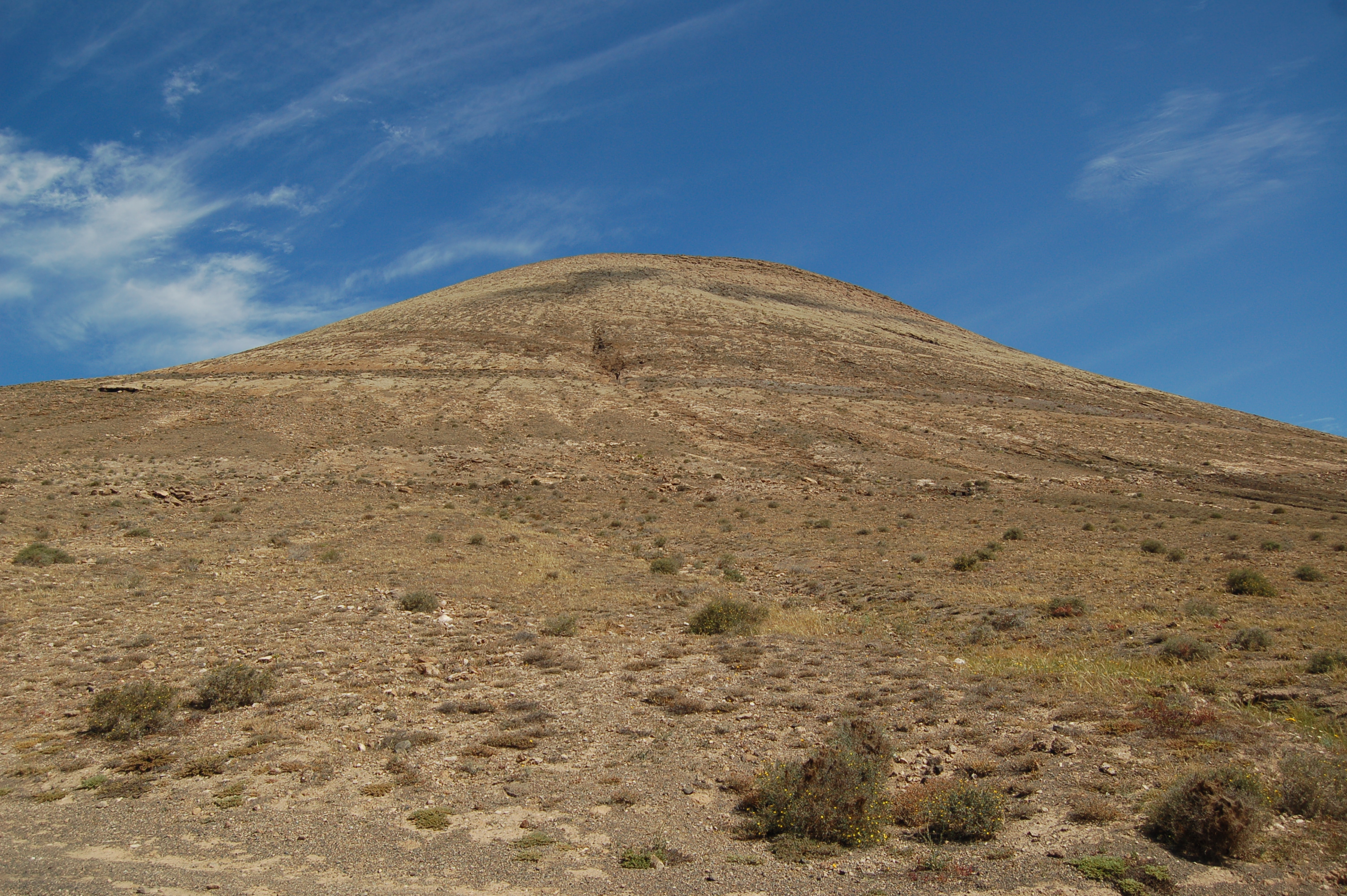
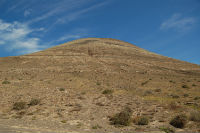
From kilometre 41 onwards, the trail becomes a narrow path that turns into a wide dirt path again after a few metres. This is the end of the uphill slope in the mountain pass between the slopes of Los Morretes (439 m) and Montaña Blanca (596 m).
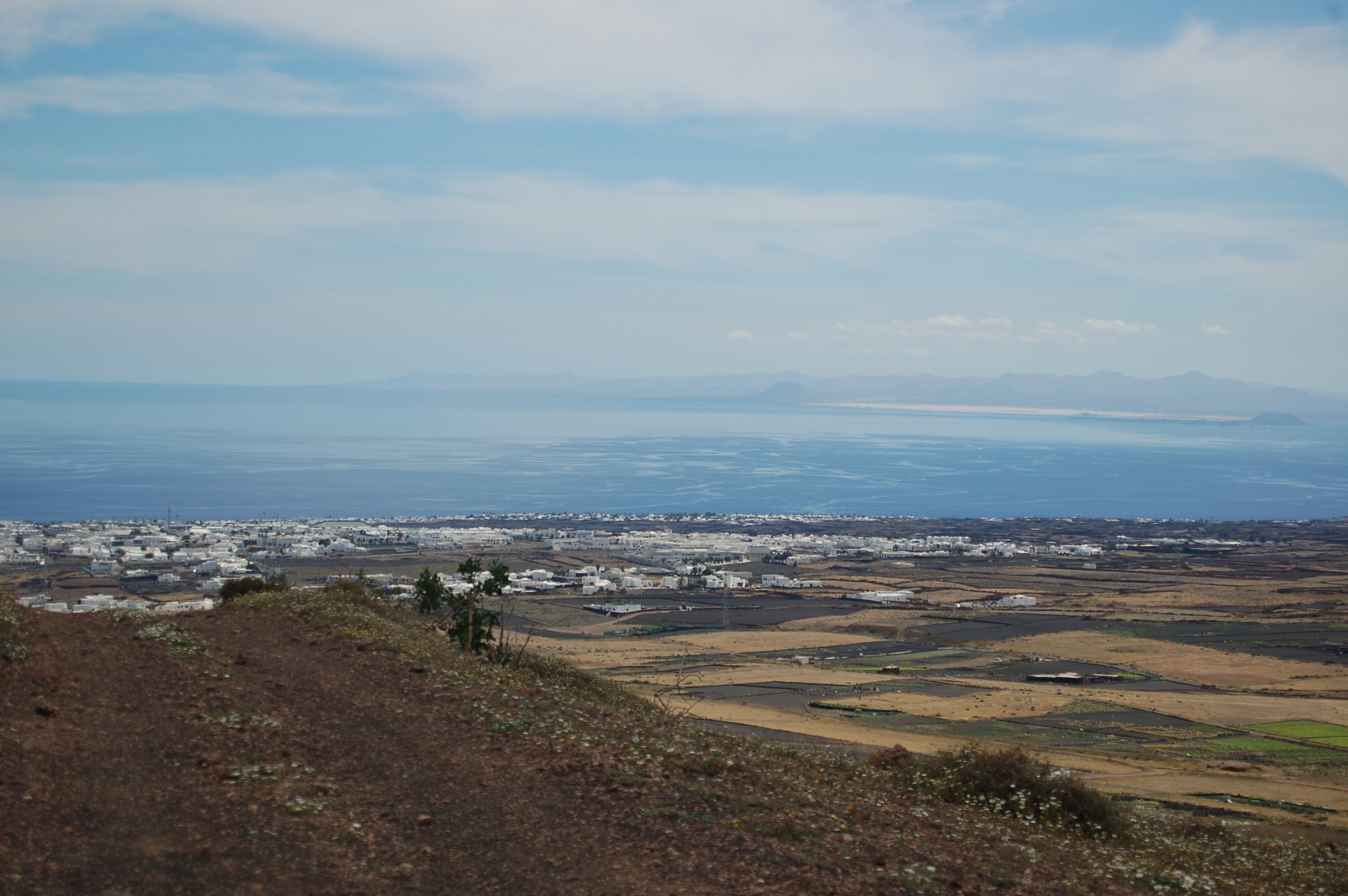
While the trail begins to go down, the traveller can admire the beautiful panoramic view of the neighbouring island of Fuerteventura. Then the trail turns right a few metres before kilometre 43, leaving behind the Protected Landscape of La Geria. Cross then the paved road known as Los Fajardos path, exercising great caution. The trail keeps going up past the kilometre 44. It becomes paved the moment it starts to go down towards the town of Conil along the Peña del Asiento path. Cross the LZ-501 and continue on the Callao path. The trail continues to go down out of the town centre and all the way to kilometre 46, where it starts to go up towards the town of La Asomada. The ascent finishes here, with the Cerro Tegoyo path on your right.
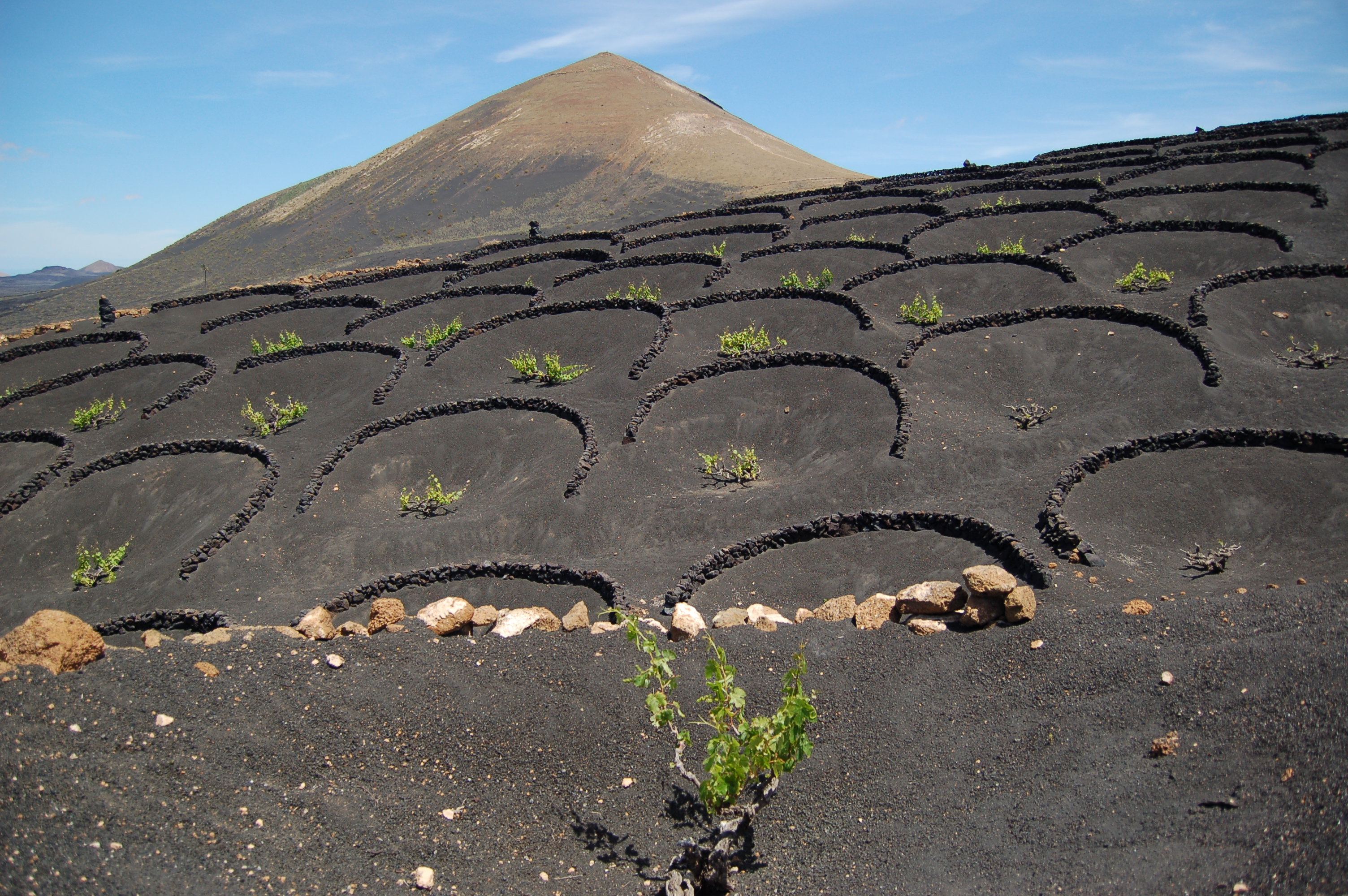
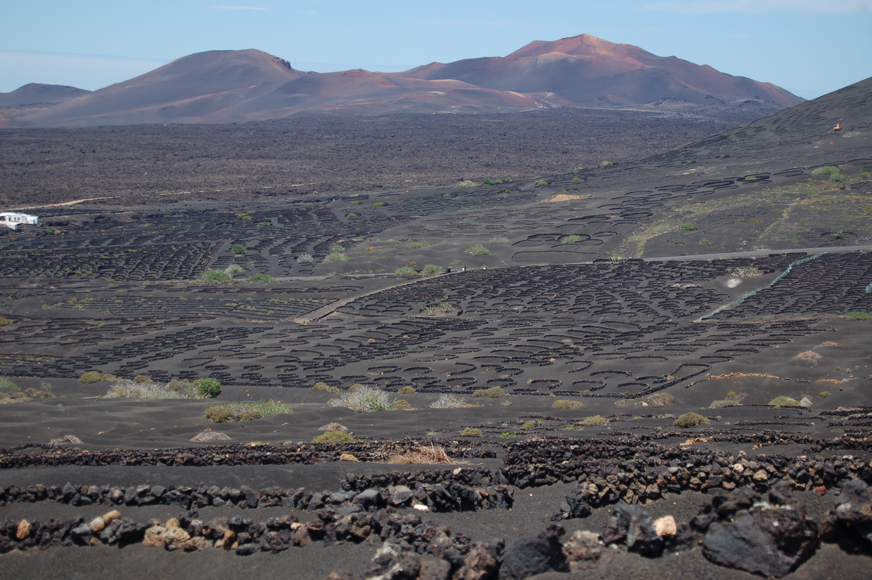
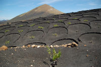
Turn left onto the LZ-503 road and, shortly afterwards, turn right along La Caldereta path, always within the town of La Asomada. The last house of La Asomada marks the end of the paved road. The trail continues along a wide dirt path up the northern slope of the Montaña Tinasoria and deep into the Protected Landscape of La Geria. The ascent comes to an end shortly after the first traditional vineyard crops come into view. You can enjoy the gorgeous landscape these extensive crops represent while going down the trail.
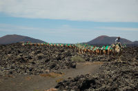
Past kilometre 51, the descent ends and the trail continues among vineyards right before a left turn onto the LZ-30 road. Continue along it for just 150 m. Take a right turn down and into the town of Uga via La Agachadilla Street. Walk through this town leaving the church of San Isidro on your right. The houses gradually disappear. Make a right onto Los Camellos path to leave the paved road. Past kilometre 54 there is an interpretative display panel about volcanic eruptions. There, the wide trail turns into a narrow path that runs through the Badlands and into the Los Volcanes Natural Park. Once past kilometre 55, the path widens yet again. In this stretch the traveller might come across one of the typical rows of dromedaries from Uga.
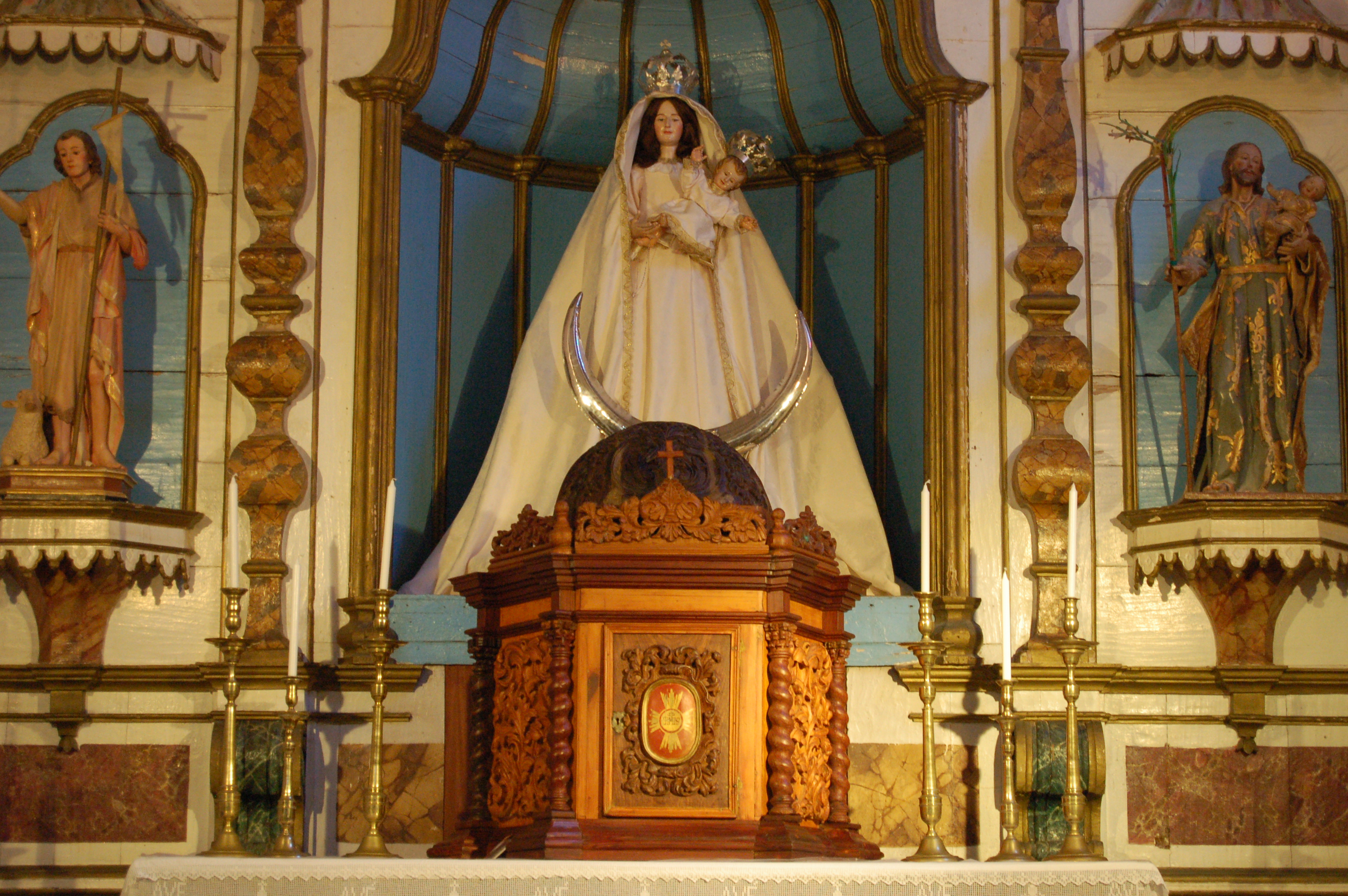
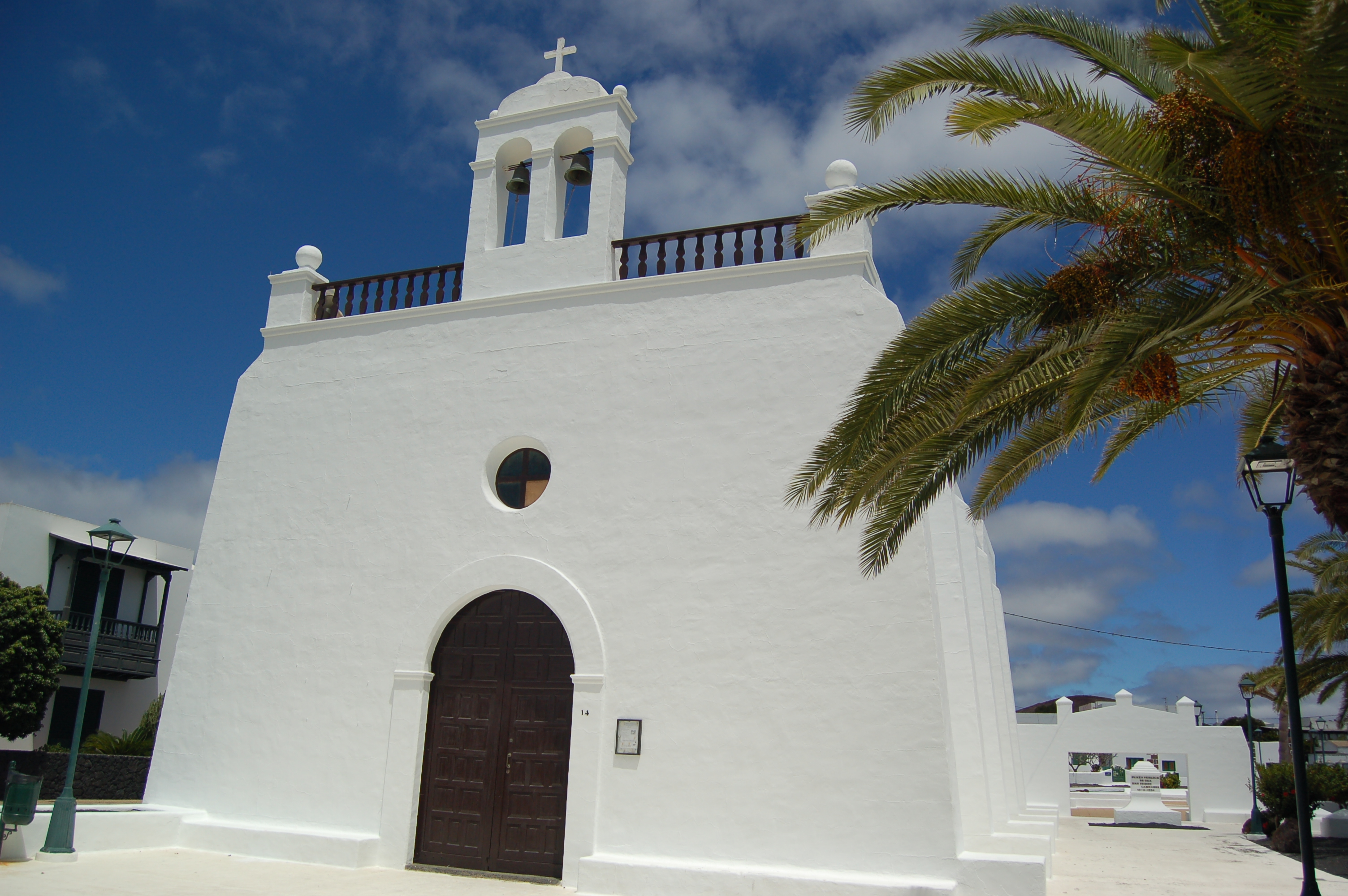
The traveller reaches the roundabout of the LZ-67 road connecting with the LZ-2 road, where a common 745 m long stretch with the LZ-67 ensues. This stretch leaves Los Volcanes Natural Park behind, leading the traveller into Yaiza via Muyay Street. Muyay Street comes to an end and at kilometre 56, where La Cuesta Street begins. Turn right along Vista de Yaiza Street, leaving the church of Nuestra Señora de los Remedios on you right. Enjoy its extensive collection of paintings with religious motifs made on volcanic rocks.
The longest stage of the Órzola-Playa Blanca Nature Trail ends after a few metres in the eastern area of the town of Yaiza.
Sites of interest
Profile
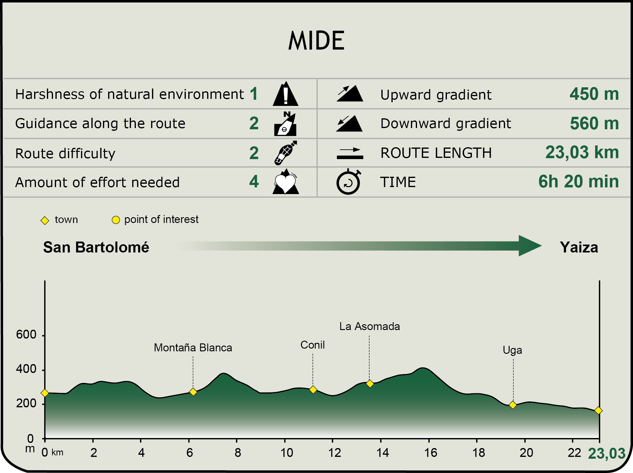
MIDE (Method for the Information of Excursions)
 Harshness of natural environment
- 1. The environment is not risk-free
- 2. There are more than one risk factors
- 3. There are various risk factors
- 4. There are quite a lot of risk factors
- 5. There are many risk factors
 Guidance along the route
- 1. Well defined trails and crossings
- 2. There is a clearly marked trail and signage
- 3. Requires the identification of geographic features and cardinal points
- 4. Requires off-path navigation
- 5. The trail is interrupted by obstacles that have to be gone around
 Route difficulry
- 1. Walking on a flat surface
- 2. Trails with different types of path
- 3. Walking on stepped paths or irregular terrain
- 4. The use of hands or jumping over the terrain is necessary
- 5. The use of hands is required to progress
 Amount of effort needed
- 1. Up to 1 hour of continuous walking
- 2. Between 1 and 3 hours of continuous walking
- 3. Between 3 and 6 hours of continuous walking
- 4. Between 6 and 10 hours of actual walking
- 5. More than 10 hours of continuous walking
Featured
Further information
Plains of El Jable
This extensive sandbank is made up of organogenic marine sand from decomposed shells and carapaces. The trade winds create this landscape by transporting this type of sand from La Caleta de Famara to the central and southeast areas of the island. Its name, Jable, comes from a local word that means marine sand. While several products are cultivated in these plains, the sweet potato (‘batata’ in Spanish) deserves a word of mention, since the inhabitants of San Bartolomé are called ‘Batateros’ for this reason. Vegetal barriers or bardos made out of different plants, such as wheat and rye, are installed to protect the crops against the wind.
San Bartolomé
This Lanzarote municipality is located in the central part of the island, and has archaeological sites that attest to its pre-Hispanic existence. After the conquest, the municipality began to grow thanks to its relatively intense farming activity particularly sweet potatoes in El Jable and wine in La Geria. Its rich and diverse architectural heritage is found mainly in the León y Castillo Square, the church of San Bartolomé, the theatre and the city council. Also of note are the house and mill of Don Juan Armas Perdomo, the house of Don Sebastián Martín Perdomo and that of Mayor Guerra in the Southwest of the town centre.
Multimedia