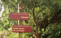
Stage 3: Valverde - Ermita Virgen de los Reyes
Description
Back to the Shrine of La Dehesa
In its third stage, trail GR-131, which is popularly known as Camino de la Virgen (Path of the Virgin) follows in the footsteps of the pilgrims who, from Villa de Valverde, take the image of the Virgin back to La Dehesa, stark land of herdsmen where the shrine of the Virgin is located.
Every four years, the people of El Hierro take the image of the Virgen de los Reyes from its shrine and carry it to the capital city of the island in a popular pilgrimage known as Bajada de la Virgen (Descent of the Virgin). After celebrating Mass in the shrine, the authorities carry the image to Alderman’s Stone, where it is handed over to the local people in order for the image to be taken to Valverde along the so called Camino de la Virgen (Path of the Virgin), a distance of a little more than 37 km following ancient cattle trails. GR-131 goes along this route on the way back, following in the steps of the pilgrims who carry the Virgin on their way back to the shrine, a remote and secluded place among grazing lands.
The Camino de la Virgen is divided by “rayas” or “lines” that mark the boundaries between the different villages of the island; these “rayas” are points where the image is handed over from one village to the other. Shows of neighbor rivalry are unavoidable at these points: the pilgrims that have to hand over the image procrastinate, while the people of the village that receives the image want to get hold of it as soon as possible. The people of the village go to meet the image of the “beloved mother” bearing images of the patron saints of each village, amid dancers wearing their traditional apparel and dancing to the sound of whistles, drums and chácaras (a local variety of castanets).
From Valverde to Raya de Tejegüete
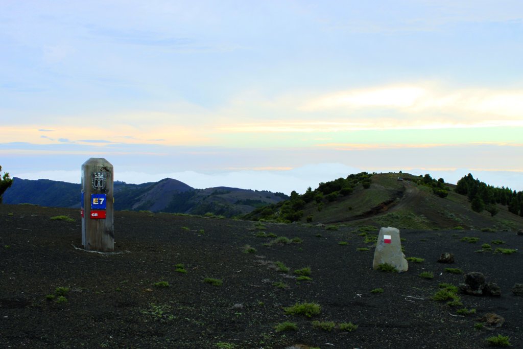
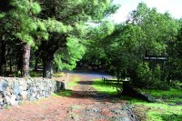
The third section of GR-131 starts from the church of Nuestra Señora de la Concepción, in the village of Valverde, and heads in a southeasterly direction for Tiñor. After passing through this town, we come to Raya de Tejegüete, where the image of Virgen de los Reyes of Valverde is handed over to the people of El Mocanal Norte (during the ascent of the image; during the descent is the other way round); in this section we will see plant formations consisting of fire tree and heath, announcing the evergreen laurel forest we will see further on.
We will often see directional signs about Ruta del Agua or Arbol de Garoé, since these paths join the Camino de la Virgen for a stretch, even though it is necessary to make a detour in order to reach it. The trail also goes along asphalt tracks and skirts the facilities of the future hydro-wind power plant, a project that aims to achieve energy self-sufficiency for El Hierro exclusively through the use of renewable sources of energy.
From Las Cuatro Esquinas to Raya de la Mareta
Later on, we will arrive at Las Cuatro Esquinas, a resting area for pilgrims during the ascent and descent of the Virgin, and then we will head out for the raya or line of the same name, where the image of the Virgin is taken from El Monacal Norte to San Andrés.
In this part of the route the trail is wide and pleasant; it goes across several paths and enters a Monterey pine (Pinus radiata) grove with some trunks of Canary Island pines (Pinus canariensis) that are gradually invading this stretch of land. The trail goes between dry stonework walls that mark out the lands belonging to local farmers, where they grow pastures and forage such as tagasaste or escobón (Chamaecytisus proliferus). We can see in these region herds of sheep, and some cows and horses, close to a series of small volcanoes that we will see in this part of the trail. After Raya de la Cruz del Niño, where the image of the Virgin is handed over from San Andrés to Isora, we reach Raya de la Mareta, where the image of the virgin is conveyed from Isora to El Pinar.
La Raya de La Llanía
Further on, we will go into the Parque Rural de Frontera (Frontera Rural Park) where we can appreciate the results of forest hydrological restoration works carried out after the forest fire of 2007. We will find here a viewpoint that will allow us to see the inside of a crater. This area is crossed by several tracks, marked with different colors, in the area called La Hoya de Fireba, where Raya de la Llanía is located (here the image of the Virgen de El Pinar is handed over here to El Golfo).
Following the road, we enter laurel forests, populated by species which are only found in the Macaronesia area, and then we climb to a perpetually windy line of ridges, with an abundance of scattered pine trunks or pine groves mixed with heather and fire tree formations. If we keep going along the way, we will come to Piedra de Dos Hermanas, 1,360 m above sea level, and we will reach the top of a ridge that marks the limit of Valle de El Golfo. Once we leave the asphalt road behind us and reach the peak of Tenerife, a line of wooden poles marks the way up to the area known as Tábano, a hillside descending into the Valle de El Golfo.
From Raya de El Cepón to Raya de Binto
We continue the trail until we come to the ravine of Cepones, where we find Raya del Cepón (here the image of the Virgin is handed over from El Golfo to El Pinar), and from here we follow a path - parallel to the asphalt road that goes along the higher part of the island - which will take us to Cruz de los Reyes, a place where there rises a large wooden cross and where we can drink water from a spring.
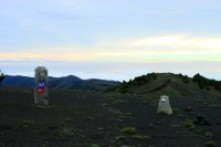
From the summit, the views of the bay of El Golfo and the southern part of the island are spectacular. There are hardly any plants, and what little vegetation there is has to endure the continuous push of strong winds. We gently ascend slopes of reddish jable (volcanic sand) to the Malpaso peak, which, at 1,501 m, is the highest point on the island, from where, on a clear day, you can make out in the distance the islands of Tenerife, La Gomera and La Palma.
From this point, the rest of the trail begins its descent. In the area of Binto, where the ground is covered with black jable, we find the raya or line of the same name, where the image of the Virgin is handed over from El Pinar to Sabinosa. From Raya de Binto, we can see the volcanoes in the area of La Restinga, as well as the hillsides of El Julán and the lighthouse at Orchilla. Another highlight of the trail is Cruz de los Humilladeros, a stopping place where drinking water is available.
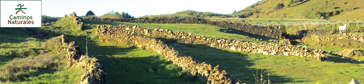
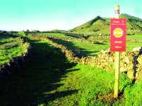
Soon after, the path is interrupted by a Monterey pine or pinus radiata forest, with scattered specimens of Canary Island pine. As we get out of the forest, we can already see pasture lands, whose green hues will amaze us, as will the colors of a magnificent forest of fire trees and heather trees. The track rises, and then runs mostly along a path bordered by stone walls used to mark the limits of pasture plots, where we can often see sheep grazing.
Specimens of savin juniper are very infrequent, while the presence of fire trees on the boundaries between two fields is quite common. Along the way we can enjoy magnificent views of the commons of La Dehesa.
Piedra del Regidor and the Shrine of La Dehesa
Before reaching our destination at the foothills of a mountain, we will see Piedra del Regidor (Alderman’s Stone), a resting place for the image of the Virgin during its descent in pilgrimage. In the course of this festivity, the authorities of the island and of the Brotherhood of the Virgin (Cofradía de la Virgen), carry the image of the Virgin to the Alderman’s Stone for it to be taken again at dawn by the local people, the inhabitants of Sabinosa being the first ones to carry the image from this point.
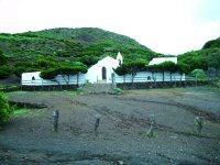
From Piedra del Regidor, the trail takes a detour for a few meters in order to reach our destination: the shrine of Virgen de los Reyes, a simple building – abode of the image of the Virgin - that stands out for its white color against a background of green and black hues.
Sites of interest
Profile
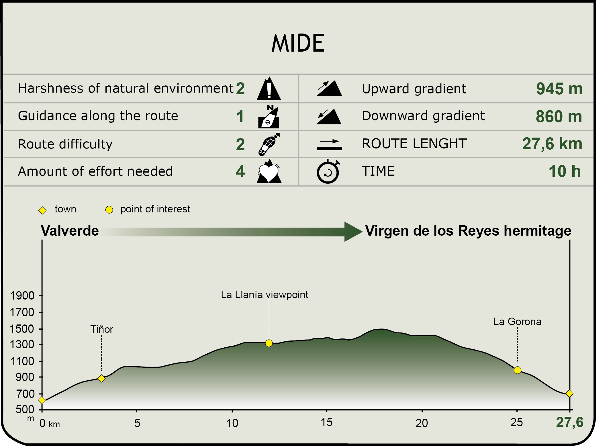
MIDE (Method for the Information of Excursions)
 Harshness of natural environment
- 1. The environment is not risk-free
- 2. There are more than one risk factors
- 3. There are various risk factors
- 4. There are quite a lot of risk factors
- 5. There are many risk factors
 Guidance along the route
- 1. Well defined trails and crossings
- 2. There is a clearly marked trail and signage
- 3. Requires the identification of geographic features and cardinal points
- 4. Requires off-path navigation
- 5. The trail is interrupted by obstacles that have to be gone around
 Route difficulty
- 1. Walking on a flat surface
- 2. Trails with different types of path
- 3. Walking on stepped paths or irregular terrain
- 4. The use of hands or jumping over the terrain is necessary
- 5. The use of hands is required to progress
 Amount of effort needed
- 1. Up to 1 hour of continuous walking
- 2. Between 1 and 3 hours of continuous walking
- 3. Between 3 and 6 hours of continuous walking
- 4. Between 6 and 10 hours of actual walking
- 5. More than 10 hours of continuous walking
Featured
Further information
Parque Rural de Frontera
Frontera Rural Park is a protected natural space of the island of El Hierro, and one of the most complete ones of the entire Canary Islands. It has a total area of 12,488 hectares distributed between the municipalities of Valverde and Frontera, and it includes both wild areas and crop lands and livestock farms, among which there are some communal farming areas, like La Dehesa. The Reserva Natural Integral de Mencafete (Integral Natural Reserve of Mencafete) also belongs to this rural park.
This protected area has places of great interest from the standpoint of nature conservation, and is home to several endangered flora and fauna species: birds such as the tern (Sterna spp.) or the Osprey or sea hawk (Pandion haliaetus), and plants such as the Hierro scallion (Androcymbium hierrense subsp. hierrense) and the Hierro fire tree (Myrica rívas-martinezii). Some parts of the coastline of La Restinga and La Dehesa play an essential role as nesting areas for some endangered species.
There are also interesting geomorphological structures in the park, such as El Lajial and El Verodal, and significant and representative samples of the most characteristic natural habitats, such as pine groves or tabaibal. The communities of Savin Juniper (Juniperus turbinata ssp. canariensis) in La Dehesa are probably the best of their kind in the entire Canary archipelago.
In this region are located most of the forest areas of the island; particularly interesting as a landscape is the semi-cirque of El Golfo, even though the landscapes on the slopes of El Julán and the wide lands and pastures of the central plateau are equally interesting as well.
Multimedia