
Stage 3: Camino de los Pastores - Julán
Description
Along the hillsides of El Julán toward the lands of Pinares
Following a track used by shepherds to reach the grazing fields on which their cattle feed in La Dehesa, the trail goes down the hillside of El Julán and through the valley of the same name until it comes to the municipality of El Pinar. This is a region characterized by great forest wealth, which is reached after visiting the Centro de Interpretación ot Interpretation Center at the Parque Cultural de El Julán (El Julán Cultural Park) and its important archeological site.
From the shrine of the Virgen de los Reyes, the third stage of this circular trail begins at the junction with Camino de la Virgen (Road of the Virgin), already described in the second section, and continues along a dirt track that goes through the meadows typical of this part of the island, mottled with the twisted shapes of isolated savin junipers (Juniperus turbinata ssp. canaríensis).
The first stretch of the path will allow us to cross the entire Valle de El Julán, following a route that was used by the shepherds of El Pinar when they wanted to reach their animals, which grazed for much of the year on the meadows of La Dehesa.
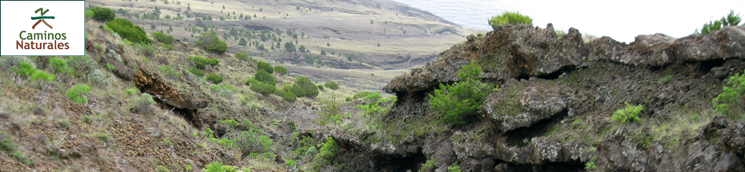
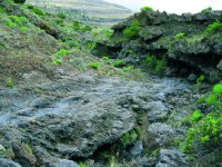
After having gone through a small grove of Canary Island pine (Pinus canaríensis), the trail joins for a few meters the road that goes down to the lighthouse at Orchilla, and then returns to a dirt track and, further on, a path that goes through a region named El Julán. The trail here consists of a steep slope that descends from the crests of Valle de El Golfo to the coastline along the southern hillsides of the island. El Julán is a depopulated area completely pierced by ravines with a volcanic substrate.
In the stretch of the path that goes through the area of El Julán we can admire the purest specimens of original pine grove, since the trail approaches the lowest levels of the island where it is possible to find Canary Island pines, which grow from the foothills up to the summits. We will also find on our way tabaibas (Euphorbia sp.) and junipers, which thrive in this area.
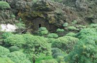
Along the trail we will see old stone shelters that were used by shepherds to move their herds to the grazing lands on the commons, and we will eventually grow accustomed to the view of flocks of ravens (Corvus corax) flying over us. Among all the islands of the archipelago only on El Hierro it is possible to see such large numbers of these birds.
Shortly after sighting a majestic fire tree (Myrica faya) that grows in one of the numerous ravines that cross El Julán, the trail reaches the Interpretation Centre of El Julán Cultural Park, boasting a splendid view of Mar de Las Calmas and the marine reserve of La Restinga.
From the intersection with the road that goes through El Julán (the only asphalt road that traverses this part of the island) the trail continues along a forest track. In its initial stretch, the path goes between the rim of the pine belt and an area of farm lands and plots growing a variety of crops. From the path, we can see La Empalizada Mountain, repopulated with Monterey pines (Pinus radiata).
Later on, the trail leaves the pine belt and begins a continuous descent between dry stone walls that used to mark the boundaries between mostly abandoned farms, where there are patches of prickly pears (Opuntia maxima), common figs (Ficus carica) and other fruit trees, although most of the farms grow vineyards, as is the case in most of El Hierro.
The vast forests of Canary Island pine, ranging from a level of 900 m up to the summits of the mountains, have determined for centuries the life of the population of this area, as evidenced by the very name of El Pinar (pine grove), a recently established municipality whose name has its origin in the forest wealth of this part of the island. This municipality consists of the urban areas of Las Casas and Taibique, located on the southern rim of the great pine forests that carpet a large area of this municipality.
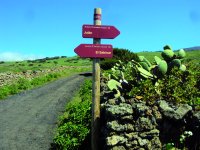
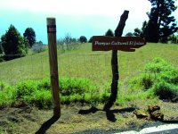
Shortly before reaching the neighborhood of Taibique, the trail leaves the Parque Rural de Frontera (Frontera Rural Park), which we have been touring from the start. A highlight of Taibique - a predominantly rural village - is its ornate square, where this section of the trail ends.
Profile
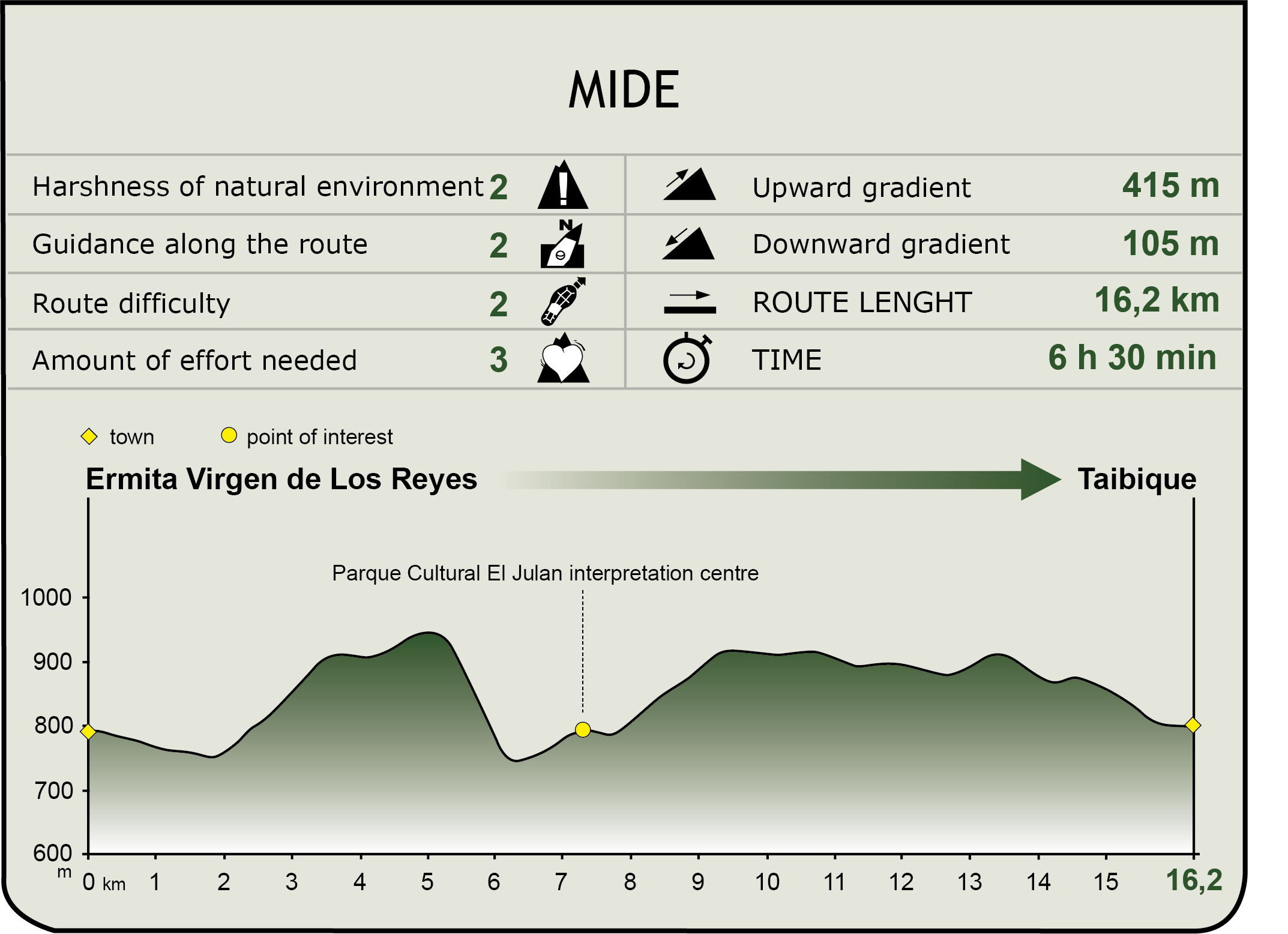
MIDE (Method for the Information of Excursions)
 Harshness of natural environment
- 1. The environment is not risk-free
- 2. There are more than one risk factors
- 3. There are various risk factors
- 4. There are quite a lot of risk factors
- 5. There are many risk factors
 Guidance along the route
- 1. Well defined trails and crossings
- 2. There is a clearly marked trail and signage
- 3. Requires the identification of geographic features and cardinal points
- 4. Requires off-path navigation
- 5. The trail is interrupted by obstacles that have to be gone around
 Route difficulty
- 1. Walking on a flat surface
- 2. Trails with different types of path
- 3. Walking on stepped paths or irregular terrain
- 4. The use of hands or jumping over the terrain is necessary
- 5. The use of hands is required to progress
 Amount of effort needed
- 1. Up to 1 hour of continuous walking
- 2. Between 1 and 3 hours of continuous walking
- 3. Between 3 and 6 hours of continuous walking
- 4. Between 6 and 10 hours of actual walking
- 5. More than 10 hours of continuous walking
Featured
Further information
Centro de Interpretación de El Julán
The Interpretation Center of the Cultural Park of El Julán (Centro de Interpretación del Parque Cultural de El Julán), inaugurated in July 2008, is one of the most important tourist/cultural centers in El Hierro. It has two floors dedicated to exhibitions of items on the life of the Bimbaches - aboriginals of El Hierro - and vestiges of their cultural heritage found in El Julán.
It is an interesting Pre-Hispanic site that showcases different architectural items such as houses made of dry stone, burial caves, places of worship, tagorores (the buildings where public meetings took place), taros (buildings used as shepherds’ shelters) and concheros (prehistoric deposits of shells and remains of mollusks and fish used for food).
Attached to this complex, there is an important archaeological site with a series of panels - engraved on solidified lava flows - called “The Signs” (“Los Letreros”) and “The Numbers”(“Los Números”) by the shepherds of El Hierro. Most of these engraved signs are geometrical and representational in nature, but there are also inscriptions in the Libyan-Berber alphabet etched using a stone surface chipping technique.
The walking tour of the archaeological site is carried out in the company of a professional guide, and the number of visitors is restricted in order to prevent damage to the items. It is a four hour walking trail: two hours to descend to the famous Tagoror and “Los Letreros” and two hours to come back.
Multimedia


