
Stage 13: Jinama - El Golfo
Description
The Road of the "Mudadas"
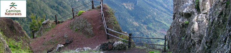
This thirteenth stage of the trail goes along Camino de Jinama (Jinama Road), an ancient livestock migratory route used by the people of the island to carry out the “mudadas” (“movement of animals”) from the villages of the interior to the Valle de El Golfo during the season in which weather conditions became harsher on the plateau.
Starting from the viewpoint of Jinama, on the highest part of the Nisdafe plateau, a sign informs us that we are entering Parque Natural de Frontera (Frontera Natural Park), the largest protected natural area of El Hierro, which we will not leave until we reach the village of Frontera, end of this section of the trail.
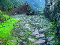
The trail descends steeply along a cobbled road that will continue for most of the way, hemmed in by walls and protective barriers that mark the limit between the road and patches of vegetation and rocky escarpments. Some 400 m from the Jinama viewpoint, as we descend, we reach a resting area built of stone on rocky ground that serves as a scenic overlook.
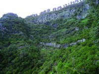
The phenomenon of "horizontal rain", very common on the island, is caused by the constant action of trade winds that originate the well-known “sea of clouds” over the Valle de El Golfo, creating a very humid environment that produces lush vegetation. For this reason, we will notice along the trail the presence of species characteristic of the laurel forest, such as heather (Erica arborea), fire tree (Myrica faya), Canary holly (llex canariensis), Canary laurel (Laurus azorica) and “mocán” (Visnea mocanera). Particularly large specimens of the latter species are found along the road, such as the Mocán de la Sombra and the Mocán de los Cochinos, growing on a bend of the road. We can also see specimens of strawberry tree (Arbutus unedo). The fruits of both species were a staple of the diet of the natives of El Hierro, the Bimbaches.
Mocán de los Cochinos was used as a resting place for migratory shepherds carrying out the seasonal “mudada” or movement of cattle from the interior to the Valle de El Golfo, and owes its name (Mocán of Pigs) to the fact that the animals were tethered to the roots of the tree while the shepherds rested.
After covering a distance of about 1,500 m, we reach El Miradero, a resting area located on a sweeping curve of the road that serves as a balcony that allows travelers to fully appreciate the beautiful views of the Valle de El Golfo towards its western boundary, marked by the village of Sabinosa and the coast of Arenas Blancas.
Some 1,800 m away, to the left of the path as we descend, we see the Fountain of Tincos, known since ancient times by travelers who used to stop to drink from it. Near the fountain is the so called Hoyo de Tincos (Tincos Hole), flanked by a large vertical wall.
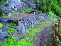
At about 600 m above sea level, we can see the first crops, among which vineyards are particularly prominent; their grapes being used to produce wines that have been exported for centuries and are now protected by the prestige of a renowned designation of origin.
To the right of the path, in this area of crop lands, stands a wooden cross erected in memory of the deceased. A little further down, there is a majestic example of Canary pine (Pinus canaríensis), the only one we will see in the entire stretch of the trail.
From this point, we leave the path to travel along an asphalt road that reaches a group of buildings, showing us that we are in the vicinity of the village of Frontera. This section of the trail ends in this village, as soon as we reach the main square and the church of Nuestra Señora de la Candelaria, patron of Valle de El Golfo.
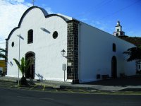
The Candelaria church has a distinctive feature: namely, its bell tower is built on top of Joapira Mountain, of a reddish color, creating one of the most characteristic images of the island of El Hierro. The so called bell tower of Joapira (Campanario Joapira) is located in this unique place in order for the ringing of its bells to be heard throughout the valley.
There is a junction of paths in this place about which we can find information on a panel.
Profile
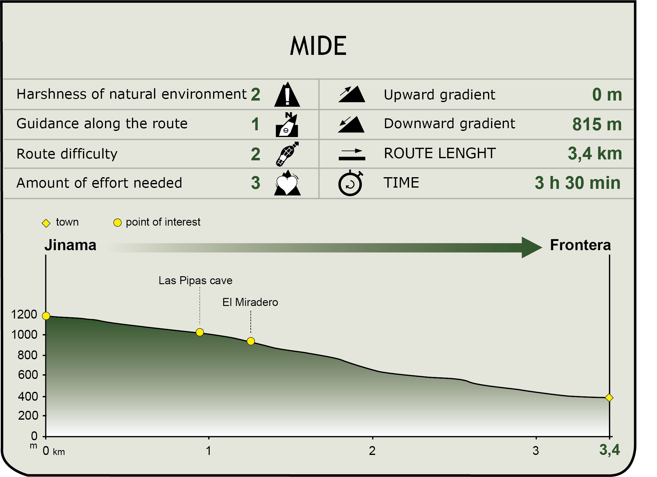
MIDE (Method for the Information of Excursions)
 Harshness of natural environment
- 1. The environment is not risk-free
- 2. There are more than one risk factors
- 3. There are various risk factors
- 4. There are quite a lot of risk factors
- 5. There are many risk factors
 Guidance along the route
- 1. Well defined trails and crossings
- 2. There is a clearly marked trail and signage
- 3. Requires the identification of geographic features and cardinal points
- 4. Requires off-path navigation
- 5. The trail is interrupted by obstacles that have to be gone around
 Route difficulty
- 1. Walking on a flat surface
- 2. Trails with different types of path
- 3. Walking on stepped paths or irregular terrain
- 4. The use of hands or jumping over the terrain is necessary
- 5. The use of hands is required to progress
 Amount of effort needed
- 1. Up to 1 hour of continuous walking
- 2. Between 1 and 3 hours of continuous walking
- 3. Between 3 and 6 hours of continuous walking
- 4. Between 6 and 10 hours of actual walking
- 5. More than 10 hours of continuous walking
Featured
Further information
The Camino de Jinama
The Jinama Road (Camino de Jinama) is an old cattle migration road that goes down the hillside that marks the middle section of El Golfo Valley. It starts next to the shrine of the Virgen de la Caridad, in the highest part of the plateau of Nisdafe and reaches the square in front of the Candelaria church in the village of Frontera.
The Jinama Road is one of the paths most commonly used to carry out the above mentioned “mudadas” by the people of the interior of the island, particularly the inhabitants of San Andrés, Isora and La Cuesta, who moved their animals toward the villages of El Golfo when weather conditions became harsher on the plains. These “mudadas” took place twice a year, in winter and summer, in time for the harvest and in order to feed the cattle in El Golfo.
Multimedia


