- Home
- Rural Development
- Nature Trails
- Nature Trails
- Canary Islands Sector
Cumbres de La Gomera Nature Trail
Description
Among valleys, “roques” and thousand-year-old forests
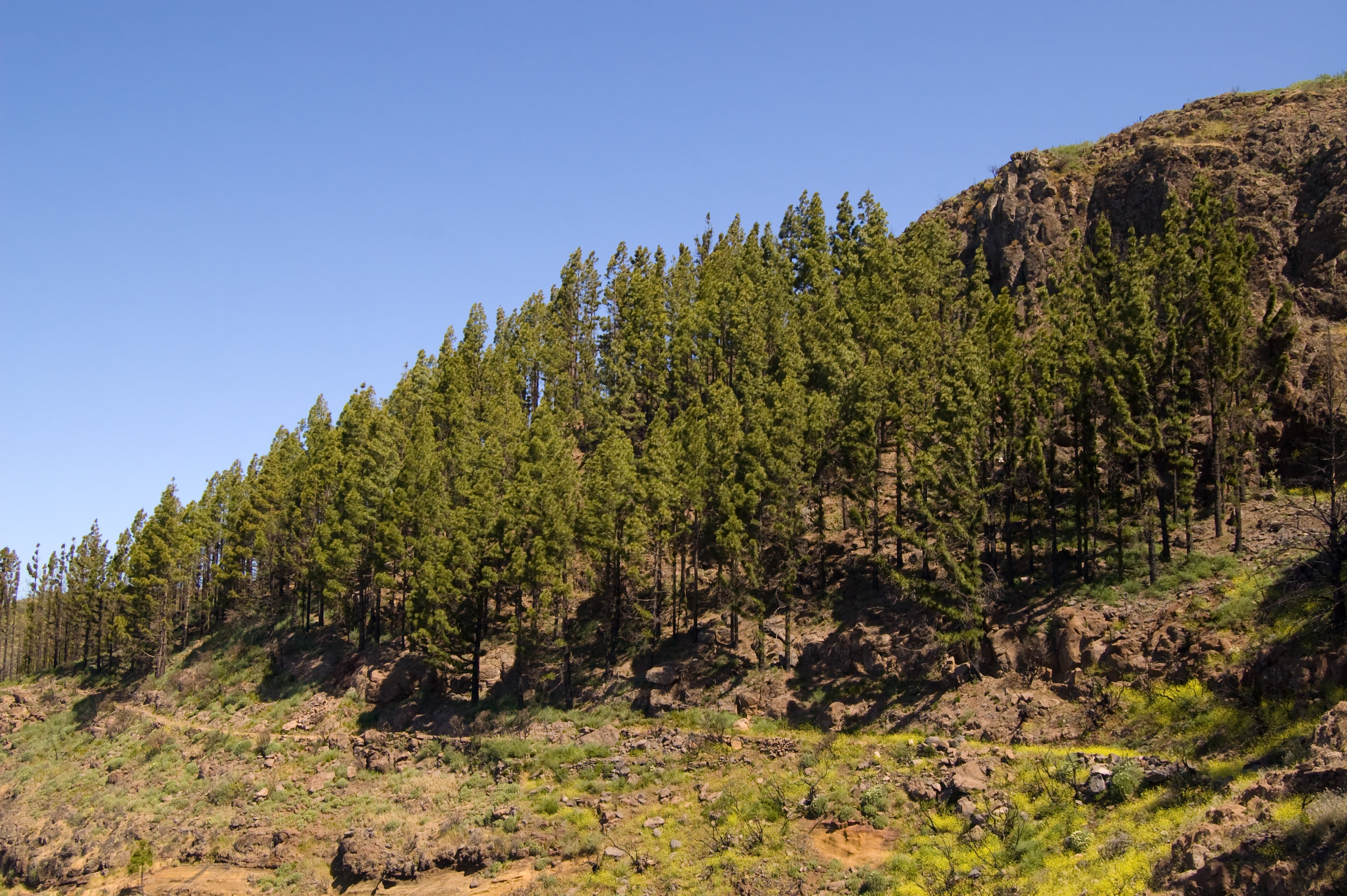
This nature trail connects San Sebastián de La Gomera with the beach of Vallehermoso, sharing almost its entire length with path GR-131. Along the three sections (plus a branch linking the village of Vallehermoso with the beach) of which the trail is comprised, travelers will see a large part of the island ecosystems (the coastline, the basalt layer of Canary islands spurge and tabaiba or Euphorbias in the basal area, thermophile forests, laurel forests and fire tree and heath forests forming the so-called monteverde or evergreen forest, as well as Canary Island pine groves) and will be able to contemplate the varied terrain of the island, dotted with quaintly shaped “roques” (volcanic plugs) and deep ravines cutting into a hillside inhabited by rich vegetation consisting of many endemic species. There are magnificent examples of Canary Island green forest in the central plateau, the finest ones being found in Garajonay National Park (Parque Nacional de Garajonay), all of which makes this trail a genuine feast for the senses.
From San Sebastián de La Gomera to Degollada de Peraza
This first section of the nature trail runs between San Sebastian de La Gomera and the observation point at Degollada de Peraza, after a 9.6 km ascending route along which the traveler can admire the traditional architecture and the spectacular views offered by the ravines of Cabrito and La Laja, whose terraced slopes are witness to the remarkable agricultural tradition of the area.
An information board at the entrance of the port of the capital city of the island marks the start of this section of the trail. After walking a few meters along the sea promenade, following the signs we can see along the path, the route goes around the park of Torre del Conde along Avenida del Quinto Centenario and continues - after crossing the ravine of La Villa - along Cañada del Herrero and Avenida Las Galanas in order to reach an area called Cañada del Herrero, where the asphalted stretch of road ends and we can see another information board. We should keep in mind that the first 1.5 km of the trail go through the center of the village, which means we should exercise extreme caution regarding road traffic safety.
From this point begins a tough ascent, a little more than one kilometer long, along a paved path that zigzags up the slope of Lomo de las Vueltas, between the ravine of Tajinastas (on the south side) and the ravine of El Machal (on the north side), until we arrive at the place known as La Sabina or El Higueral. Particularly noteworthy in this section of the trail are the views of the bay of San Sebastian with the background of Mount Teide on the neighboring island of Tenerife. The road keeps going up, although on a less pronounced slope, and now enters a landscape characterized by a scrubland area typical of the Canary Islands, mostly consisting of tabaibas (Euphorbia berthelotii) and balos (Plocama pendule).
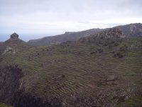
Once this initial tough stretch uphill is over, we move away from the small village of Ayamosna, whose surrounding area used to be considered as one of the most important breadbaskets of the island. The path, which is stone-paved in this section, crosses the access road to the small village and continues for a few meters along an asphalted track. Then the path branches off to the left along a cobbled path from which travelers can enjoy the full extent of magnificent views of roque de Sombrero and roque de Magro, both of which belong to the natural monument Barranco del Cabrito, where countless terraces climb up the slopes of the hills. These terraces are real works of popular engineering, consisting in small vertical stonewalls which make it possible to increase the area of arable soil in an insular environment that is not particularly favorable to crop farming. Most of these terraces, in which wheat, barley and chícharos (local name given to several legumes and their seeds) used to be grown, are now covered by Euphorbias and agaves or century plants (Agave americana) and are grazed by sheep and goats. We can appreciate in this area the distribution of plants characteristic of the region, with numerous rock plants and some isolated patches of column cactus or spurges (cardonales) on the cliffs, while in the foothills and the bottom of the canyons we find scrubland vegetation, with an abundance of balo (Plocama pendula Aiton), gorse (Launaea arborescens) and Euphorbias, and on the slopes we can see some concentrations of Canary Island spurge or “cardones” (Euphorbia canariensis) and Canary Islands palm trees (Phoenix canariensis).
The road continues to gain height and we soon see some beautiful specimens of Canary Islands palm tree scattered all over small stream beds. After reaching a hillock at the foot of Tagamiche hill, the road turns right and skirts the mountain of Vegueta toward the viewpoint at Degollada de Peraza, where the road becomes a well-defined path - protected by a handrail in the highest and more exposed portions of the trail - that runs along the edge of the ravine of Las Lajas, offering spectacular views of the ravine, as well as of the rural villages of La Laja and Chejelipes. The dams of Palacios and Chejelipes can also be seen down in the bed of the ravine.
In the final part of this section of the trail, we begin to encounter the first specimens of heather (Erica arbórea), among spurge (Euphorbia balsamífera), jaguarzos or rockroses (Cistus monspeliensis), pitas and palm trees, which will accompany us along the trail that ascends to the overlook of Degollada de Peraza, end of this first part of the nature trail; before we begin the next section of the trail, we recommend to cross the GM-2 motorway in order to enjoy a panoramic view of the ravine of Juan de Vera.
From Degollada de Peraza to Chipude
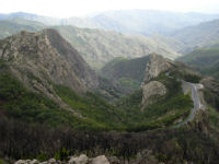
The 16.3 km of the second section of the nature trail, from Degollada de Peraza to the beach of Chipude, run along a spectacular landscape of steep terrain dotted with “roques” and dramatic canyons. This stretch of the trail goes through one of the most remarkable regions of the island from the standpoint of its natural value, Parque Nacional de Garajonay (Garajonay National Park), with the most important concentration of laurel forest in the entire Canary Islands.
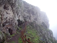
The overlook of Degollada de Peraza is the starting point for this second section of the trail. The route starts from the path that appears to the right of the information board, and continues up a flight of stairs adjacent to the GM-2 motorway, along which we reach a small flat area known as Los Campos de las Nieves. Heather begins to appear in this section of the trail, showing that we are entering a vegetation transition zone leading to the region of monteverde or evergreen forest.
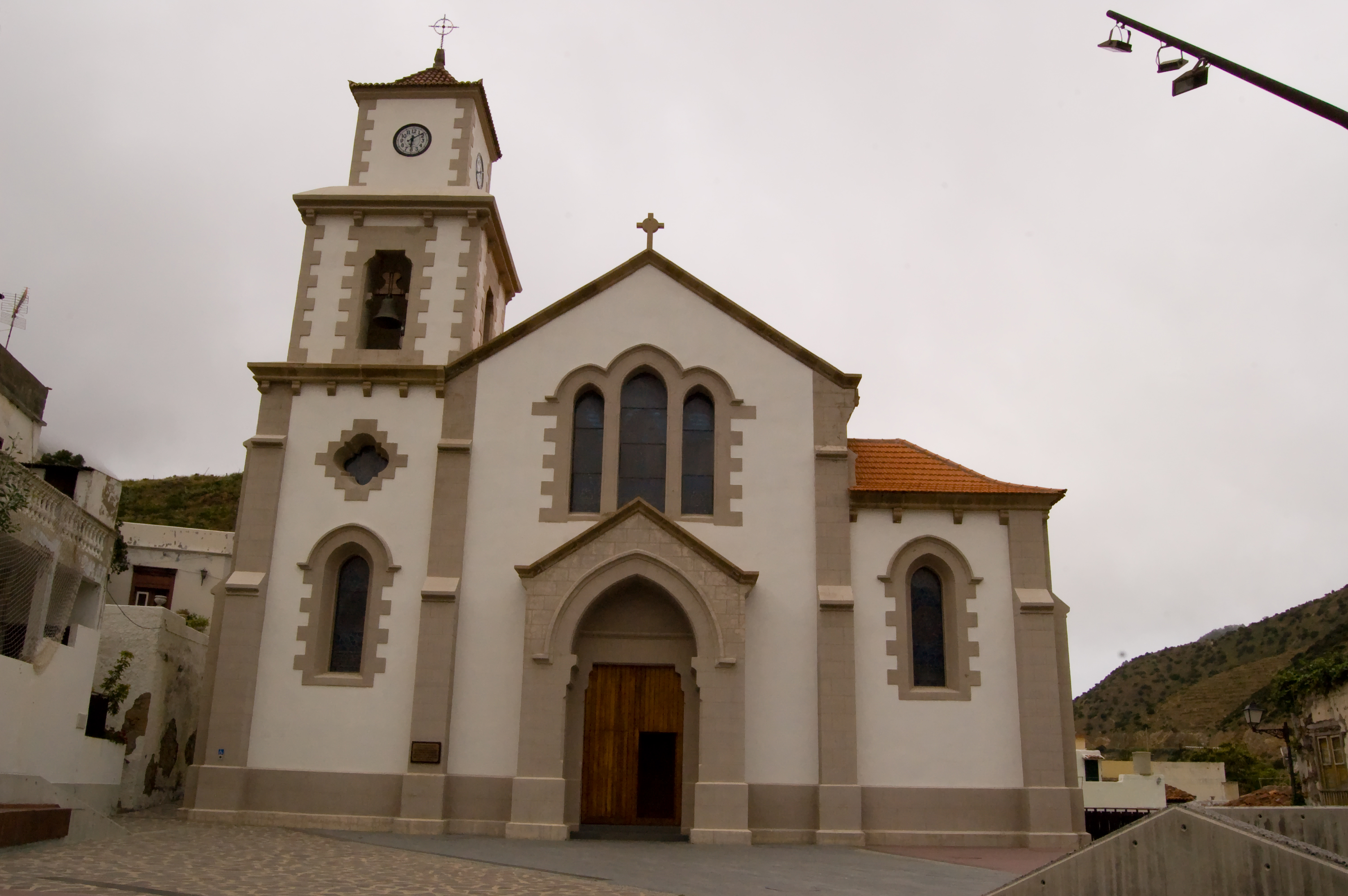
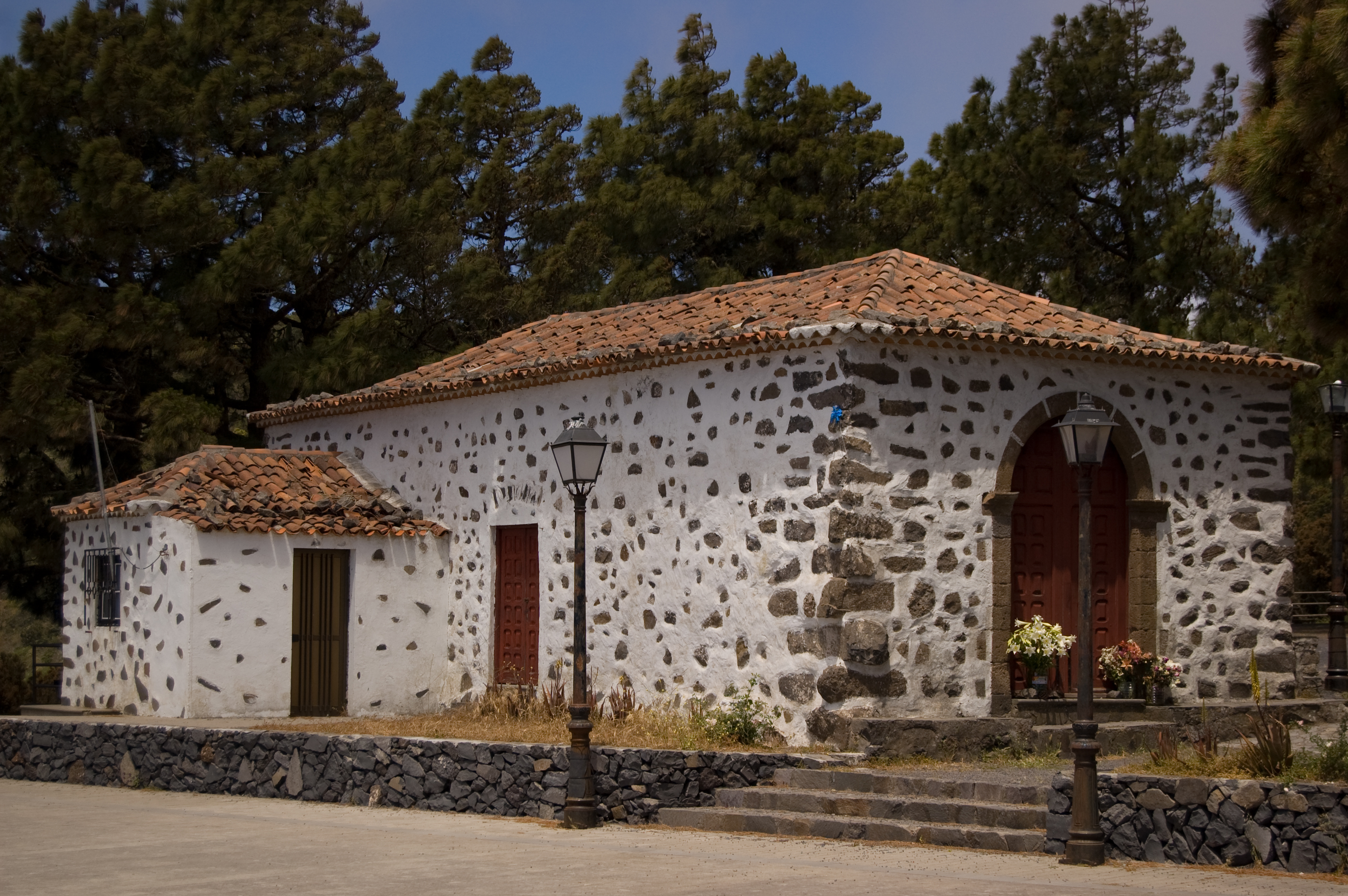
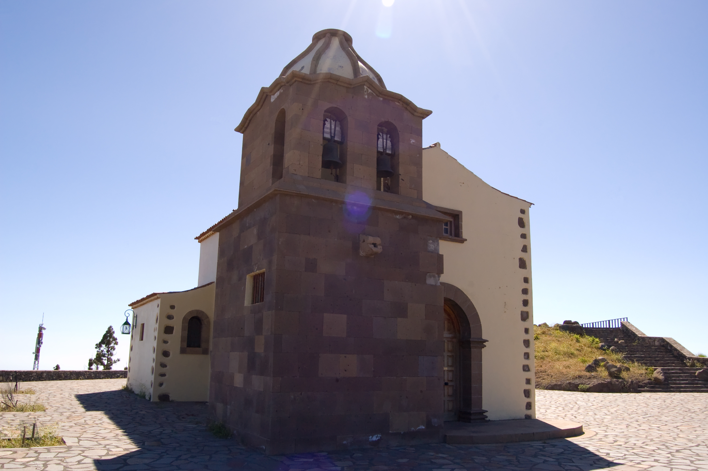
After some 800 meters, and after taking a detour to the right, next to a private house, we reach a junction with the road leading to Ermita de las Nieves (Shrine of the Snows); we can see how the heath becomes increasingly large and developed as the road approaches the shrine. A stone ramp to the right takes us to the recreational area of Ermita de las Nieves, equipped with numerous tables and grills where travelers can take a break in order to enjoy the surroundings. Inside the shrine we can see the image of the Virgen de la Salud (Virgin of Health), whose feast day is celebrated on the second Sunday of October.
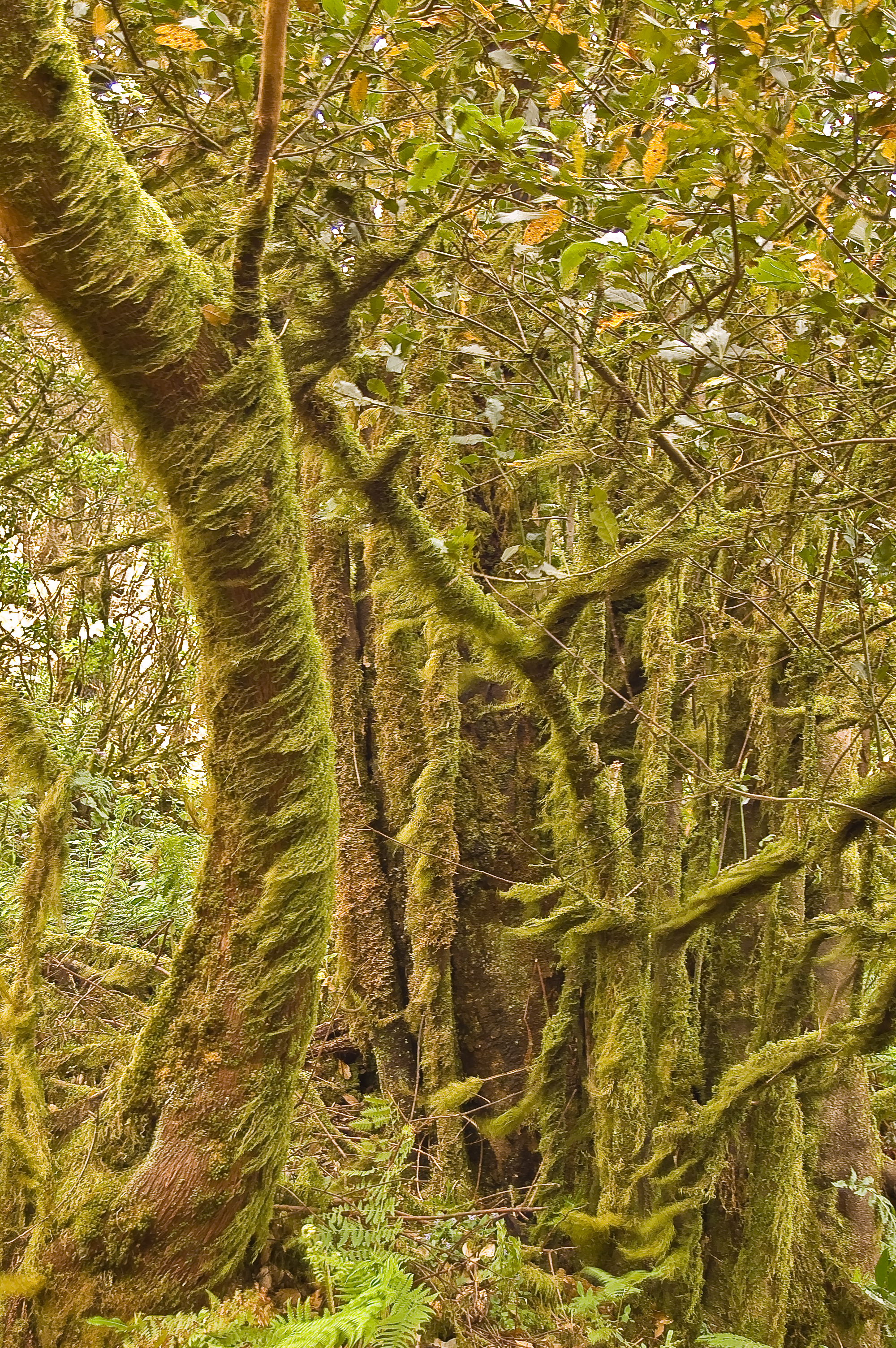
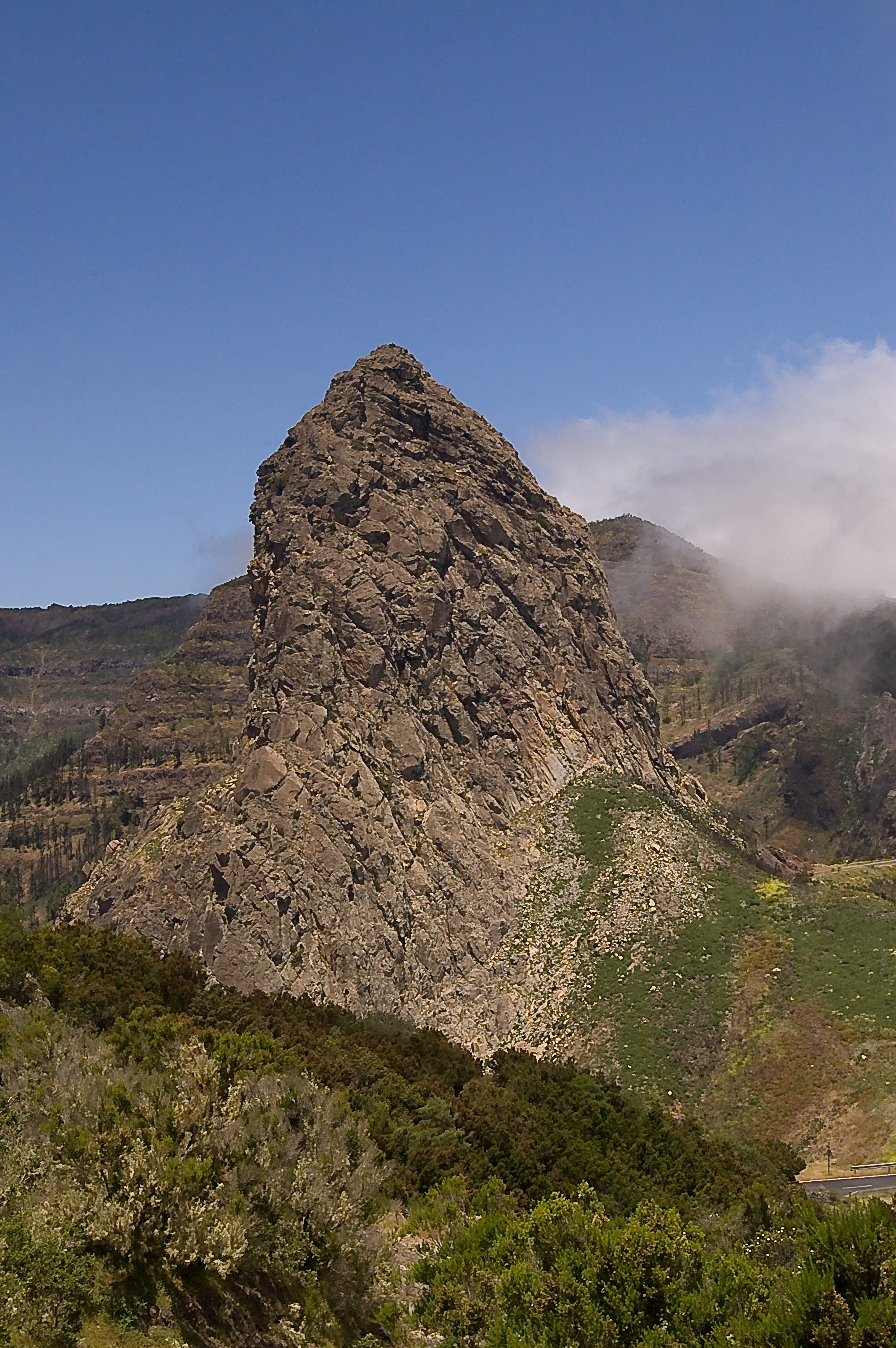
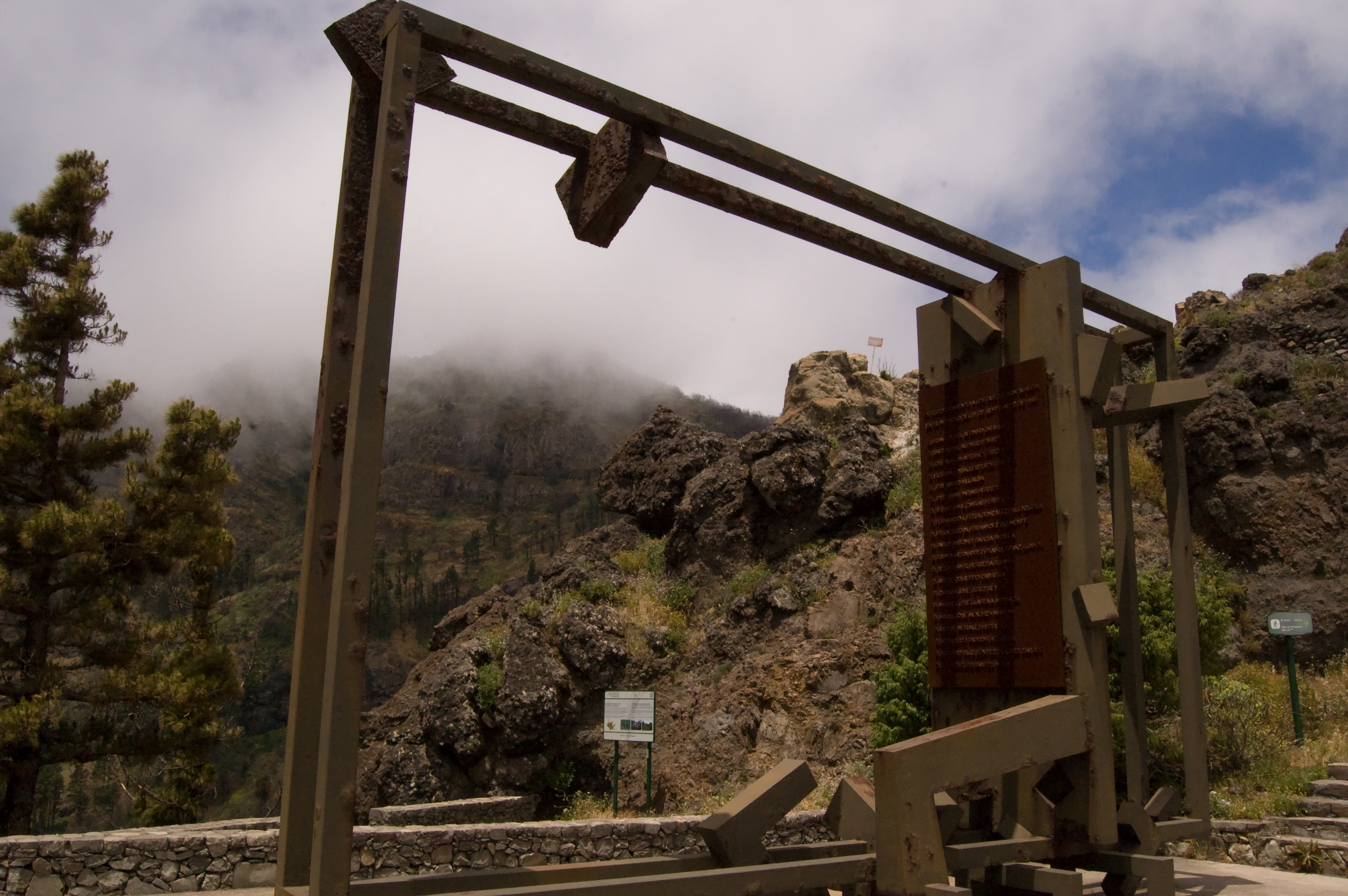
Further on along the route, we reach a point where the road is almost embedded between moss-covered slopes. After going down the road, among Canary Island pines and thick heath, we reach the GM-2 motorway, and, on the right side of this road, we can see a densely wooded area which covers the slopes of the ravine of Las Lajas. The route continues over a narrow metal walkway that goes parallel to the road and from which we can get a close-up view of a typical volcanic dyke on one of the slopes. A few meters ahead, we can stop at an overlook - where a memorial has been erected commemorating the victims of the tragic forest fire of 1984 – and see the imposing mass of Roque de Agando at the head of the ravine of Benchijigua. The trail continues toward the viewpoint of Los Roques, where if the mist (which is very frequent in this area) allows it we can see again the steep slopes of the ravine of Benchijigua.
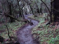
After crossing the road, we go right into the middle of the fire tree and heath forest (fayal-brezal), very characteristic of the island, where fayas or fire trees (Myrica faya) and heath trees appear in combination with other species such as acebiño or small-leaved holly (Ilex canariensis), follao (Viburnum rigidum) and peralillo (Maytenus canariensis), in addition to large numbers of ferns. After crossing the road once more, the trail meanders up this forest, where the tree trunks are covered with ivy and long curtains of moss and lichens. As we advance, a sign indicates a detour that we should by no means miss, since it leads to the spectacular panoramic viewpoint in Mirador del Morro de Agando; from this point, we can enjoy an overall view of Monumento Natural de los Roques (Natural Monument Los Roques), an impressive group of volcanic plugs that form one of the most amazing landscapes in the whole trail, with the roque of Agando in front of us and the roques of La Zarcita and Ojila to the left of the viewpoint. This place also offers a good example of how nature is slowly re-colonizing this area, which was devastated by the forest fire that took place in August of 2012 and affected 3,000 ha of land on the island, razing to the ground more than 20% of the area of Parque Nacional de Garajonay. Back on the main trail, a wooden footbridge enables us to cross the GM-2 motorway and takes us to the Tajaqué viewpoint, where, if the mists wafted often to this part of the island by the trade winds permit it, we can see once again the Benchijigua crater or “cauldron”, one of the great cliffs of the island, where the Reserva Natural Integral (fully protected natural reserve) of the same name is located.
The trail continues a few meters next to the road, and then it goes down a slope where we can appreciate the slow but increasing recovery of the forest in areas affected by the fire of 2012 by observing the way the stumps of most fire trees have vigorously re-sprouted. Later, the trail joins a forest track to the right until reaching the motorway again. At this stage, the route continues parallel to the GM-2 motorway, offering views of an area known as Lomo de la Mulata, with the “roque” of Agando on the horizon, until it reaches the roundabout at Pajarito.
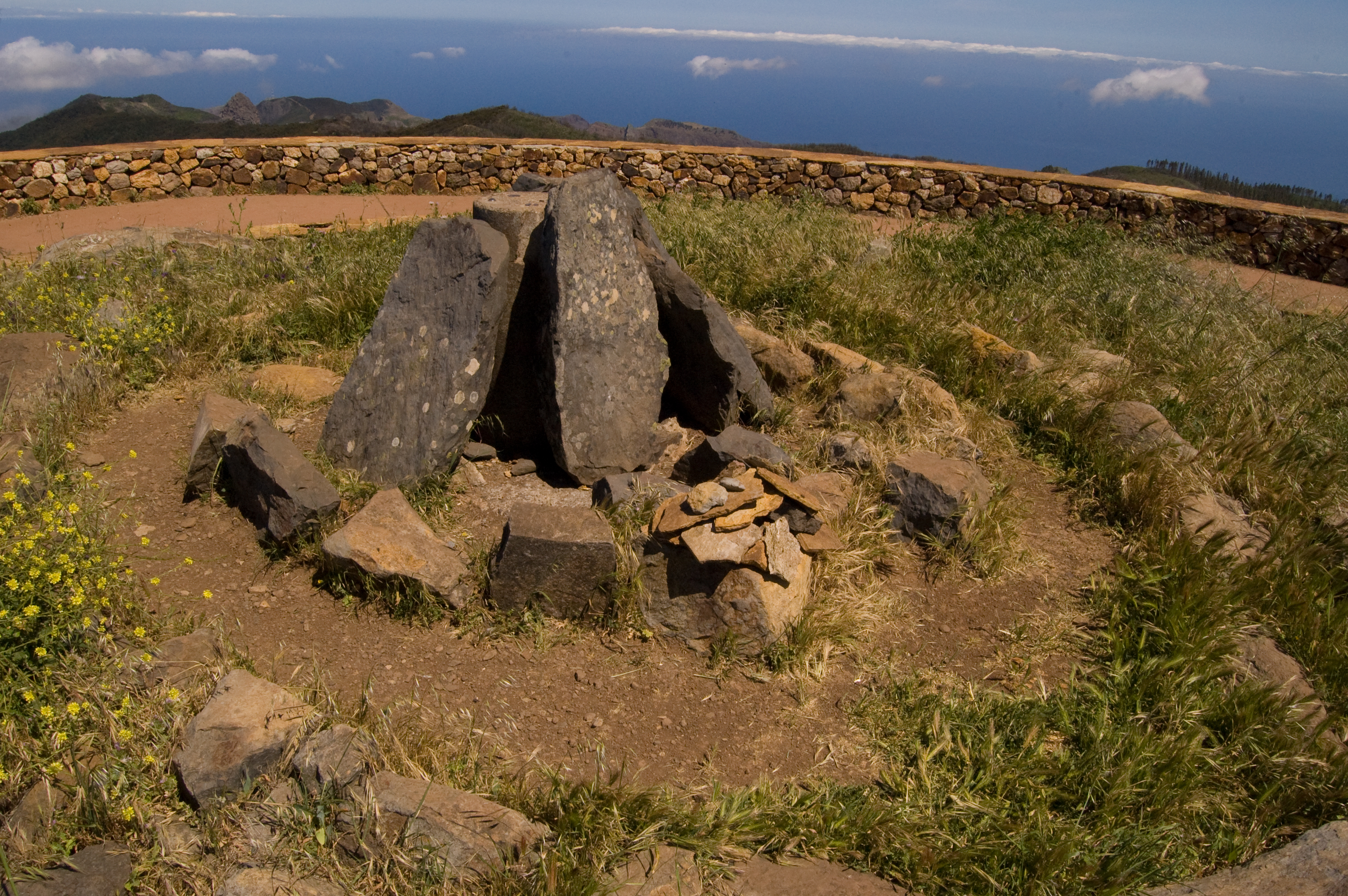
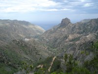
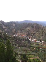
To the left of the crossroads, clearly marked - as is the entire trail - there begins an upward trail, about 1 km long, whose first leg is a showcase for the original condition of these mountains before the fire of 2012. We see a young fire tree and heath forest where heather, fire trees and some laurels raise over an uncluttered undergrowth of cerrajones or sow thistles (Sonchus hierrensis) and Canary Islands nettle (Urtica morifolia), which we will see around us during our ascent to Pajarito hill. We then take a detour to the left that leads directly to mount Garajonay, the highest peak of the island at 1,487 m, from which, on a clear day, we can see the neighboring islands of Tenerife, La Palma, El Hierro, and even Gran Canaria. We can stop at this spot to contemplate the many valleys, ravines, natural barriers and “roques” or volcanic plugs on the island. Going around a stone building that rises on the hill – a ceremonial complex created by the Prehispanic inhabitants of La Gomera – we must follow a stone track to the right in order to begin a gentle descent toward Igualero. Several routes converge at this point, but the signs along the trail help us follow our way without any problem. Guided by the impressive profile of one of the most unique geographic features on the island – the natural fortress of Chipude – and after little more than 1 kilometer, we move away from the forest track, and we take a winding downward path to the right, from which we can appreciate the forest recovery effort carried out in the area affected by the 2012 fire.
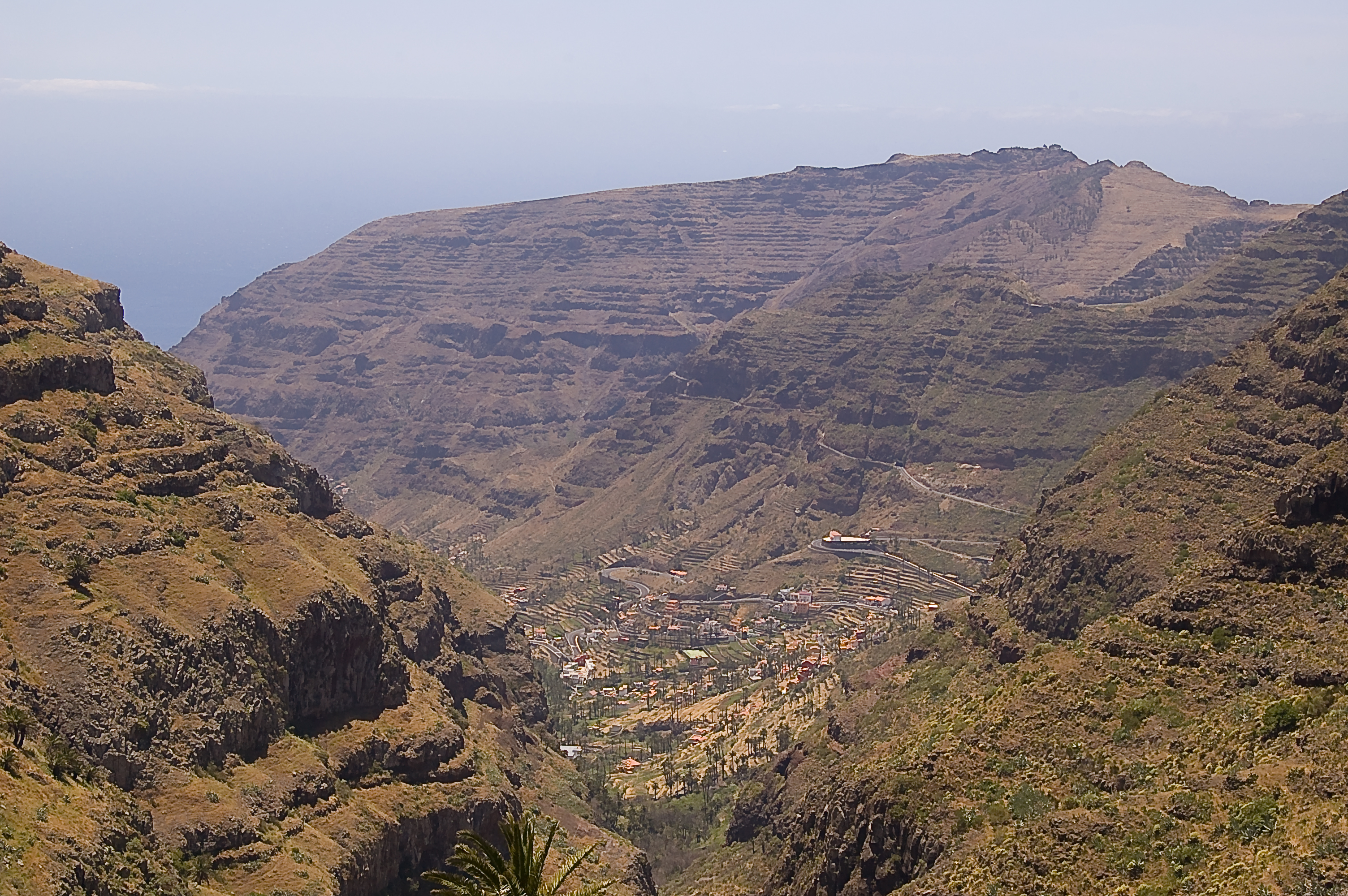
After reaching the CV-17 motorway, the route continues along the driveway leading to Igualero, but soon takes a detour along a path to the right, parallel to the motorway, taking us to an esplanade where we find Mirador de Igualero (Igualero Overlook). This panoramic viewpoint has a monument celebrating the Gomera “silbo” or whistled language and a shrine built in honor of St. Francis of Assissi, patron saint of forestry workers. It pays off to stop at this point and enjoy a complete overview of the ravine of Erque, in the protected landscape of Orone (Paisaje Protegido de Orone), with the natural monument Fortaleza de Chipude in the background, and see how the dense vegetation on the central plateau of the island is replaced by scrubland and an increasingly arid landscape.
The route continues along an asphalt path on the left of the shrine that goes down to the village of Igualero. After a little more than 500 m, and once we have taken a detour to the right, the road becomes a path that skirts the ravine of Erque, at the edge of a precipitous slope, with Fortaleza de Chipude in the background, offering us a complete overview of the ravine.
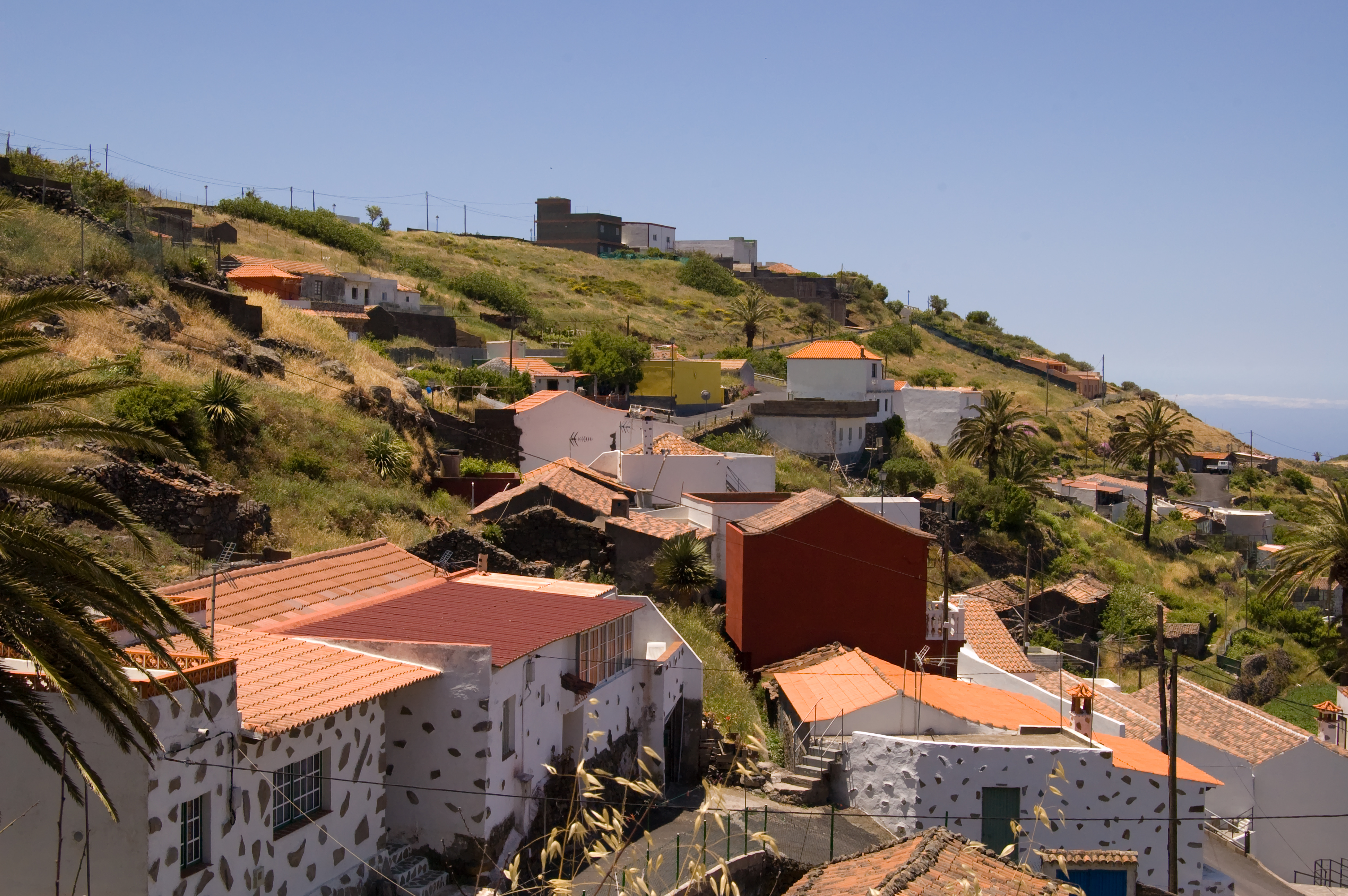
After the dam of China, the route continues some 700 m along an asphalt road whose use we must share with road traffic, and then shifts to the left along a path that runs under the north side of Fortaleza de Chipude, at the feet of which we can see the rural village of Pavón. On the almost vertical face of this iconic mountain, we can see a diverse range of rock vegetation, with endangered species such as the cabezón de sataratá (Cheirolophus satarataënsis) and the siempreviva or immortelle (Limonium redivivum), among other endemic species.
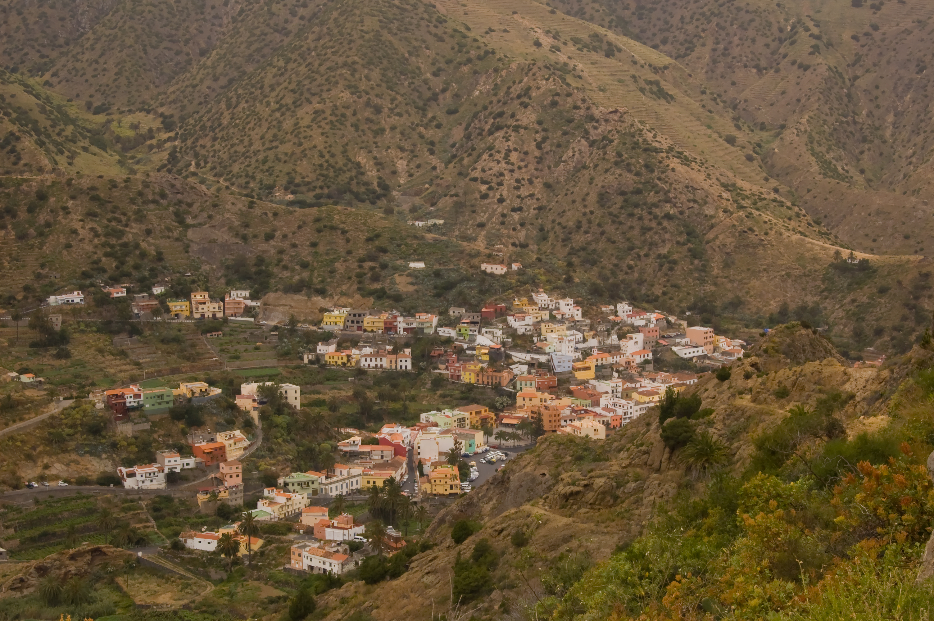
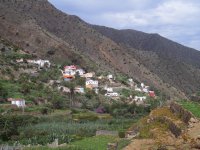
Once in Pavon, and after crossing the CV-12 motorway and the ravine of Iguala, the road continues for some 900 m parallel to this motorway until it reaches the village of Chipude, in the municipality of Vallehermoso, in whose square we reach the end of this second section of the nature trail.
From Chipude to Vallehermoso
Having a length of 14 km, the third section of the nature trail starts from the square of Chipude and, after passing through the villages of El Cercado and Las Hayas, characterized by the quality of their traditional crafts and cuisine, goes into the very heart of Parque Nacional de Garajonay (Garajonay National Park), in the area of Jardín de Las Creces, and finally reaches the village of Vallehermoso, which historically has been one of the main regional hubs for the export of agricultural products. From this point, hikers can extend the route along a branch that will take them, after 3.7 km, to the beach of Vallehermoso.
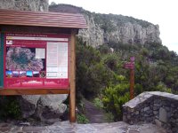
On the foothills of the archeological area of La Fortaleza is situated the village of Chipude, starting point of the third section of the nature trail. The route begins behind an information board placed in one of the side streets of the square - a particular highlight of which is the sixteenth-century shrine of Nuestra Señora de la Candelaria - and skirts the village until reaching the CV-18 motorway near Los Lavaderos de la Vica. After some 200 m down the road, the route veers to the left in order to cross the ravine of Los Manantiales, the natural fortress of Chipude still an imposing presence that we gradually leave behind.
After crossing the CV-18 road again, the route continues toward El Cercado, a rural village with a great pottery tradition, where, in accordance with Prehispanic tradition, ceramic ware and clay are still shaped without the help of a potter’s wheel; the village is surrounded by a landscape dotted with Canary Islands palm trees, orchards and ancient agricultural terraces climbing up the slopes of the ravine of La Matanza. The road goes through the center of the village, leading to an information board at the end of the village, where the asphalted section of the road ends, and we continue our journey along a dirt path that leads us through a beautiful landscape of terraced slopes over the head of the ravine of Agua, located in the valley Valle Gran Rey, where we can see the rural park of the same name; this is undoubtedly the most impressive ravine of La Gomera. In the highest points of this area it is possible to make out the different rock layers created by successive volcanic eruptions, while we can see in the background several villages settled on fertile lands at the bottom of the valley. This is one of the most spectacular views of the route. After a brief but steady ascent through a section of the path where visitors should be aware of a potential landslide risk, the route reaches the village of Las Hayas, after having crossed a magnificent palm grove. In the last 680 m of the trail, we follow a road that crosses the small village. If we take the road to Coromoto, we will reach the shrine of the village, where there is a rest area equipped with tables, grills and a drinkable water fountain. After a few meters, we enter again the boundaries of Parque Nacional de Garajonay (Garajonay National Park).
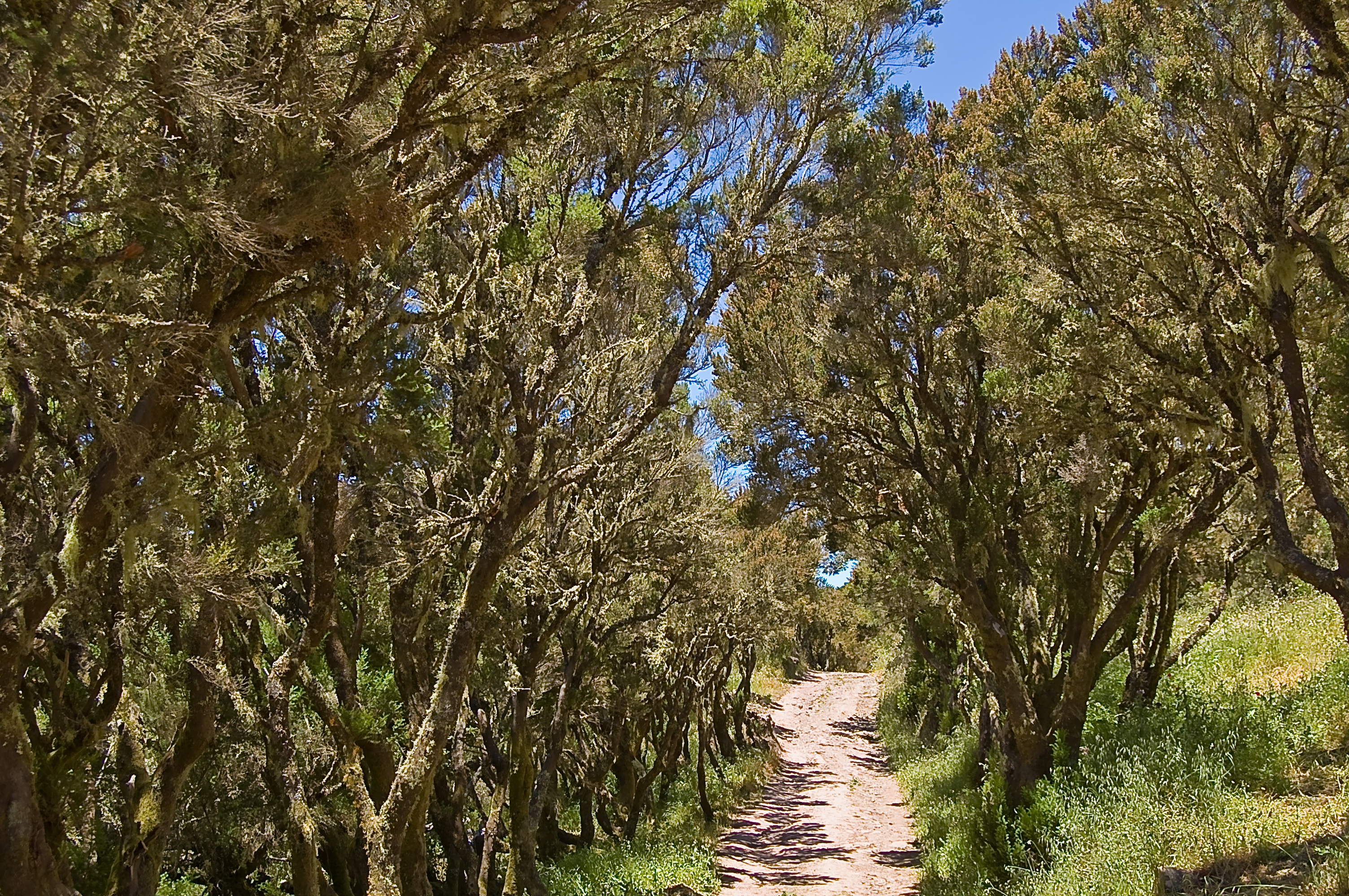
After taking a detour to the right along a narrow path, we soon reach another path that allows us to enjoy once more the magic of the laurel forest, usually covered in a veil of mist which provides vegetation with so-called horizontal rain, whose water yield is sometimes even larger than that of vertical rains. This section of the trail continues up to the recreational area Las Creces, an old sheepfold were cattle was raised until the 50s and which now provides travelers with a rest area to take a break and freshen up under large trees.
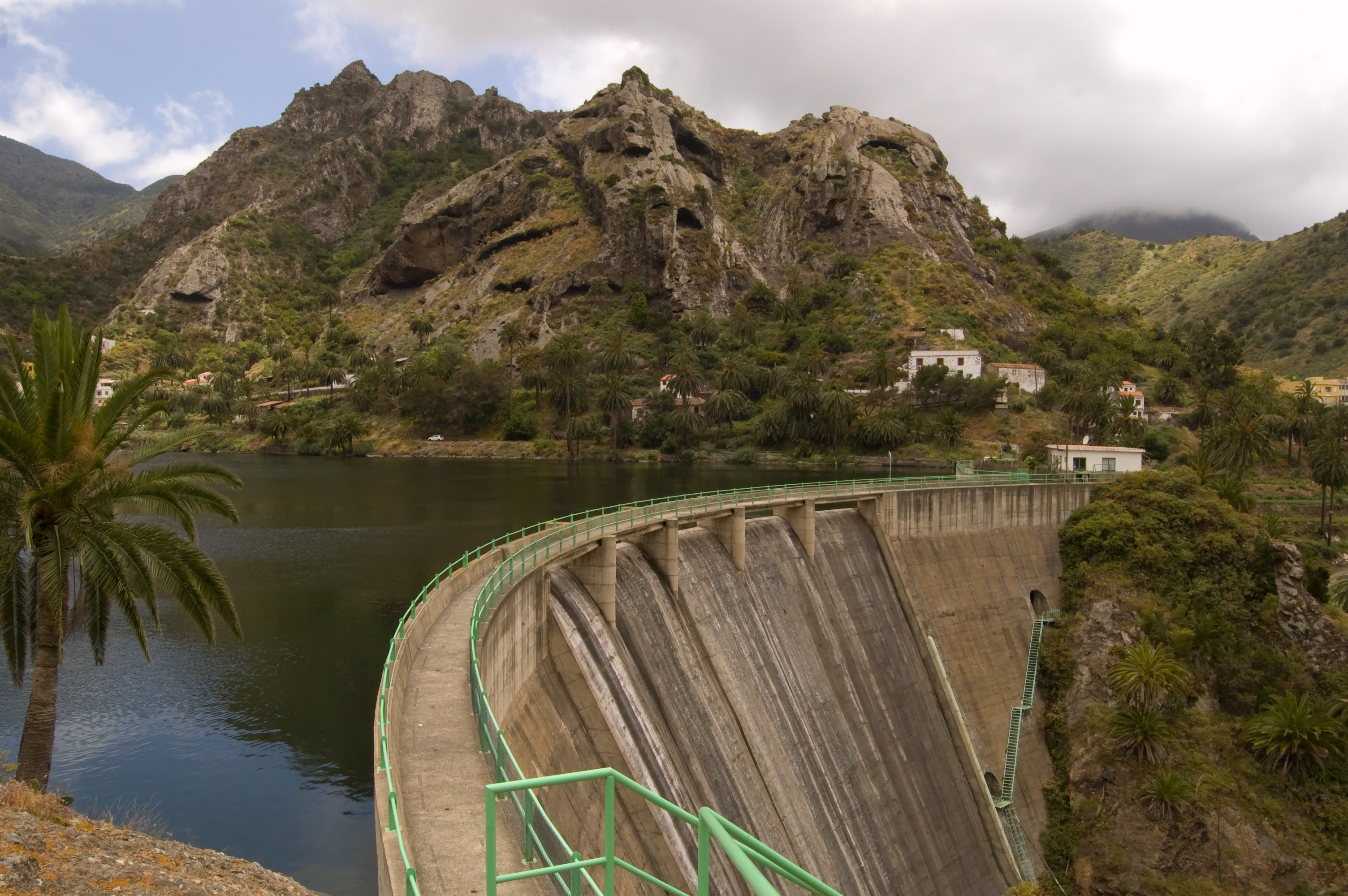
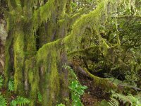
After crossing the dorsal motorway (GM-2), we begin our descent along the slopes of Mount Araña, through a pleasant laurel forest where the trunks of the trees are still completely covered in abundant moss and lichens. The overlook in Risquillo del Corgo offers a wide panoramic view of the Vallehermoso basin, historically the most productive agricultural area of the island. The route continues over the mountain top through a transition zone between the evergreen mountain region and the largest Canary juniper forest (Juniperus phoenicea var. canariensis) in the entire archipelago, in an area known as meseta de Vallehermoso (Vallehermoso Plateau). Once the trail crosses the forest track leading to the shrine of Carmen, there begins a winding descent with a succession of wooden step sections leading down to a rocky hill from which we can admire the fertile Vallehermoso valley, flanked by “roque” Cano, the entire hillside being dotted (almost polka-dotted) with junipers. Following the signs we see on the road, we reach another crossroads, where there is a small water abstraction machine, and we begin a short but steep descent among terraced vineyards, at the foot of a large rock wall, leading to an asphalt track that takes us to La Rosa de las Piedras, a small village located in the ravine of Ingenio. At a distance of just over 400 m, we reach La Encantadora dam, one of the main water reservoirs of the island, where a recreational area with several display panels invites us to relax and enjoy the views.
The route continues, skirting the right side of the dam along a stretch of 1.25 km of a badly paved road at the feet of Roque Blanco, where we will have to exercise caution since the road is also used by motor vehicles and the hillsides are susceptible to landslides. At this point, the road turns into a path and we begin a challenging ascent of about 500 m, which will allow us to enjoy the landscape, as well as the geological features and the vegetation prevailing in the northern part of the island. In addition to fire tree and heath (fayal-brezal) formations, the nearby north face of Roque Blanco has large populations of rock plants, many of them endemic to the island, as well as the most important community of Canary Islands strawberry tree (Arbutus canariensis) in the island.
At the top of the ascent, hikers can enjoy the fascinating views of the ravines of Ingenio (west) and Garabato (east) under the looming presence of Roque Cano, with Vallehermoso at its feet. From this point, and until we reach this village, the path goes down, offering beautiful views of the ravine of Ingenio and the surrounding valley, dappled with Canary Islands palm trees and agricultural terraces.
The route goes into Vallehermoso by the road that leads to the ravine of Ingenio and then - following the signs placed in different parts of the village - we reach Plaza del Ayuntamiento (town hall square), where an information sign indicates that we have arrived at the end of this section of the trail. In the square, we can connect with one of the sections of the nature trail Costas de la Gomera (Coasts of La Gomera); we will also have the opportunity of connecting with this trail in the beach of Vallehermoso.
From Vallehermoso to the beach of Vallehermoso
From the center of Vallehermoso, the traveler has the opportunity to continue the route along a 3.7 km branch that leads to the beach of Vallehermoso. After some 400 m through the urban area of the town, along the road that leads to the beach, the route branches off to the right and we cross the bed of the ravine of Valle along a small footbridge. The following 2 km of the trail run along the edge of the right side of the ravine, at the feet of Roque Cano, showing a characteristic landscape of terraced hillsides and bottoms of ravines speckled with Canary palm trees, banana trees and numerous vegetable gardens.
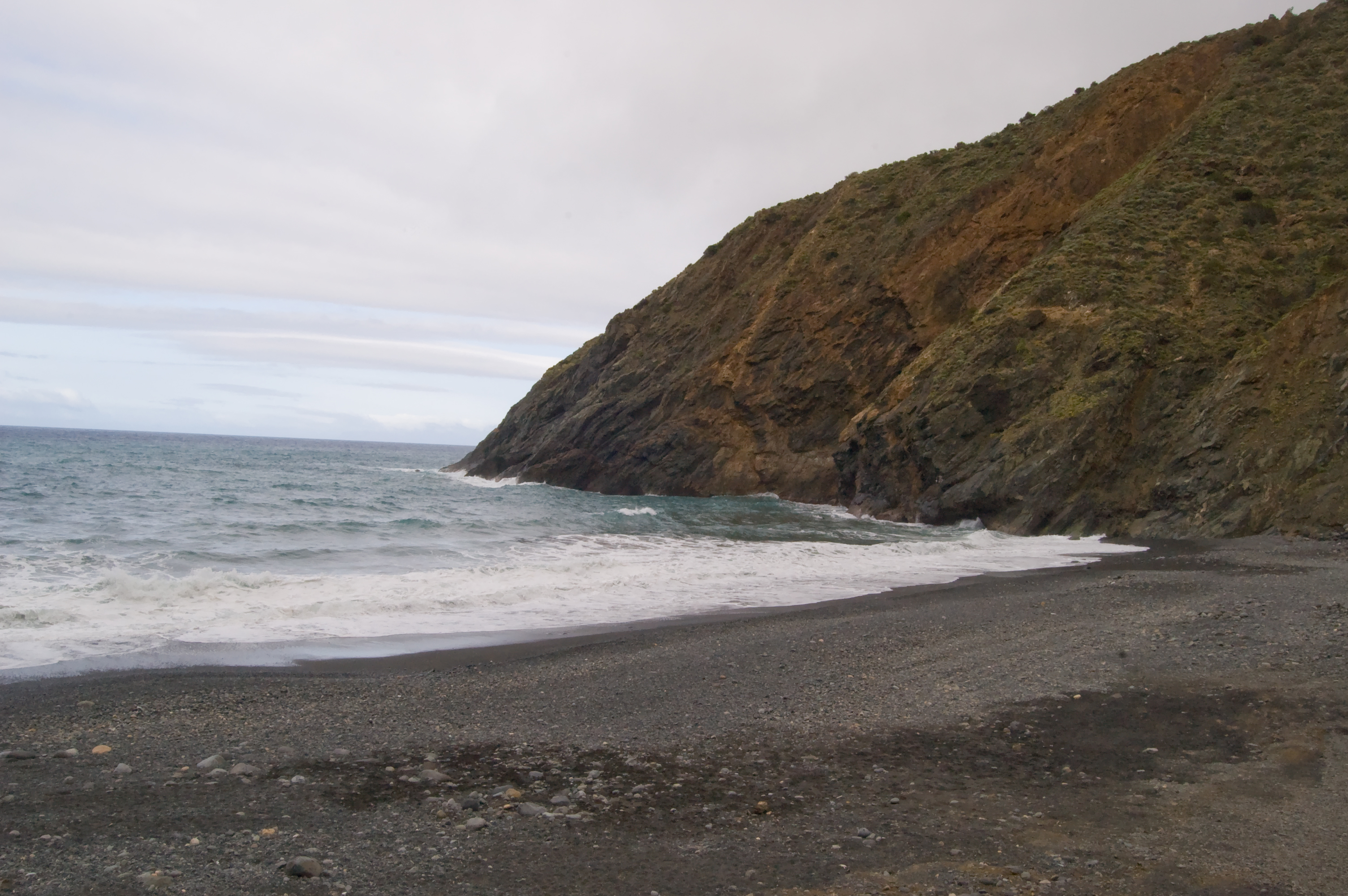
When we reach the rural village of Valle Abajo, the road veers to the left and crosses again the bed of the ravine, the last 1.1 km of the route going along a road that leads to the marine park of Vallehermoso (beach of Vallehermoso), which marks the real end of this section of the nature trail Cumbres de la Gomera. At this point, we can connect again with the nature trail Costas de la Gomera, which goes around the coastline of the island.
We can see from this point the remains of an old davit used - as in other municipalities in the northern part of the island - to facilitate agricultural exports, and which is situated under a cliff that is very dangerous owing to landslides, which makes any visit to the area quite inadvisable.
Profile
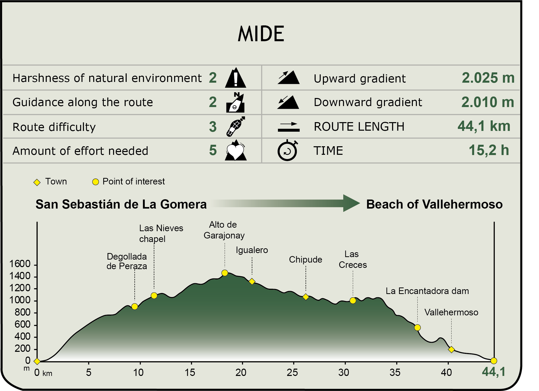
MIDE (Method for the Information of Excursions)
 Harshness of natural environment
- 1. The environment is not risk-free
- 2. There are more than one risk factors
- 3. There are various risk factors
- 4. There are quite a lot of risk factors
- 5. There are many risk factors
 Guidance along the route
- 1. Well defined trails and crossings
- 2. There is a clearly marked trail and signage
- 3. Requires the identification of geographic features and cardinal points
- 4. Requires off-path navigation
- 5. The trail is interrupted by obstacles that have to be gone around
 Route difficulty
- 1. Walking on a flat surface
- 2. Trails with different types of path
- 3. Walking on stepped paths or irregular terrain
- 4. The use of hands or jumping over the terrain is necessary
- 5. The use of hands is required to progress
 Amount of effort needed
- 1. Up to 1 hour of continuous walking
- 2. Between 1 and 3 hours of continuous walking
- 3. Between 3 and 6 hours of continuous walking
- 4. Between 6 and 10 hours of actual walking
- 5. More than 10 hours of continuous walking
Featured
Further information
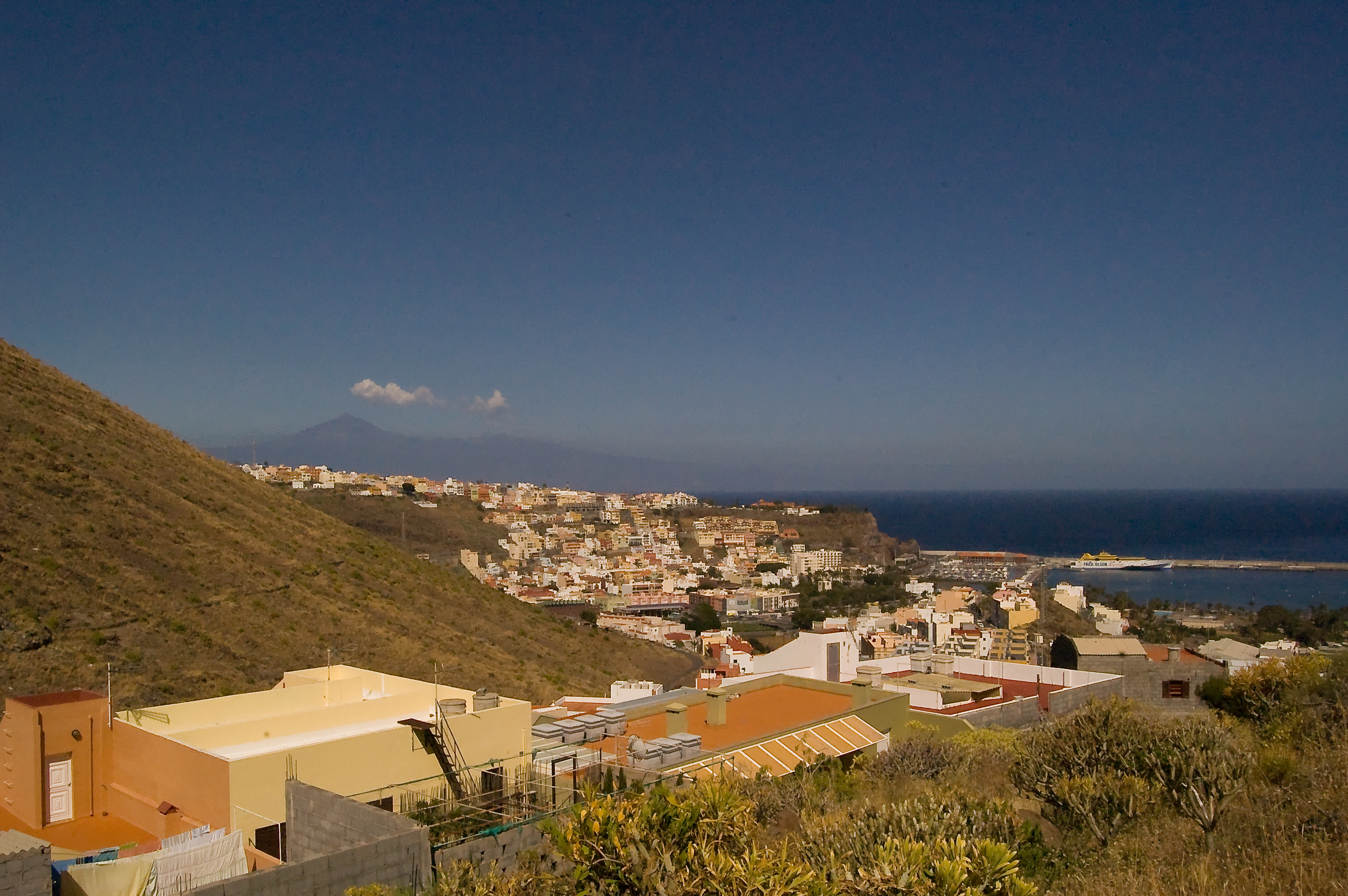
San Sebastián de La Gomera
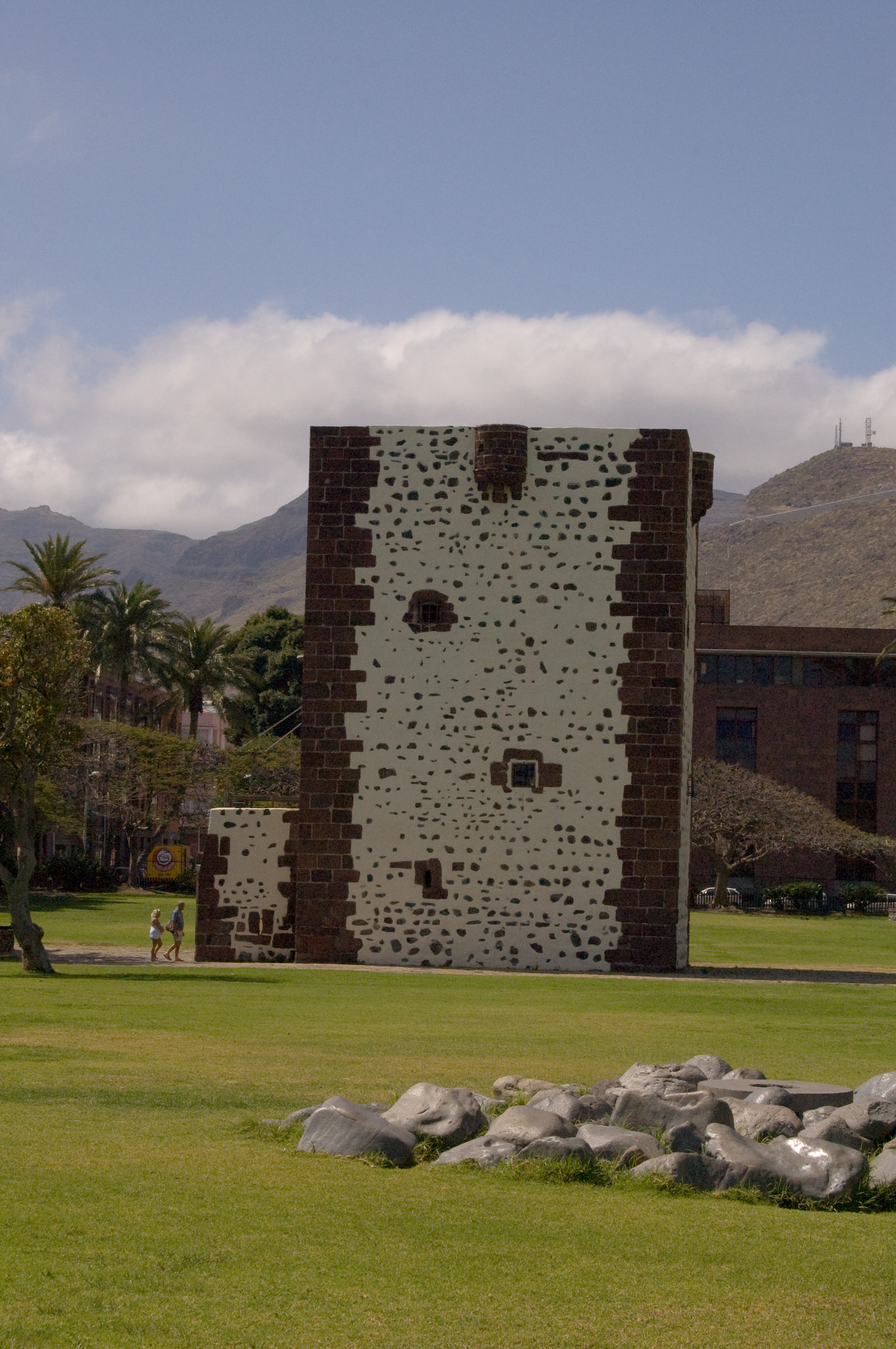
San Sebastián, capital city of La Gomera and entry point to the island, is remarkable for its historic role as the last departure point of Christopher Columbus before discovering America.
Particularly noteworthy, among other historical landmarks, are the Torre del Conde or Torre de los Peraza (Tower of the Count or Tower of the Peraza Family), a medieval fortress that is the oldest building preserved in the islands; the church of Nuestra Señora de la Asunción, a veritable museum of sacred art with pieces ranging from the sixteenth to the nineteenth century; the San Sebastián shrine, built around 1530, and the house known as Casa de la Aguada, with a well from which, according to the legend, Christopher Columbus took the water used to baptize the new continent.
It is also a large municipality, dotted with small rural settlements and villages - where we find beautiful examples of traditional architecture of the Canary Islands - such as La Laja, Vegaypala or Tejiade, which bear witness to the agricultural past of the region.
Garajonay National Park
Was created in 1981 with the object of protecting the best preserved community of laurel forest in the whole Canary Islands, and was included in 1986 in the UNESCO World Heritage List in recognition of its natural values, thus achieving the highest level of protection awarded to a protected natural area. It covers an area of 3,984 ha, and is situated on the central plateau of the island of La Gomera.
The term monteverde or evergreen forest refers to two types of forests covering 85% of the park area: the laurel forest, a subtropical cloud forest with trees whose leaves resemble laurel - hence its name - and species such as the viñatigo or Canary avocado (Persea indica), the tilo or rain tree (Ocotea foetens), the Azores laurel (Laurus azorica), the palo blanco (Picconia excelsa), the acebiño or small-leaved holly (Ilex canariensis) and the sanquino or sanguinero (Rhamnus glandulosa), accompanied with numerous mosses, ferns and grasses, which grow in the most humid and shady spots; and the fayal-brezal/ or fire-tree and heath forest, which is a plant community consisting of a large number of tree heaths (this park being one of the places in the world where these plants reach their largest size) and fayas or fire-trees, which grow in drier spots and poorer soil (for this reason, they usually appear in the higher limits of the laurel forest, as well as on wind-beaten steep slopes) or in areas affected by the degradation of the laurel forest by human activity.
Roques y fortalezas
La Gomera is a volcanic island with geological formations whose basal complex date back more than 20 million years and is formed by an accumulation of materials sent out at different eruptive periods, interspersed with long periods of calm. In contrast to other islands of the archipelago, the last eruptions here took place more than two million years ago, and the differential erosion of the materials sent out in the course of such eruptions has created impressive geological formations.
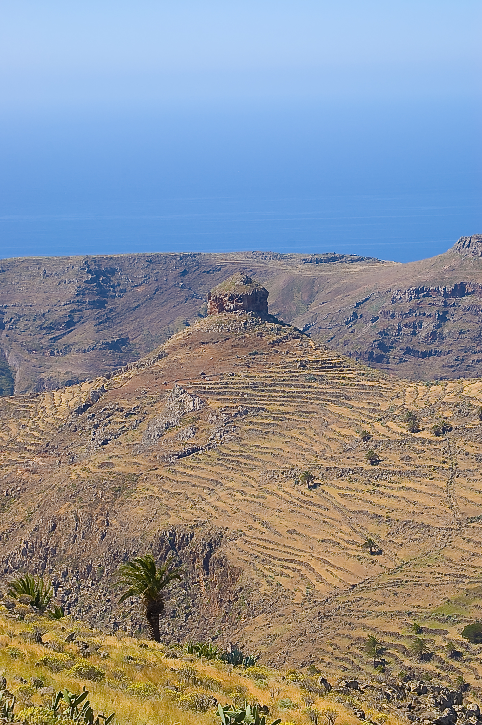
Roques or volcanic plugs, are geological formations of volcanic origin formed by the accumulation of dense lava masses which remained trapped in volcanic conduits and vents without coming to the surface, thereafter cooling very slowly and becoming solid from the inside. The subsequent erosion of the materials covering this central mass of lava originated the numerous pitons or volcanic plugs that can be seen across the island, such as Roque Cano or Roque de Agando.
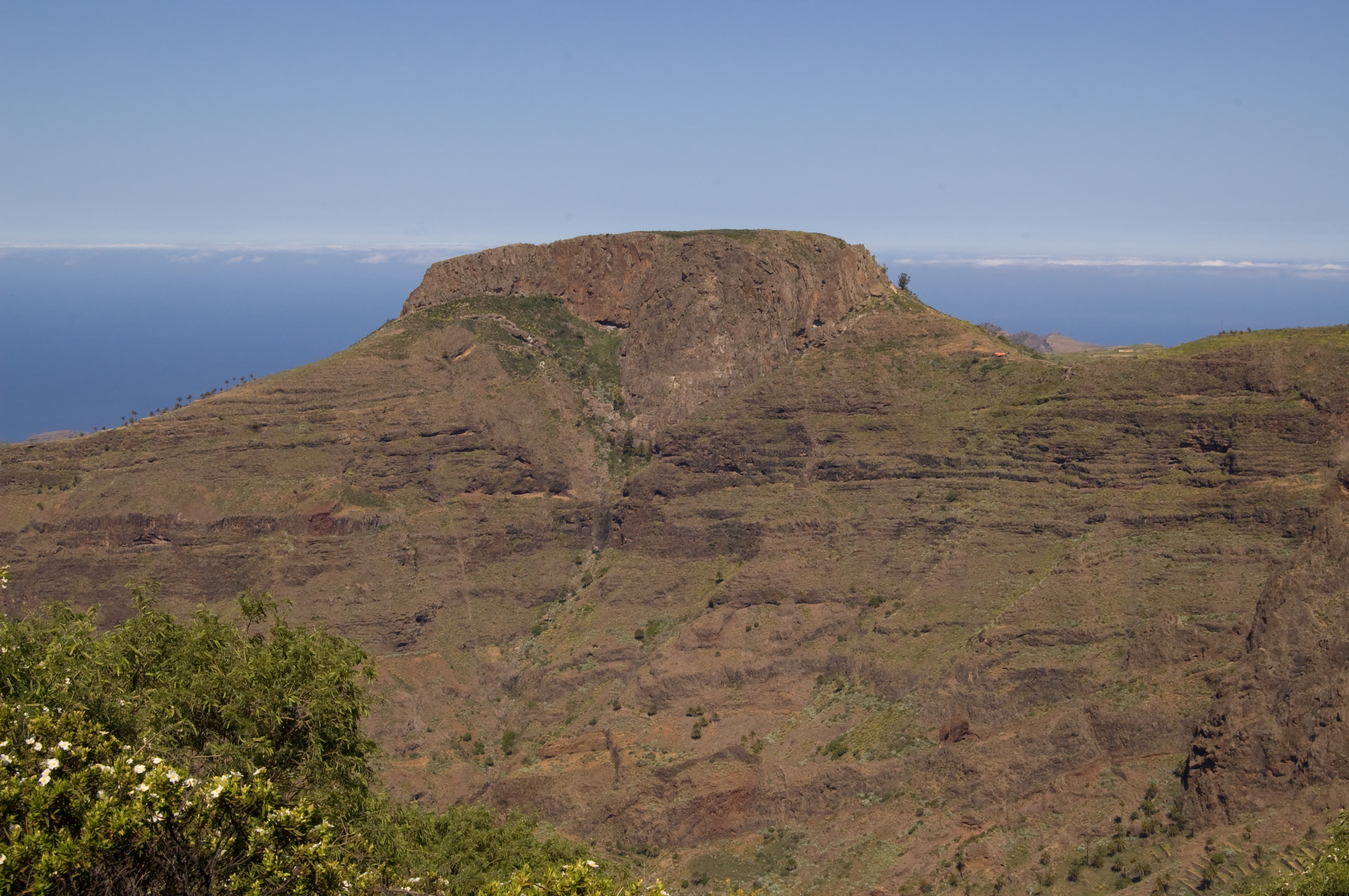
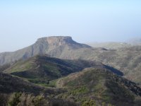
Fortress,fortaleza in Spanish, is the name given to certain mountains with rocky walls and more or less flat tops (table-tops). Fortaleza de Chipude, with a maximum altitude of 1,243 m above sea level and a diameter of 300 m, is one of the most striking fortresses in the Canary Islands, clearly visible from the island of La Palma. It is intrusive in origin (trachyandesites, of an acid nature and with high viscosity), and was formed by the accumulation of highly viscous lava which flowed for very a very short distance on the surface and was accumulated in the very mouth of a volcanic vent until it was exposed to the surface by the effects of erosion.
It is a Natural Monument since 1994, and has also been included within the boundaries of the Paisaje Protegido de Orone (Protected Landscape of Orone). It is also part of Red Natura 2000 (Natura 2000 Network) as a Special Area of Conservation.
This mountain – apparently a sacred place for the Prehispanic population of La Gomera – was known as Argodey in the aboriginal language, and preserves one of the most important archeological sites in La Gomera, which has been declared an asset of cultural interest.
Multimedia