- Home
- Rural Development
- Nature Trails
- Nature Trails
- Canary Islands Sector
- Costas_Gomera
Stage 7: Alajeró - Playa de Santiago
Description
Transforming a landscape
The 10.5 km of this simple Stage of the trail run from the town of Alajeró to Playa de Santiago (Santiago Beach), along a landscape of valleys and hills which, not so long ago, were occupied by large croplands. The abandonment of most of these crop fields has changed the landscape of this part of the island, but the charm of this environment, shaped by human action, still remains.
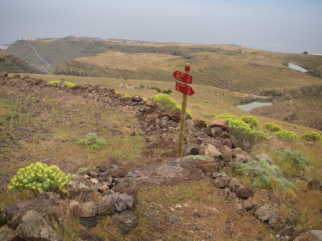
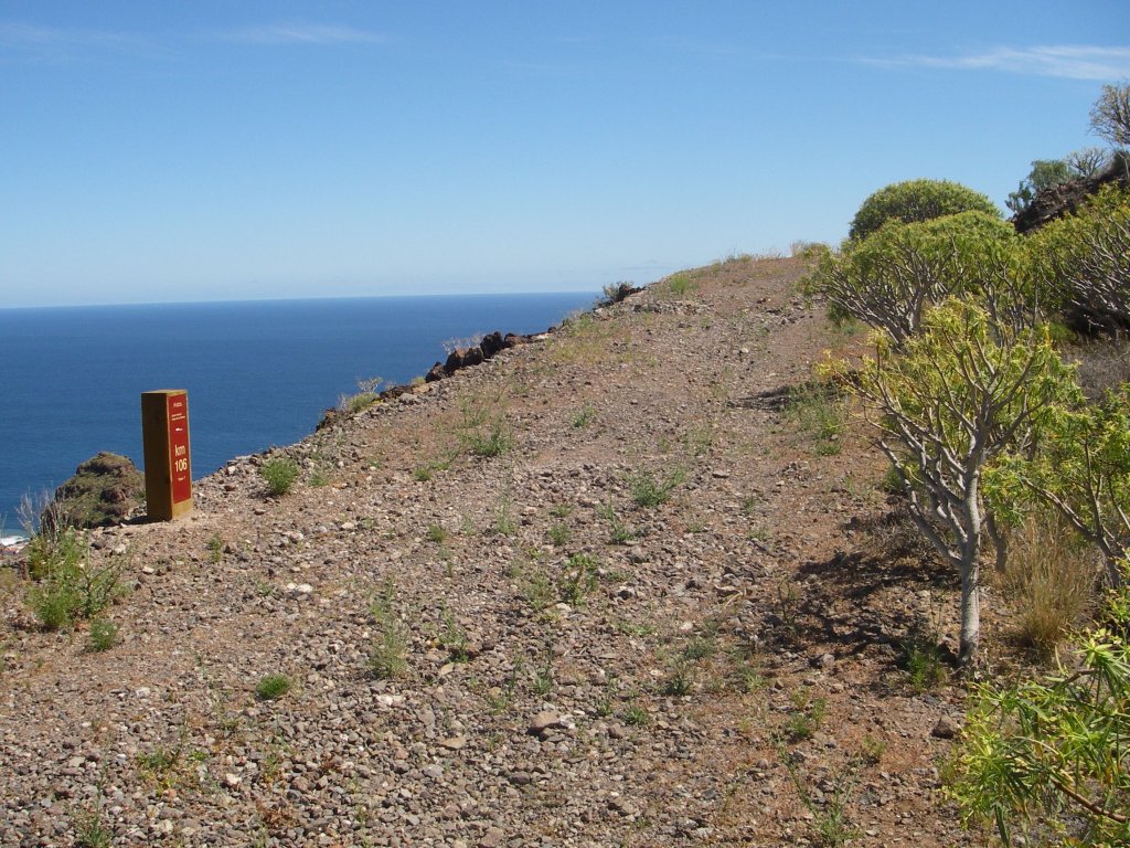
The last Stage of the nature trail Costas de La Gomera starts at the town hall square of Alajeró, from where a narrow street leads to a motorway where a directional post indicates the distance to the next town, Targa, 2 km away.
After walking about 680 m on the motorway, we turn left along a marked path that leads to Targa. From this point, we can enjoy beautiful views of mount Montaña del Calvario and the shrine of San Isidro, perched on top of the hill; on a clear day we can even make out the island of El Hierro on the horizon.
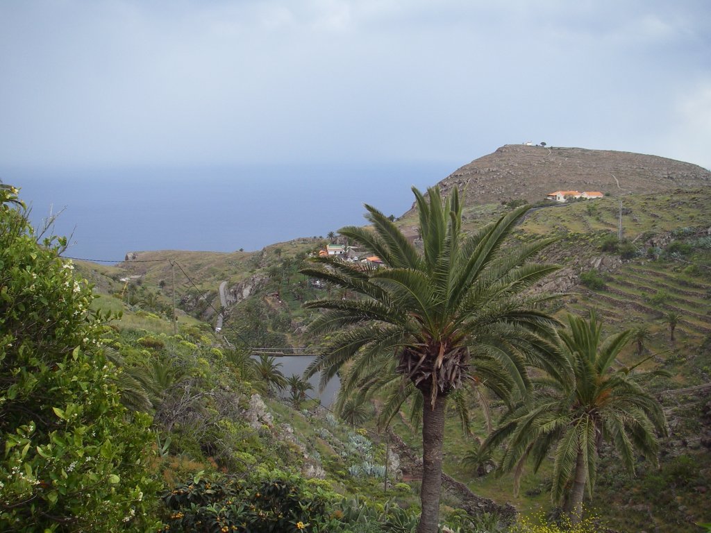
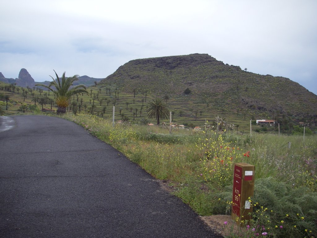
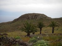
After about 190 m, we reach the CV-11 motorway, which we shall cross with caution in order to continue our ascent up a cobblestone path that runs along the hill and soon reaches an asphalt road, and is surrounded by century plants (Agave americana), prickly pears (Opuntia maxima), spurge(Euphorbia sp.) and Canary Islands palms (Phoenix canariensis), After nice views of the small terraced hillock at the foot of the ridge of Cabezo de las Vetillas – carpeted with grass and dappled with a beautiful palm grove –the immense volcanic plug of Roque Agando stands out in the distance, located at the head of the ravine of Bechinjigua.
After 80 m, the trail branches off the asphalted Stage of road to descend, between small stone walls, toward the small village of Targa, located at the foot of Cabezo de las Vetillas. After another crossing, this time with the main access road to the town, we move away from the small ravine of Sao and reach the motorway once more. After walking along the road for some 70 m, we see that the trail definitely branches off to the right, leading to Playa de Santiago (Santiago Beach), about 8.5 km away.
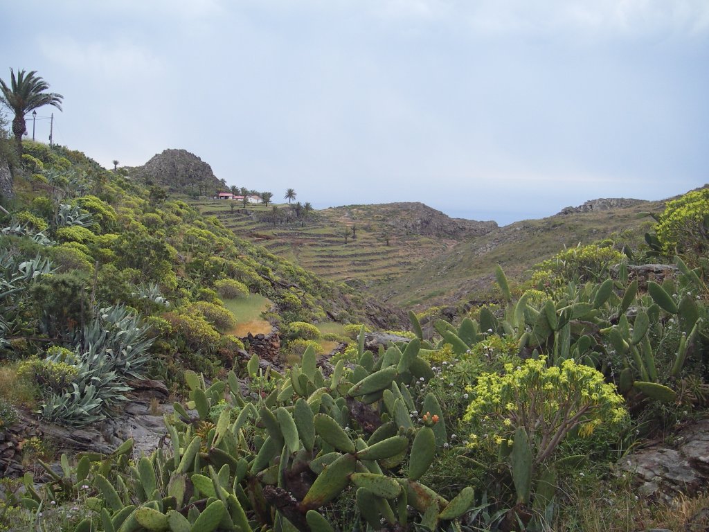
The trail runs along a terraced hillside, covered by a carpet of grass and dotted with palm trees. After passing by a small cave used as a shelter for cattle, we must turn left along route 22 of the Red de Senderos de La Gomera (La Gomera Trail Network) toward Playa de Santiago, moving away from the path that leads to Antoncojo on the right.
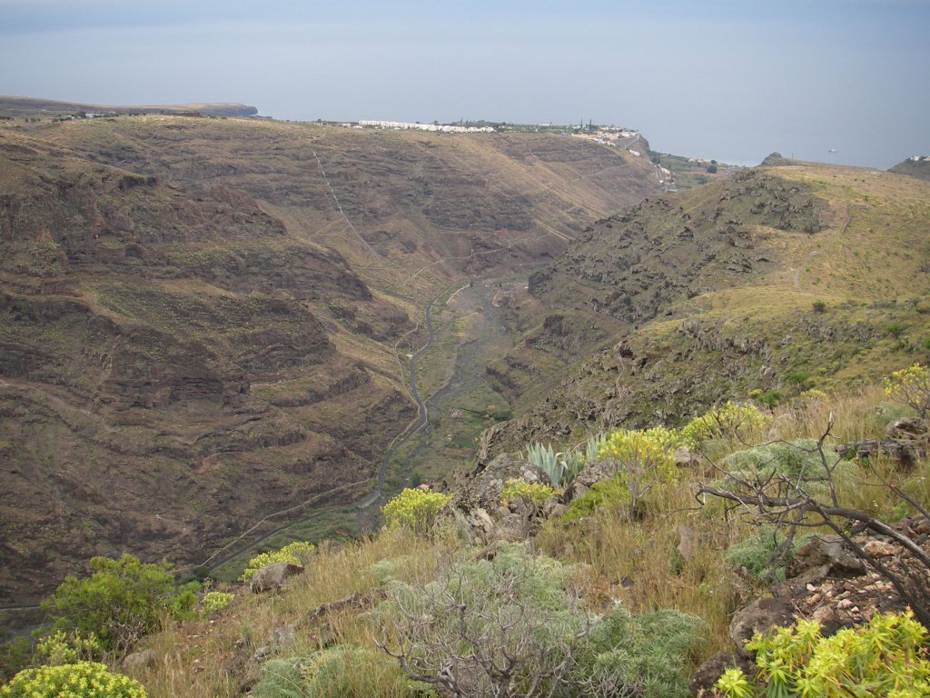
We move away from Roque de los Moros, on the left, and continue a gentle descent down the hillside track until the trail connects with an old motorway coming from Targa that has been turned into a dirt track. The traveler has in front of his eyes a wide scenic view of the region. He can see to the right Roque Redondo, with its rounded shape, separated from Cabezo de la Jiguerita by the ridge of Degollada de la Joya. A little further down, in the middle of a wide terraced expanse of land, the small dam of Cascajo and the reservoir of Antoncojo, and, on the hill of Los Llanos, the small airport of La Gomera, used exclusively for inter-island flights.
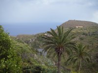
Gradually, the trail begins a gentle descent, crossing the wide hill from one side to the other, with spectacular views of the ravine of Bechinjigua, called ravine of Santiago in this last part of the trail. Standing out over the ravines of the point of Marichal, we can see from here the hill of Tecina, where a major tourist resort has been built on a spot that was previously occupied by extensive tracts of farmland devoted to the production of export crops, such as initially tomatoes and bananas later.

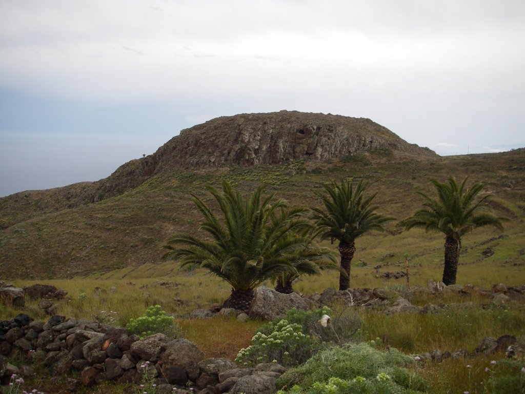
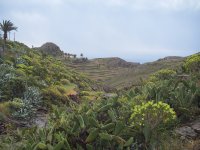
We walk along this large hill covered by an abundant herbaceous layer whose color changes according to the season of the year in which we make our visit, from the green hues of the humid season to the saffron yellow prevailing in the summer period. But it hasn’t always been like this; this barren and harsh place, where only degraded scrubland consisting of plants such as spurge, vinegar trees and gorse manages to survive now, used to be an important source of food supply for the local population, who used the terraces carved into the hillsides to grow plentiful crops.
After passing by a dilapidated house in the area of El Repecho, and by a small pipe that takes water from the ravine of Santiago to the dam of Cascajo, the trail continues its descent along the ridges of Degollada de Altamache, passing by an old pond, on one side, and the steep slopes of the ravine of Santiago on the other side.

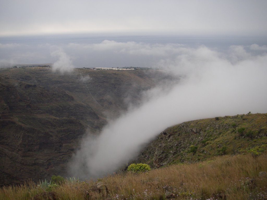
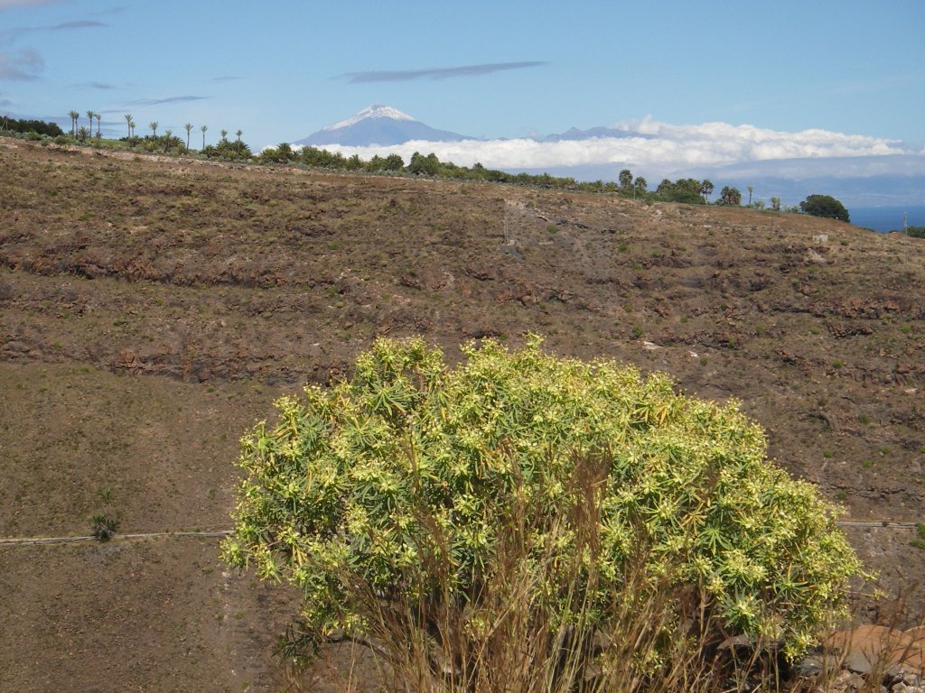
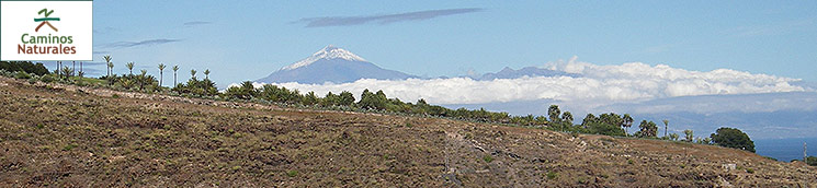
The trail continues its gentle but steady descent past two derelict buildings and reaches the ravine of La Junta, which joins further down the ravine of Cocos and goes down to meet the sea in Playa de Santiago (Santiago Beach). Here hikers can enjoy the view of mount Teide in the neighboring island of Tenerife, whose pointed shape usually pokes over a strip of clouds – known as the sea of clouds - caused by the clash of trade winds with the slopes of the volcano.
Gradually the trail goes down and, after a few sharp turns in the final stretch of the hill, it continues its descent along the slope of the ravine of Santiago, offering ample views of the bottom of the ravine and the spot near the beach where it meets the sea, as well as of the villages of Laguna de Santiago and Playa de Santiago.
Once again the trail goes along the slope of the ravine of La Junta, where the gravelly path turns into an asphalt track that leads to some deposits. Here the trail makes a turn to the left and descends toward the CV-20 motorway which comes from Alajeró. After crossing this junction with caution, we can take a break at the rest area located in this place, where there is also a small parking and a children’s play area.
The remaining part of this Stage of the trail runs along a motorway, which means that we should be extra careful. After taking the CV-20 motorway to the capital city of the island, San Sebastián de La Gomera, we must branch off toward Playa de Santiago (Santiago Beach) and walk down Santiago Apóstol Street until we reach the beach, where we can enjoy a relaxing swim and the rich cuisine of the town.
In the neighboring district of San Juan there is a beautiful ethnographic park that is well worth a visit, its exhibits being organized around three large sized threshing floors traditionally used by farmers to thresh the grain harvested in this area; there are also several explanation panels informing visitors of the hard life of the peasants in older times.
Sites of interest
Profile
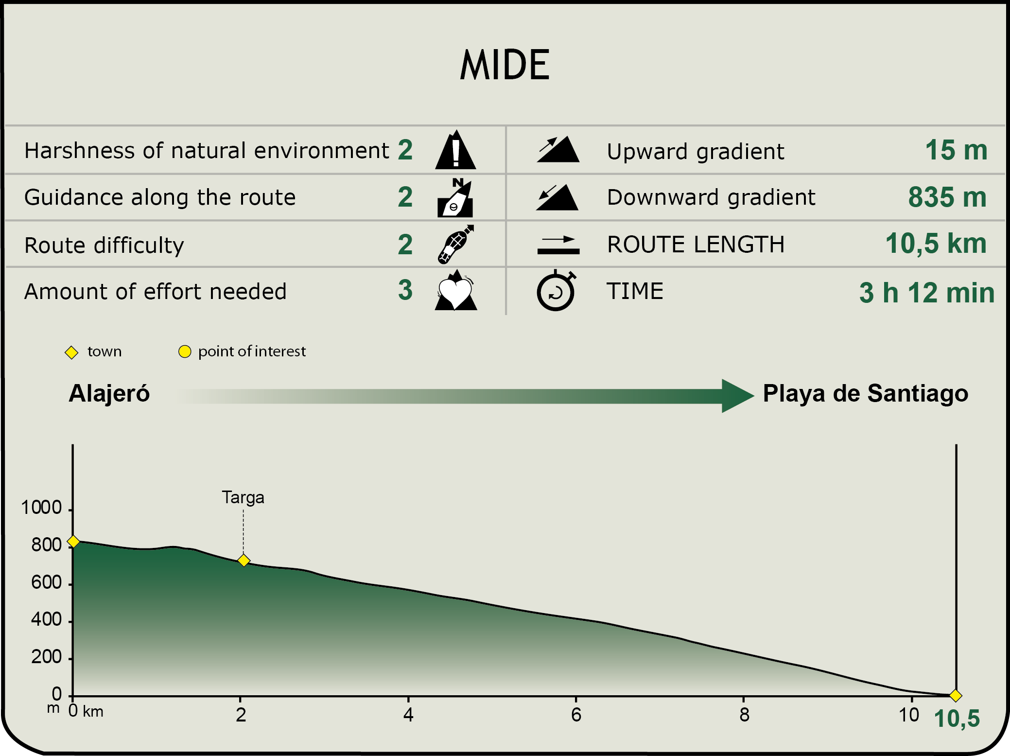
MIDE (Method for the Information of Excursions)
 Harshness of natural environment
- 1. The environment is not risk-free
- 2. There are more than one risk factors
- 3. There are various risk factors
- 4. There are quite a lot of risk factors
- 5. There are many risk factors
 Guidance along the route
- 1. Well defined trails and crossings
- 2. There is a clearly marked trail and signage
- 3. Requires the identification of geographic features and cardinal points
- 4. Requires off-path navigation
- 5. The trail is interrupted by obstacles that have to be gone around
 Route difficulty
- 1. Walking on a flat surface
- 2. Trails with different types of path
- 3. Walking on stepped paths or irregular terrain
- 4. The use of hands or jumping over the terrain is necessary
- 5. The use of hands is required to progress
 Amount of effort needed
- 1. Up to 1 hour of continuous walking
- 2. Between 1 and 3 hours of continuous walking
- 3. Between 3 and 6 hours of continuous walking
- 4. Between 6 and 10 hours of actual walking
- 5. More than 10 hours of continuous walking
Featured
Further information
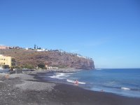
Playa de Santiago
Playa de Santiago is a small village in the south of La Gomera belonging to the municipality of Alajeró and situated in the spot where the ravine of Santiago meets the sea.
The origin of this village goes back to the early twentieth century, when a small group of fishermen settled next to the beach in order to make use of the fisheries resources existing in this part of the coast, which resulted in the building of two canneries. The production of export crops caused a rapid increase in the population of this settlement, since many locals came to this place in search of jobs. In a short space of time, Playa de Santiago became one of the most prosperous economic hubs of the island.
The crisis of the 60s and 70s caused the abandonment of crops and even the closure of fish farms, resulting in hard times of economic decline and decadence, offset in recent years by the robust development of the tourist and services industries.
Multimedia