- Home
- Rural Development
- Nature Trails
- Nature Trails
- Canary Islands Sector
- Costas_Gomera
Stage 1: San Sebastián de La Gomera - Hermigua
Description
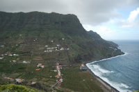
From San Sebastián de La Gomera to the beach of Hermigua through Majona’s Natural Park.
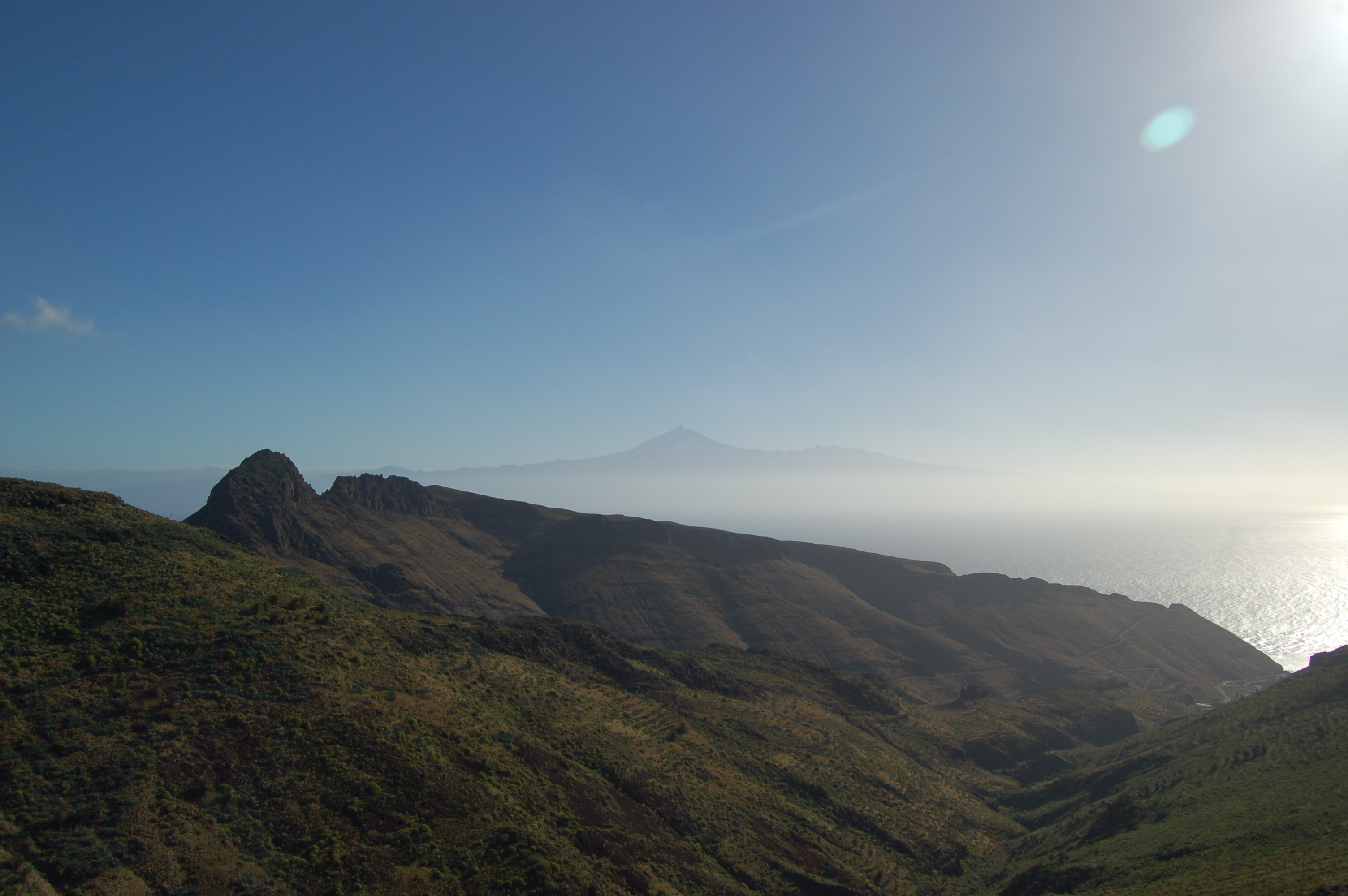
The first stage of the Shores of La Gomera Nature Trail begins in the island’s capital city, San Sebastián de La Gomera. It crosses the historic centre of the city and then goes through Majona’s Natural Park, which boasts plant formations of Canary Island pines, palm trees and stands of fayal/brezal (typical plants from the Canary Islands), and from where the Teide can be contemplated, in the neighbouring island of Tenerife. The stage ends in Hermigua Beach.
The stage begins in San Sebastián de La Gomera, capital city of the island, more specifically in the roundabout that links roads GM-1 and GM-2. After crossing GM-1 and leaving the guagua station to the left, the route continues through avenida de Colón, reaching the church of La Asunción. After passing this church and a staircase, the ascent starts through calle de La Pista. After passing by the National Parador of Tourism of La Gomera, this street becomes calle Orilla del Llano. By following this path, now far from the urban area, we reach a roundabout where we must follow a paved track that some metres farther becomes a dirt track. After passing by a farm, the track keeps going up among abandoned terraces which, little by little, give way to Canary Island spurges. Shortly before kilometre 4, the ascent ends and the route reaches then a Canary Island pine stand (Pinus canariensis).
Alterning uphill and downhill strechts, the traveler reaches kilometer 6, where there are excellent views of Ávalo ravine.
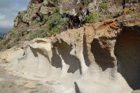
By continuing through the same path, kilometre 7 is reached, where the traveller goes through spots of livestock activity (more specifically, goat and sheep shepherding). In this stretch, the effects of erosion on soft ground, shaped by wind and water, can be observed.
Soon after kilometre 8, the route starts going down among Canary Island pines which take the traveller deep into Majona’s Nature Park, going through it for the next 13 km of the stage. When the descent is over, the route crosses a wide track, then goes up through a stone staircase and continues through a narrow path, passing by the so-called ‘Altos de Uteza’.
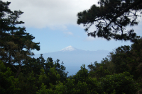
After kilometre 10, the route starts a descending stretch that ends in a wide forest track that the traveller must follow to the left for the next 11 km of the stage. By going over this track, the traveller reaches an agriculture and livestock area in the Gully of Majona. There, a long ascent with a slight slope begins, offering unbeatable views to the traveller, who can see the neighbouring island of Tenerife from several points, with the peculiar silhouette of the Teide.
By continuing the gentle ascent and going through Majona’s Natural Park, the hiker will contemplate masses of Canary Island pines, palm trees (Phoenix canariensis) and heathers (Erica arborea) with a high scenic and botanical value.

Twisting around the mountainside, the user leaves the path towards the houses of Helechal to the right. A few metres before kilometre 16, there is a short descending stretch that takes the traveller into a dense fayal-brezal. Soon after, the route goes up again and once kilometre 17 is passed, the track is no longer made from dirt and becomes a paved track, keeping its width.
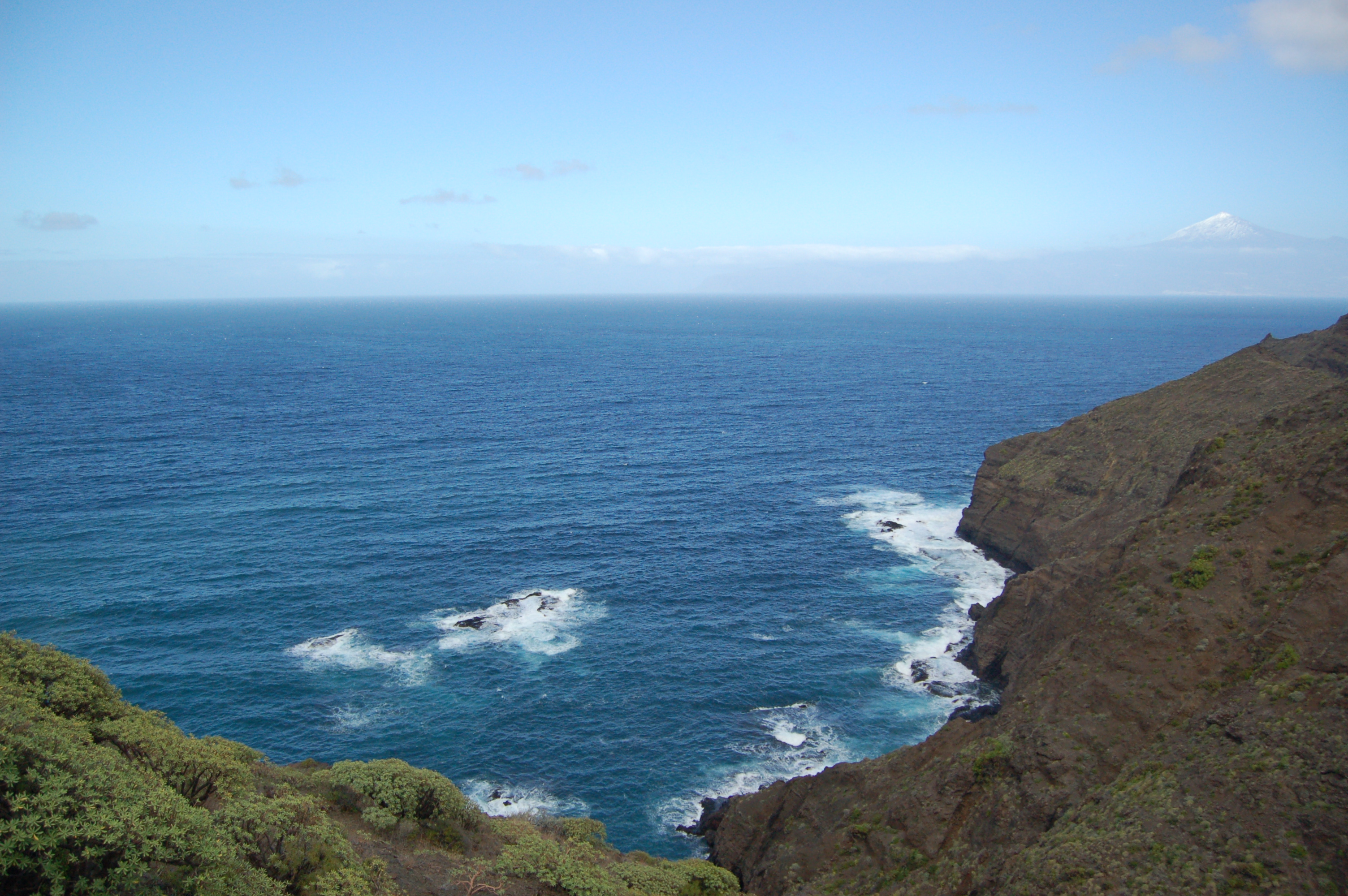
The descent starts and the paved track becomes once again a dirt one, twisting and turning around the mountain, with the Roque Caraballo to the right. The vegetation is now more diverse, as the humidity of the route is higher in this side of the mountain, from where the coastline of La Gomera can be sighted.
After passing a natural pond to the left of the track, the right branch must be followed. Soon after kilometre 22 the main track is abandoned and a narrow path to the left is taken, passing through the houses of El Palmar.
The route arrives at a paved road after going through different ascending and descending stretches, again with formations of Canary Island spurges, and crossing a little stream. We must turn left to carry on with the stage, leaving the path from La Caleta to Punta San Lorenzo to the right.
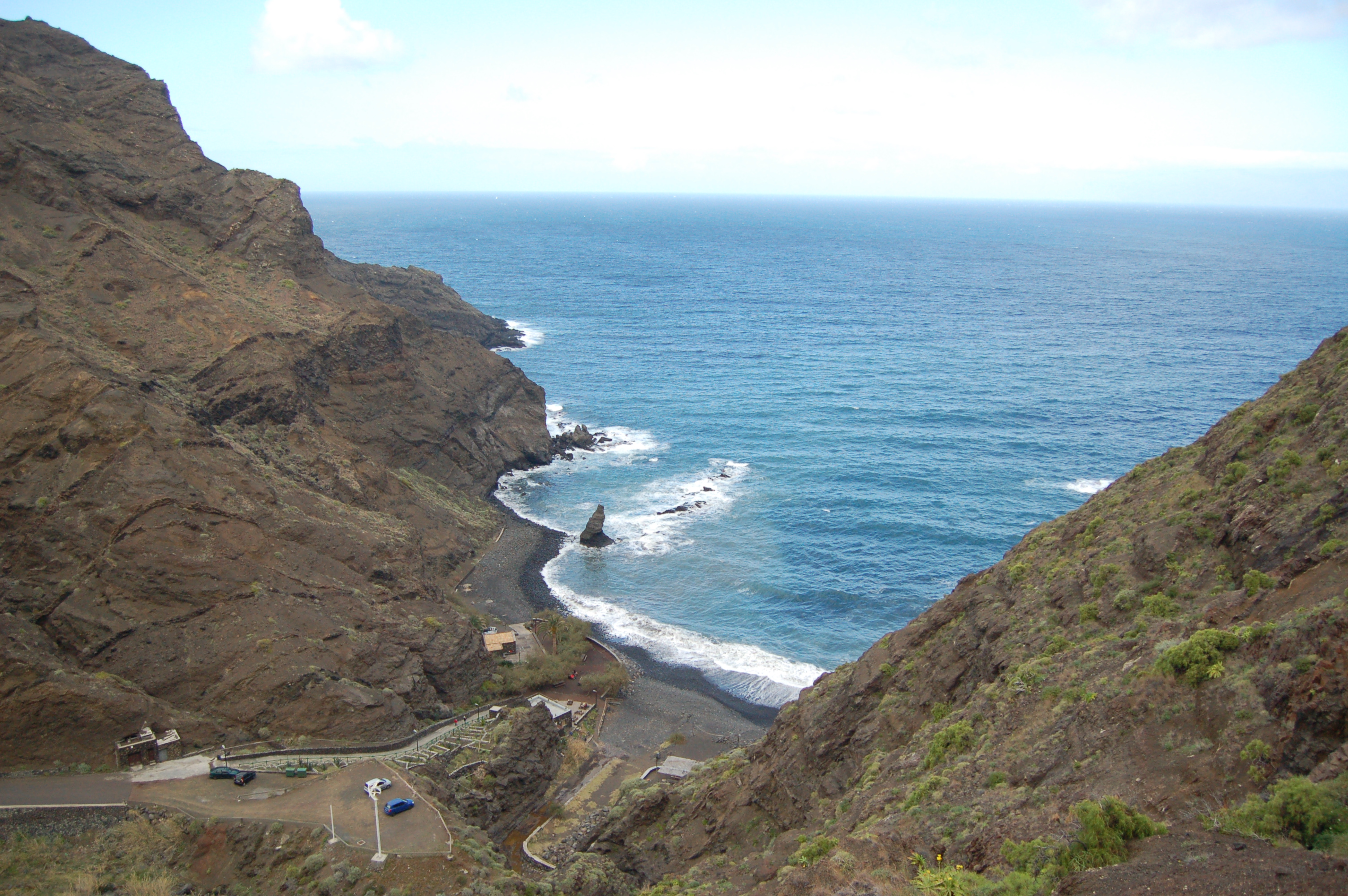
The stage goes through this paved track, now ascending, and then leaves it after kilometre 25, going up through a narrow path until crossing the road. Then, the sharp descent starts, also through a narrow path, passing by the houses of Altozano. Already on the pavement, the traveller arrives at Santa Catalina to end this first stage of the Shores of La Gomera Nature Trail among banana trees in Hermigua Beach.
Profile
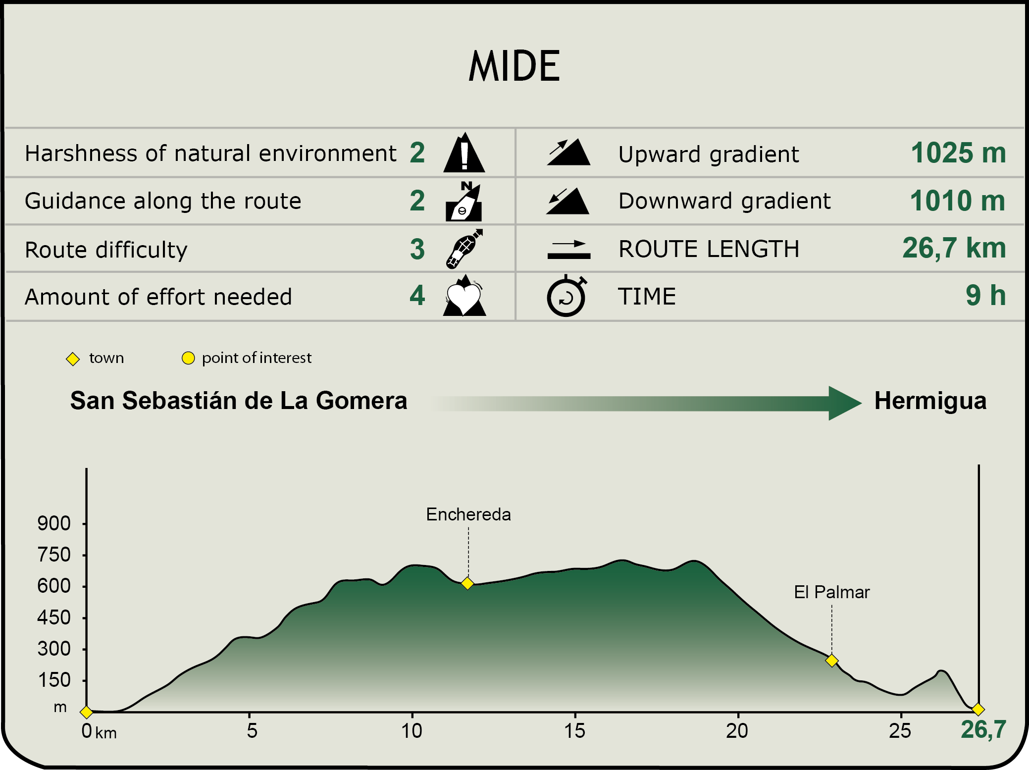
MIDE (Method for the Information of Excursions)
 Harshness of natural environment
- 1. The environment is not risk-free
- 2. There are more than one risk factors
- 3. There are various risk factors
- 4. There are quite a lot of risk factors
- 5. There are many risk factors
 Guidance along the route
- 1. Well defined trails and crossings
- 2. There is a clearly marked trail and signage
- 3. Requires the identification of geographic features and cardinal points
- 4. Requires off-path navigation
- 5. The trail is interrupted by obstacles that have to be gone around
 Route difficulty
- 1. Walking on a flat surface
- 2. Trails with different types of path
- 3. Walking on stepped paths or irregular terrain
- 4. The use of hands or jumping over the terrain is necessary
- 5. The use of hands is required to progress
 Amount of effort needed
- 1. Up to 1 hour of continuous walking
- 2. Between 1 and 3 hours of continuous walking
- 3. Between 3 and 6 hours of continuous walking
- 4. Between 6 and 10 hours of actual walking
- 5. More than 10 hours of continuous walking
Featured
Further information
San Sebastián de La Gomera
San Sebastián de La Gomera, popularly known as La Villa, is the capital city of the island and therefore its entrance gate. This port was the last stop of Columbus before departing towards the discovery of America in 1492. Nowadays, the Columbus House, where he stayed, is a museum open to the public.
The traditional Columbian architecture is present in La Villa, combined with modern buildings such as the National Tourism Parador “Conde de La Gomera”, the Cabildo Insular (island council) or the Insular Auditorium “Infanta Cristina”. The church of Nuestra Señora de la Asunción is the main temple of the capital city, and today it is a museum and a reminder of adventures and misadventures of the past, as it suffered from multiple fires and pirate attacks throughout its history.
The hermitage of the Virgin of Guadalupe, patron saint of the island, is located in this town, though not within the urban area, but in the Natural Special Reserve of Puntallana.
Majona’s Natural Park
EMajona’s Natural Park is located north-west of San Sebastián and has a surface of 1,757 ha. Its most remarkable characteristic is the sharp orography of its landscapes, showing how the erosion has shaped its landscape with gullies and cliffs of great geomorphological interest.
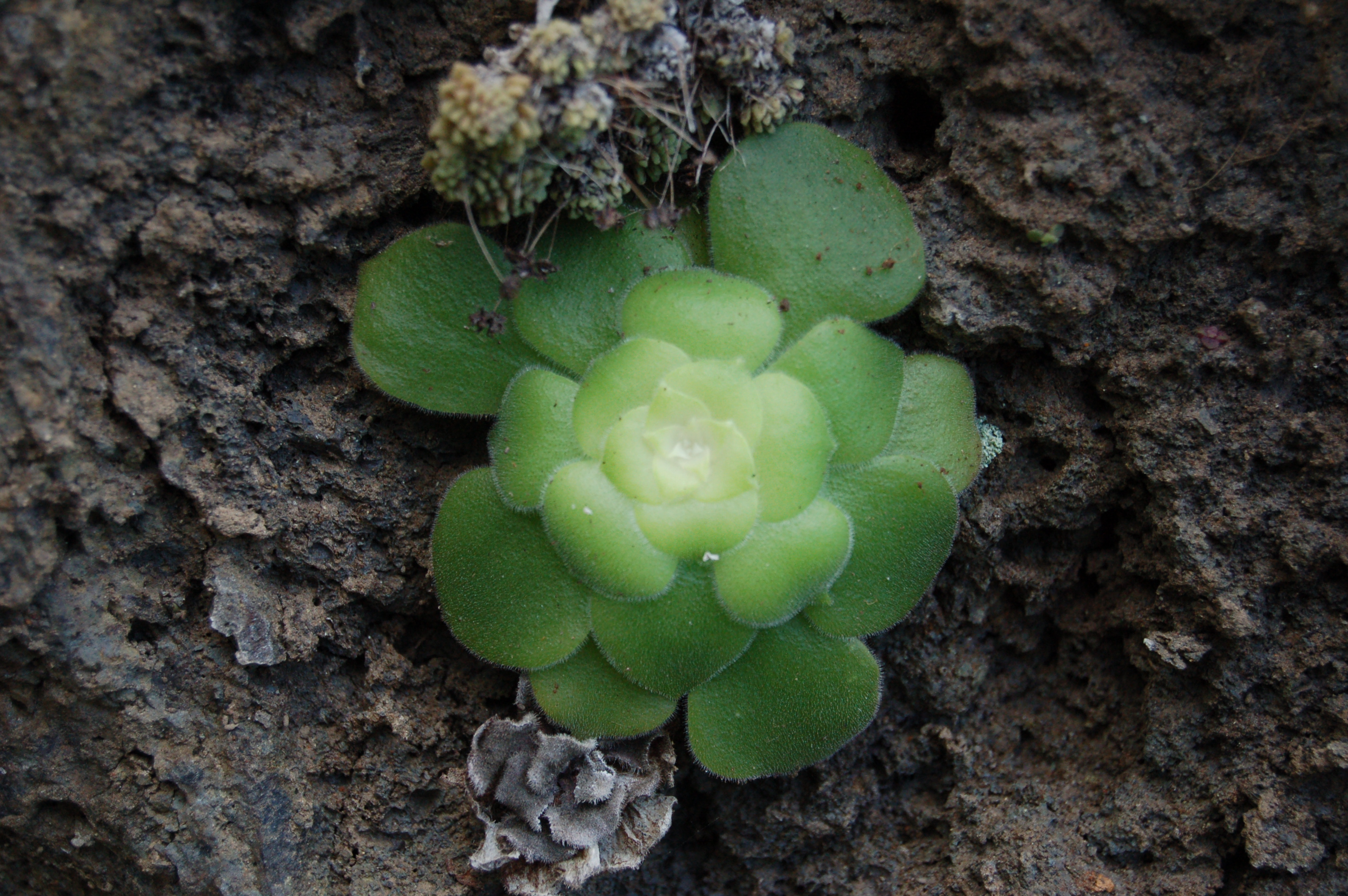
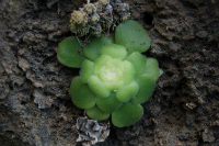
The vegetation in the high areas of the gullies plays an important role in the protection of the soil and the recharge of aquifers. Likewise, it has a great scientific interest, as several endemic or endangered species can be found, such as the cardoncillo (Ceropegia dichotoma subsp. krainzii) and the bejeque gomero (Aeonium gomerense), with a varied exhibit of habitats.
This natural space was a former cattle meadow where shepherding is still present, and where nowadays an interesting tabaibal grows, as well as other species of the basal flora and an important representation of fayal-brezal.
Majona’s Natural Park is accessed through the road that links San Sebastián and Hermigua, through a spot known as Las Casetas. It must be noted that there are no rural hotels, bars or restaurants around the park.
Livestock and livestock products in La Gomera
The Canary Islands have a great genetic livestock heritage, driven by the island status of its territory, which has allowed for the pure-breeding of its different breeds in the past. Nowadays, the Canary Islands have 2 bovine breeds, 3 goat breeds, 3 sheep breeds, 1 pig breed, 1 ass and the Canary Islands camel included in the Spanish Livestock Breed Official Catalogue. Among these breeds, there is undoubtedly a great predominance of the Canaria sheep breed, the Canaria de Pelo breed and, mainly, the Majorera goat breed. La Gomera cheese, which is one of the most valuable food products of the Island, is made from the raw milk of this goat, and sometimes from the mixture with the raw milk of the Canary Island sheep. In addition, the Canaria de Pelo goat is closely linked to the cultivation of bananas, by means of the use of the agricultural waste and the manure production.
Multimedia