- Home
- Rural Development
- Nature Trails
- Nature Trails
- Canary Islands Sector
- Anaga - Chasna
Anaga-Chasna Nature Trail
Description
An Explosion of Nature in Tenerife
The Nature Trail of Anaga-Chasna is one of the long-distance trails of Tenerife; a route that goes through forested areas and the hills of the island to the delight of hikers, who will have the privilege of admiring along the way the great contrasts offered by the landscapes of Tenerife, from lush vegetation to quaint volcanic formations, all of it crowned by the imposing Mount Teide.
The island of Tenerife is the largest and highest of the seven islands of the Canary archipelago. It has 43 protected natural areas - distributed throughout the island - which cover 45% of its total area. The high level of protection of the territory is just a reflection of the diversity and uniqueness of ecosystems and landscapes that can be found in an area less than that of any other Spanish province.
What catches the visitor’s attention powerfully is the quality and quantity of contrasts offered by Tenerife: from lush laurel forest formations in middle and high altitudes to volcanic landscapes, particularly Teide National Park with its volcanic cone, which remains active and is the highest peak in Spain, at 3,718 m. The island also offers a combination of black sand beaches and high cliffs, and villages that preserve their typical colonial-style architecture.

Its insular nature, combined with its volcanic origin and a mild climate, without sudden or extreme changes in temperature and weather conditions, has generated many endemic animals and plants. These unique features have turned Tenerife into an important focus of attention for nature lovers and researchers from around the world.
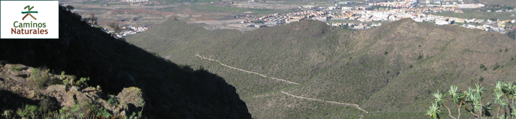
The Nature Trail Anaga-Chasna or GR-131 is one of the two long-distance trails on the island. Starting in the northeast of Tenerife, in the Anaga range, it goes through the central region of the island in a south-westerly direction from the town of La Esperanza to the historic quarter of Arona.
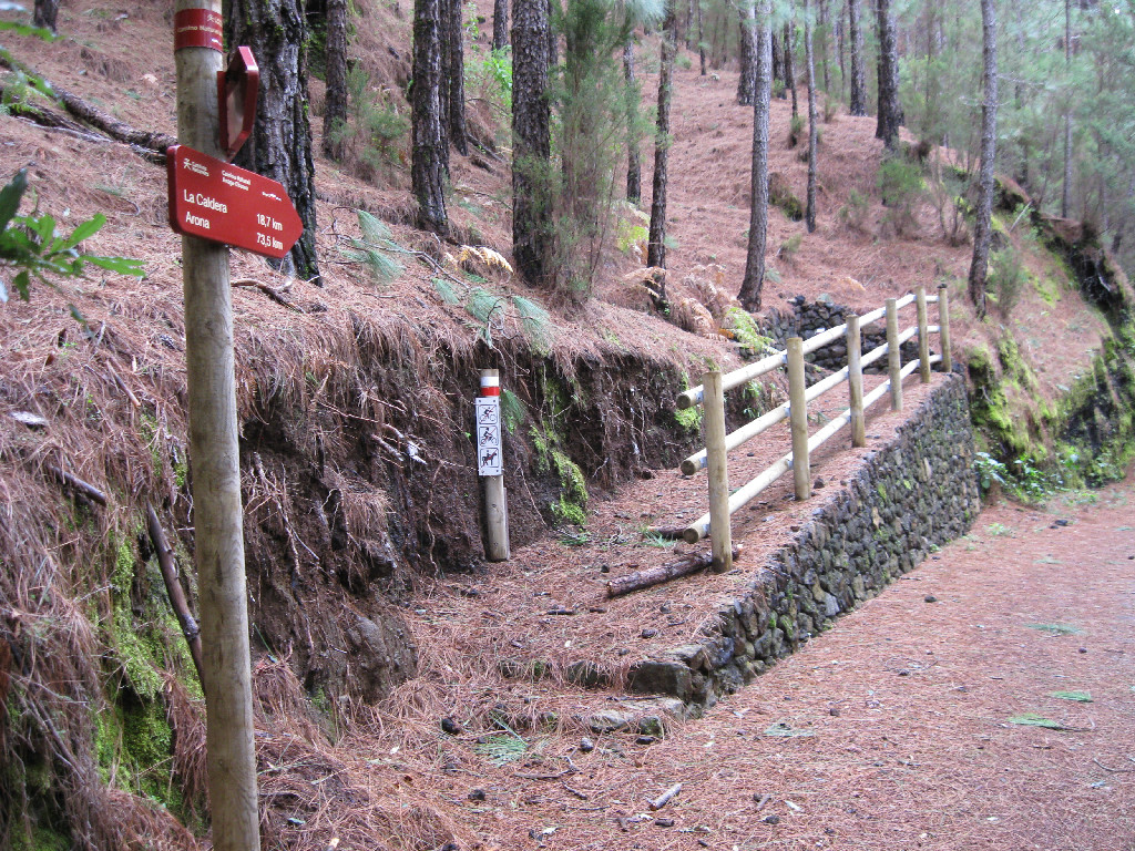
The trail runs through the forest areas of the island, along ridge lines, and covers most of the Forest Trail and the Royal Trail of Chasna, one of the roads used most frequently in the past by the people of Tenerife to link the North and the South. Due to its length, around 93 km, GR-131 is divided into five section, each of which has its own character, characterized mainly by the dominant vegetation, the level of human intervention in the landscape, or the climate.
From La Esperanza to La Caldera
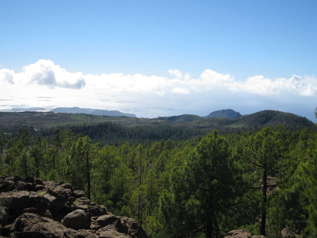
This stretch of the trail, even though it is the third one, is really considered the first section of the Anaga-Chasna Nature Trail, since the first two stretches are not part of the Nature Trails scheme. This stretch follows almost entirely forest roads, with gentle upward slopes which will take us near some of the best examples of historic pine and laurel forests of Tenerife, a type of evergreen rainforest that used to cover a large portion of the island.
Our point of departure will be the main square of Adelantado de La Esperanza, a village with a very traditional character, capital of the municipality of El Rosario, and, from this village, we will enter the iconic forest of Adelantado, remaining vestige of a millenary laurel forest which has been turned into an urban park.
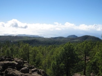
Once we leave the village, the path takes us through hills, mostly covered by forests of Monterey pine (Pinus radiata) and Canary Island pine (Pinus canariensis), usually with an undergrowth of typical laurel species. After a kilometer, this initial leg of the trail ends at the junction that leads to the recreation area and viewpoint of La Vica.
Once past the viewpoint of La Vica, the trail goes along wide forest tracks and small, sheltered paths to reach the resting area of Siete Fuentes, where we begin the steepest ascent of the trail along a zigzag path that is covered by a canopy of pines and tree heath (Erica arborea).
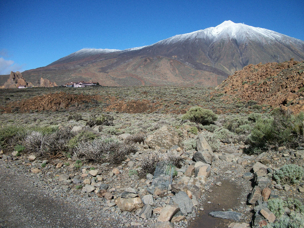
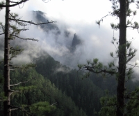
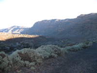
After reaching the greatest height of this stretch, the path skirts numerous cliffs in a south-easterly direction, through regions evoking enchanted forests, where moss hangs from the branches of pines and heath trees and frequent mists seep through the slopes and the crests of hills. If the fog allows it, we can enjoy magnificent views of the seemingly distant Mount Teide.
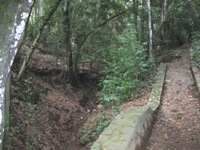
The descent down the path brings us back to a forest track that leads us first to Casa del Agua (Water House), a construction that collected piped water drained from several springs, and is an instance of the hydraulic infrastructures in the region, which were quite significant in the past. Then we arrive at the Pedro Gil resting area and, finally, without leaving the track, at the La Caldera recreational area, which offers several facilities as well as public transportation and is very close to Aguamansa, in the municipality of La Orotava.
From La Caldera to El Portillo
This stretch of the trail runs between the recreational area of La Caldera and the visitors’ center of El Portillo, in Parque Nacional del Teide (Teide National Park). From La Caldera we will have the opportunity of enjoying breathtaking views of La Orotava Valley and the island of La Palma, which can be glimpsed even when it is cloudy, under the so-called sea of clouds characteristic of this island.
From there, the path, which joins PR-TF-35 at the beginning, enters a pine forest with a thick and high undergrowth of heather which, in certain areas, conceals the sky. In this first section of the second leg of the trail, markers will indicate the boundary between public forest and the enclosures of private farms, along a road occasionally carpeted by abundant ferns.
We arrive then to the place known as Pino or Fuente del Dornajito, which has traditionally been used as a resting area and has often been described by historical naturalists who visited the island. Fuente de Dornajito (Dornajito Spring) was first described by the British naturalist J. Edens, whose account of his climb of Mount Teide in 1715 was published in the renowned magazine Philosophical Transactions of the Royal Society of London.
Gradually, the forest turns into a Canary Island evergreen laurel forest, dominated by fayas or firetrees (Myrica faya), heather trees (Erica arborea) and other species characteristic of the laurel forest, such as the Canary Islands Strawberry Tree (Arbutus canariensis). As we ascend, the path takes us into an increasingly thick pine forest, with shrub species that are particularly characteristic of this altitude, such as the Teide broom (Spartocytisus supranubius) and the codeso or laburnum (Adenocarpus viscosus). Suddenly, the forest comes to an end and we begin the ascent to the visitors’ center of El Portillo, in Teide National Park.
From El Portillo to Degollada de Guajara
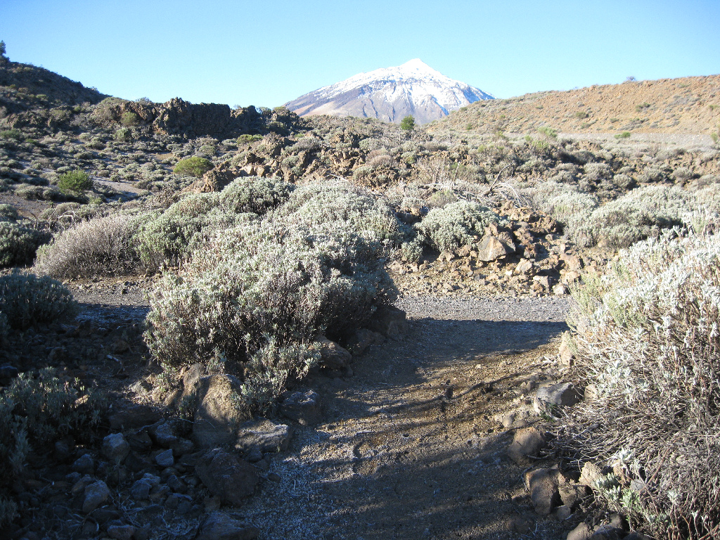
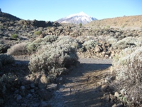
This leg of the trail takes us from the visitors’ center of El Portillo to Degollada de Guajara. This part of the trail runs along the Camino Real de Chasna (Chasna Royal Road), a road used for centuries, since the times of the Guanches (ancient inhabitants of the island before the Spanish conquest), for the bartering of goods. From El Portillo we follow the track of Siete Cañadas (Chasna Royal Road) in order to go through a unique landscape with endemic flora dominated by Teide broom and wallflower (Erysimum scoparium), hierba pajonera or flixweed (Descurainia bourgeauana) and tower of jewels or red bugloss (Echium wildpretii).
The trail runs along the base of the so called Circo de Las Cañadas (Circus of Ravines), which is always to the left of the path, allowing us to admire all along the way the vastness of Mount Teide, to the right. In this leg of the trail, we can see remarkable rock formations of volcanic origin such as La Papelera and El Palomar, interspersed with a number of ravines or mountain gaps that have given its name (cañada is ravine in Spanish) to this trail. The first ravine is that of Diego Hernández, where there is a cave that was used as a shelter by the last shepherd of Las Cañadas, Don Diego Hernández.
Along the way, and, particularly in Cañada del Topo de la Grieta, there are also Guanche settlements that were later used by shepherds. The trail ends at Cañada del Montón de Trigo, a plain that spreads under a lava wall where a large pond is formed in winter. At this point, we have the option to follow the track until we reach the Parador Nacional de Turismo (National Tourist Hotel) or to begin the next stretch of the Nature Trail in the direction of Degollada (mountain pass) de Guajara.
From Degollada de Guajara to Vilaflor
The trail departs from the Parador Nacional to connect with the track Siete Cañadas. The section of the trail that leads to the path going up Degollada de Guajara is quite easy, since there is almost no slope.
Once we reach the stretch of the trail going through Siete Cañadas we can enjoy views of the rocky formations of El Capricho, where rock climbing is allowed.
Once we reach Cañada del Montón de Trigo, we follow a path that ascends with a constant slope to Degollada de Guajara, a spot from which there are scenic views of Circo de Las Cañadas del Teide (the cirque of the ravines of Mount Teide), Pico Viejo (Old Peak), Montaña Blanca (White Mountain) and also Mount Teide. The views of both slopes of the mount are magnificent.
Once past the hillock, we begin our descent along a wall of white volcanic tuff. Up to this point, we have seen vegetation that is typical of the Teide ridges, particularly species such as Teide broom, rosalillo (Pterocephalus lasiospermus), and summit codeso or laburnum, Teide wallflower and hierba pajonera or flixweed, mentioned above.
On our descent, pine tree areas will alternate with patches of hill scrub vegetation, until we reach a sparse and low pine grove, followed by a more developed pine grove. In this part of the trail we find the ruins of Marrubial House, and, further on, a resting area under the shadow of an enormous pine tree with a diameter of over four meters.
We then continue on the road to Vilaflor, the highest altitude town in the Canary Islands, at 1,400 m. In this last leg of the trail, the Royal Road of Chasna runs between dry stone walls, and the original road surface is perfectly preserved. There are numerous stretches or stone-paved road, and sometimes the enormous size of the stones used to pave the road is particularly remarkable.
Once in Vilaflor, a series of signs on the Trail will lead us to the main square of San Pedro, where we will find the church of the same name, one of the oldest religious buildings on the island.
From Vilaflor to Arona
From the church of San Pedro in Vilaflor, the road will keep ascending up to the shrine of San Roque, offering great views of the village and the south coast of the island. A little further up, the path goes into a dry pine grove.
As we ascend, we go deeper into the Natural Park of La Corona Forestal, past the municipal water reservoir, until we reach an area called Las Corujas, a place where in ancient times firewood was turned into coal and from where we can enjoy again a wide landscape of pines reaching down to the coast.
From this point, the trail goes down into the protected landscape of Ifonche - where pine groves alternate with some cultivation terraces - and crosses the bridge at Guayero, which spans over the cliff of Las Goteras, considered the area of greatest floral interest in the region. As we approach the country house of Ifonche, and until we reach the end of the trail, we will see ancient circular threshing floors, where cereals used to be threshed out and subsequently winnowed in order to obtain grain; this is an ideal spot to make a stop along the way.
Once we reach the base of Roque Imoque, the path enters the Special Natural Reserve of Barranco del Infierno (Hell’s Cliff), from where we can make out in the distance the village of Adeje and Los Cristianos, as well as the islands of La Gomera and La Palma.
Particularly noteworthy in this last section of the road is Roque del Conde, on whose summit are some remains of aboriginal engravings, as well as plants typical of the area, particularly vegetal formations of cardonal-tabaibal (teasel and tabaiba).
If we continue the trail along the ravine of El Rey, we will reach the neighborhood of Vento de Arona, and, after a stroll through the streets of the village, we will arrive at the historic quarter. There, at Plaza de la Salud, overlooked by the church and city hall, the trail comes to its end.
Profile
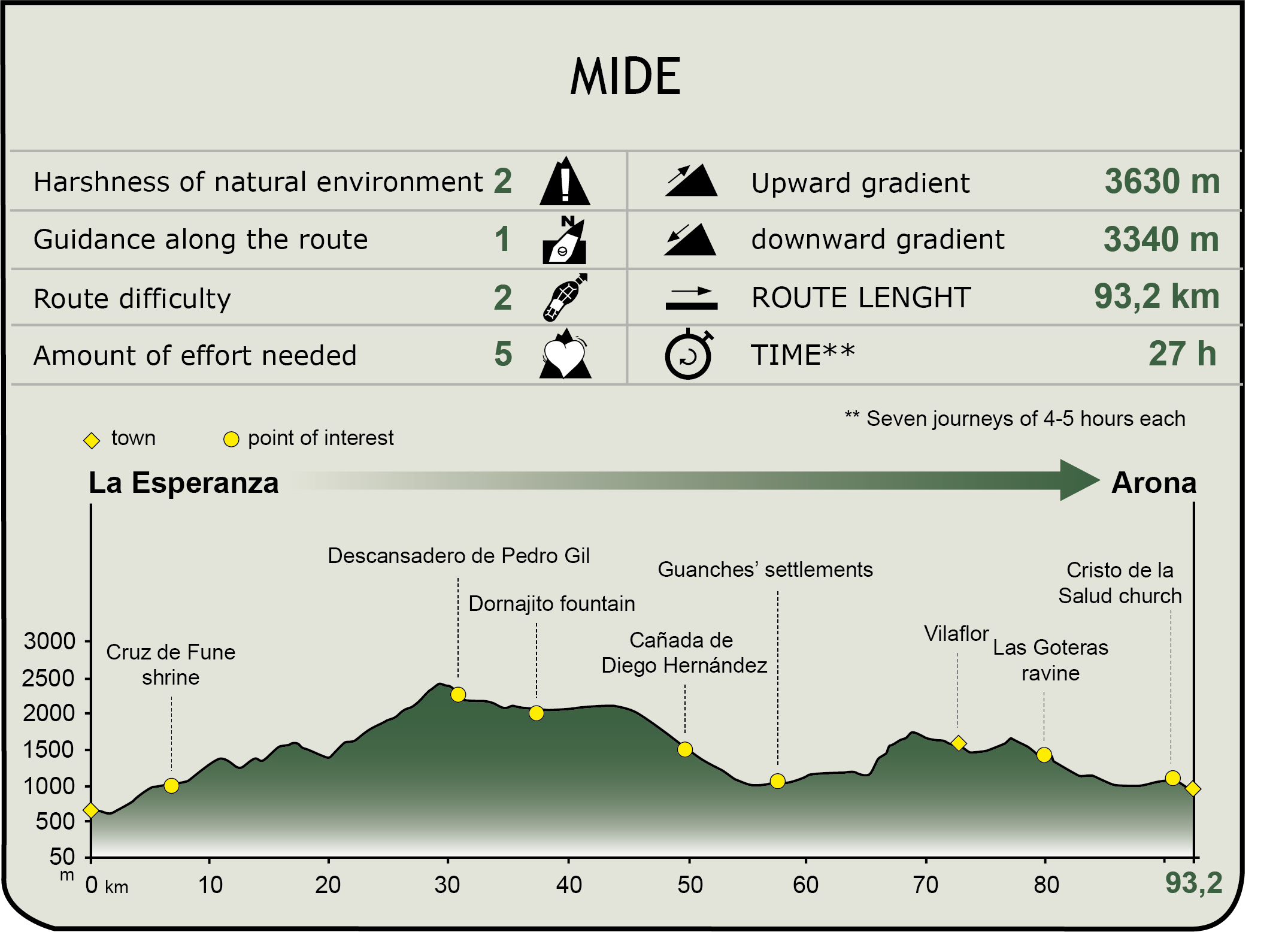
MIDE (Method for the Information of Excursions)
 Harshness of natural environment
- 1. The environment is not risk-free
- 2. There are more than one risk factors
- 3. There are various risk factors
- 4. There are quite a lot of risk factors
- 5. There are many risk factors
 Guidance along the route
- 1. Well defined trails and crossings
- 2. There is a clearly marked trail and signage
- 3. Requires the identification of geographic features and cardinal points
- 4. Requires off-path navigation
- 5. The trail is interrupted by obstacles that have to be gone around
 Route difficulty
- 1. Walking on a flat surface
- 2. Trails with different types of path
- 3. Walking on stepped paths or irregular terrain
- 4. The use of hands or jumping over the terrain is necessary
- 5. The use of hands is required to progress
 Amount of effort needed
- 1. Up to 1 hour of continuous walking
- 2. Between 1 and 3 hours of continuous walking
- 3. Between 3 and 6 hours of continuous walking
- 4. Between 6 and 10 hours of actual walking
- 5. More than 10 hours of continuous walking
Featured
Further information
Teide National Park
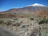
Named a World Heritage Site by UNESCO in 2007, Teide National Park, in the center of Tenerife, is a must see landmark of the island. With an average altitude of over 2,000 m, the National Park is home to one of the most spectacular examples of high mountain volcanic ecosystem in the world, whose highlight is the mythical Mount Teide.
The Teide cable car travels up a height of 1,199 m to the base of the peak of the volcano, 3,555 m above sea level. The summit of Mount Teide, with an altitude of 3,718 m, is only accessible by the path “Telesforo Bravo”, from the cable car station of La Rambleta, an ancient crater with a diameter of 850 m. A permit to access this trail must be previously obtained online or at the offices of the National Park in Santa Cruz de Tenerife.
Under the shadow of the peak, two tracks lead to Mirador de La Fortaleza (La Fortaleza Viewpoint) and to Pico Viejo (Old Peak). From the track that leads to Mirador de la Fortaleza a path ascends the steep slope of Mount Teide until it reaches its mythical crater, 80 meters in diameter, from where hikers can glimpse in the distance all the islands of the Canary archipelago.
Teide National Park stands out for its unique volcanic and biological features, with a flora rich in endemic species and amazing geological monuments, such as its magnificent elliptical caldera, one of the largest in the world - with 16 km along its major axis - within which the stratovolcano was formed, and which marks the natural boundary of the park.
Successive volcanic eruptions have molded and carved the contours of the terrain. At the foot of the cirque wall, we find the so called Cañadas del Teide (Teide Glens), sedimentary flatlands of a pale yellow color, which amaze visitors for their huge petrified lava rivers, where large amounts of eroded materials have accumulated.
The diversity of volcanic cones, craters, chimneys, volcanic plugs, ash and lava flows cover more than 18,900 ha of Teide National Park, and create an extraordinary landscape of colors and shapes that leaves no visitor indifferent.
Multimedia