- Home
- Rural Development
- Nature Trails
- Nature Trails
- Balearic Sector
- Camí de Cavalls
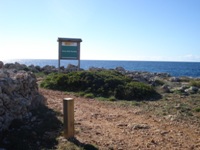
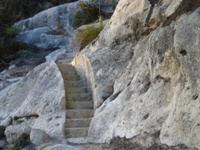
Camí de Cavalls Nature Trail
Description
Among fortresses on horseback
The name of this Nature Trail bears witness to the prominence of the Minorcan horse, a black, sleek, rather short, autochthonous specimen, which can frequently be seen along the whole tour. Horses and fortresses leave their stamp on the Camí de Cavalls or Horses Trail, a route which takes you back to the 18th and 19th centuries when the movement of troops and supplies and stores in battle was common along this track, which served to communicate the different defence constructions that extended along the entire coastline of Menorca.
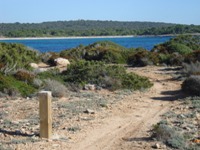
The 185 km of the Camí del Cavalls cover the coast of the eight municipalities of Menorca (Mahón, Villacarlos, San Luis, Mercadal, Alayor, Es Migjorn Gran, Ferreries and Ciutadella), where the strong north wind and salt leave their mark on the vegetation, sculpturing the strong, thorny-branched bushes into dome or cushion shapes. The route crosses places of high natural and scenic interest, such as the Natural Park of La Albufera des Grau, La Illa d’en Colom and El Cap de Favàritx, highlighting the enormous environmental value of the area. With good reason, in 1993, the whole of the island of Menorca was listed as a Biosphere Reserve by the UNESCO.
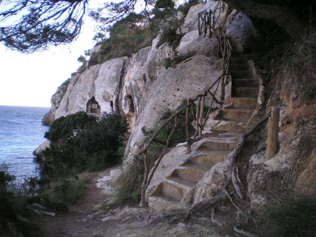
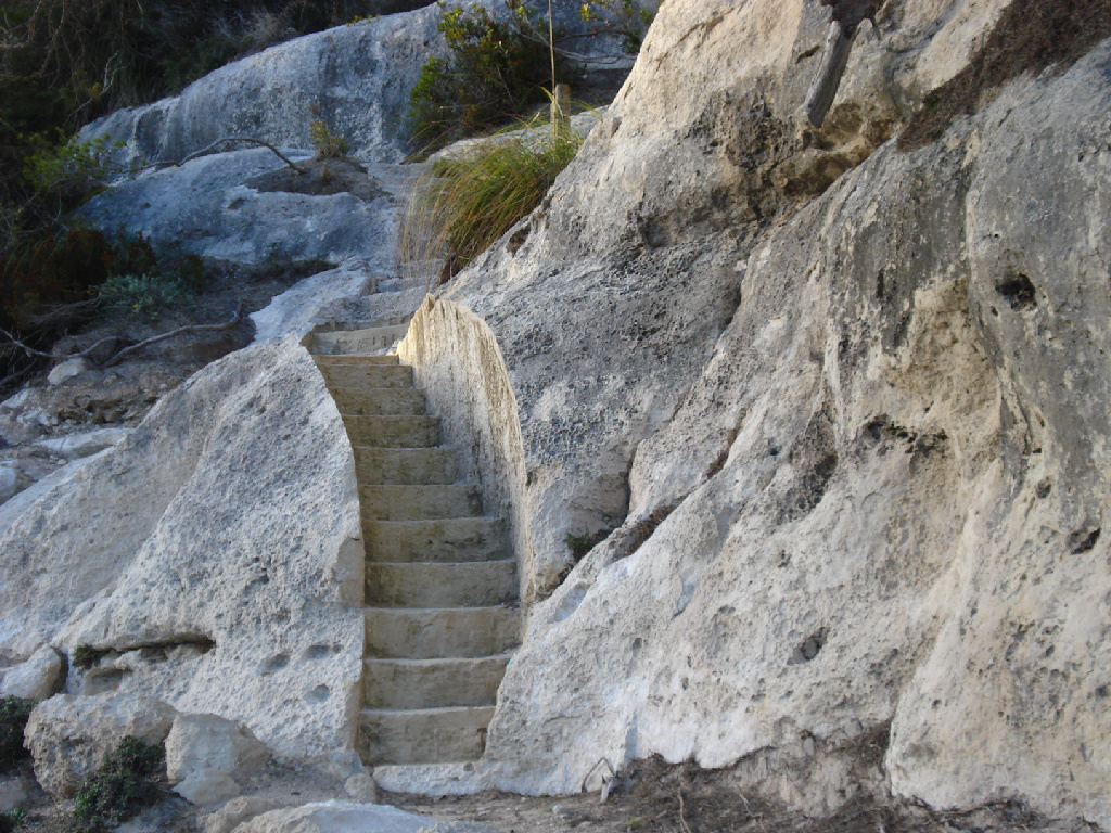
The itinerary begins at the end of the port of Maó and heads by road to the town of Sa Mesquida, where an 18th-century defence tower, which was built during British rule, stands out. In addition to ancient defence and watch towers, worthy of special attention is the presence along the route of other important archaeological components, such as Megalithic tombs, natural and artificial caves, Roman remains, naviformes and necropolises all of which abound on the island.
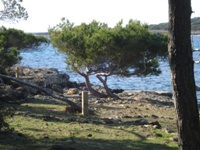
The route runs between coves of great natural richness and through agricultural land which shapes the landscape into the characteristic mosaic of Minorcan farms, els llocs, until it reaches the Natural Park of S’Albufera des Grau, which is regarded as the heart of the Biosphere Reserve. The rich biodiversity of the area allows you to enjoy different natural environments, such as the dune vegetation of the beaches of Es Grau, the cove of Sa Torreta and the cove of Morella.
Continuing along the coast, you reach the vicinity of El Cap de Faváritx, an area known for its unique landscape resulting from its dark-coloured rocks and sparse vegetation. On approaching the coast once again, you come to El Pou d’en Caldes. After passing this cove, you can see striking rock formations such as that of Es Capell de Ferro.
On following the route indicated by a horseshoe, you will come to a 3.5 km tarmacked section that links two residential areas together as far as the beach of El Arenal d’en Castell, and bordering the coast, it will lead you to the beach of Son Saura del Nord. This point gives you the chance to contemplate three different areas: a dune system, a wetland area and the forest area of La Albufera des Comte, without forgetting the enormous scenic appeal of places such as Cala Roja and Cala Blanca.
On leaving Ses Salines, five kilometres of tarmacked road emerge that lead to Cala Tirant. Along this stretch, to the west of the estuary of the natural port of Fornells, La Torre de Fornells rises up. This tower was built in the early 19th century under British rule as defence for the port.
Then, a good stretch of the Trail runs through an area listed as a Site of Community Importance (SCI) and a Special Protection Area (SPA) for Birds owing to its enormous ornithological interest as most of the reproductive species on the island, such as the osprey (Pandion haliaetus), live here.
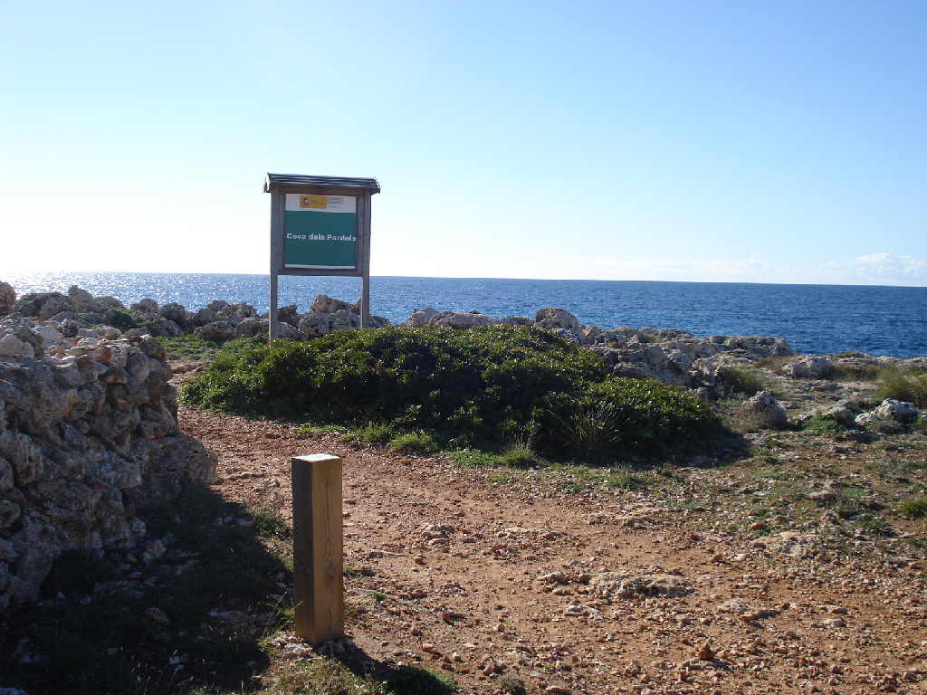
On the beaches of Binimel là, Tirant and Cavalleria, the dune systems consist of important plant communities and, a short distance away, you have the chance to visit the outstanding archaeological site of the Roman city of Sanicera. You can enjoy a privileged view of the sea from the spectacular cliffs in the area surrounding the lighthouse of Cavalleria.
A wind-swept rocky coastline
From Binimel lè to Els Alocs, the Trail runs along a stretch of virgin coast to the north of the island, where the terrain is more rugged. The North of Menorca Marine Reserve and coves such as those of Pregonda, Barril, Calderer and Pregondó are located in the waters that bathe this area.
You have to cross the pebbles of Els Alocs beach in order to reach the sandy areas of the coves of El Pilar and Alfurí, where most of the endemic species of Minorcan plants are concentrated, while the unmistakeable aroma of saltmarsh vegetation signals that you are reaching El Pla de Mar. This stretch, with its intensive and beautiful natural contrasts, leads you from the north wind area to what is known as dry Menorca.
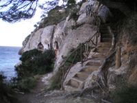
Following the coastline, the Trail goes as far as Cala Morell. Its cliffs house an important necropolis from the Talayotic era (1500-300 BC), formed by caves dug out in the rock (hypogeums).
The island often has very arid landscapes to offer. This is the case of the leg which runs between Cala Morell and Punta Nati, which have been moulded by the strong impact of the northerly wind. At Punta Nati, worthy of note is its historic lighthouse, which was built during last century to prevent the frequent shipwrecks that occurred in the area.
From Punta Nati to Cuitadella, stone becomes more prominent, as on this stretch the Trail is especially rocky. From La Cala des Corbetar, you can see El Pont d’en Gil, a bridge made of natural rock that has been eroded by the sea. From this point as far as the port of Ciutadella, the Trail runs along tarmacked roads for five kilometres.
It is here where you venture into the southern part of the west coast of Menorca. This stretch of the route begins at the port of Ciutadella and crosses the island’s westernmost city. Continuing along a 4-km tarmacked section, you reach Cala Blanca where, at the end of the beach, the remains of a room-shaped naveta, built during the Pre-Talayotic period (2000-1500 BC), are located, and which are a representative example of the first domestic settlements on the island. If you follow this Trail in springtime, orchids will pave your way along this leg of the route.
Throughout your whole journey, you will be able to contemplate the different traditional constructions of the rural landscape of Menorca, such as Ses Barraques or Es Ponts de Bens or de Bestiar, which shelter the livestock from inclement weather.
The ravines route
From El Cap d’Artruxt onwards, you can admire the beauty of the south-west coast and the ravines in the south of the island. Worthy of note is the wetland area of El Prat de Bellavista, behind the beach of Son Saura, which serves as shelter for a diverse array of water fowl. If you take a little detour from the route, you can see the 17th-century Talaia d’Artrutx, a watch tower which was used to warn of the presence of possible invaders.
In this area, ravines vertically cut the platform of chalky rock in the region and gradually become deeper and wider along the Trail, where dry-environment vegetation contrasts with that proper to the inside of the ravines, which is more sheltered from the wind and whose environment is darker and more humid. In this respect, the ravines of Macarella, Cala en Turqueta and Algendar stand out.
The most important ravines on the island can be found between Cala Galdana and Sant Tomás, which make the Trail incredibly spectacular and where you can see the torrents of water that run along the most important, such as those of Algendar, Trebalúger and Albranca.
A short distance from here, the ravine of Binigaus is located, which houses three of the four Karst caves that can be found in Menorca. La Cova des Coloms, also known as La Catedral, stands out on account of its enormous cavity. Furthermore, at the top of the ravine, an extremely interesting Talayotic Hypostyle room, known as Es Galliner de Madona, can also be found.
Following the path, the route gives you the opportunity to discover the beauty of the south coast of the island, on crossing between two important ravine areas: that of Sa Vall and Es Bec, to the west, and that of Cala en Porter, to the east.
On reaching the easternmost point of this section, you can cross along the bottom of the ravine of Sa Vall, which will allow you to enjoy a privileged view of the inside, in addition to the typical exuberant vegetation of the wetland areas that forms the ravine of Es Bec. Barely two kilometres to the east of this point, you can visit the largest Talayotic village on the island called La Torre d’en Galmés.
The eastern plain
From Cala en Porter to Punta Prima, you will discover two completely different environments. The route gradually leaves behind the winding path drawn by the ravines to the west and enters a flat and less rugged eastern part, although you will still come across some ravines. One of the last is that of La Cala des Canutells, whose interesting elm (Ulmus sp.) forest will surprise you.
After passing the Binissafúller residential area, an easy flat section emerges which crosses the south-eastern urban areas of the island. The route continues along a coastal road which links the towns of Binibéquer, Biniancolla and Son Ganxo together. On leaving Binibérquer Nou, the pathway follows a route next to the sea, from where the Island of El Aire can be seen and which can be easily identified by its lighthouse. This stage from Punta Prima to Maó runs along one of the flattest coastal areas of Menorca.
On the easternmost point of the island, the Trail follows the part of the route that is furthest inland, a good distance from the coastline. Wild olive tree (Olea europaea var. sylvestris) stands and scrubland alternate with agricultural and pasture land, shaping the typical Minorcan mosaic landscape.
On the second part of this last leg, which begins at La Cala de Sant Esteve and climbs up a small slope, you follow the Trail along an urban road that offers magnificent views of the port of Maó and the fortress of La Mola, which was erected at the entrance to the port. In the vicinity of La Cala de Sant Esteve, on the southern side of the estuary of the port of Maó, you will discover the Fort de Marlborough, an English fortress built in the early 18th century.
Passing by the castle of Sant Felip and the town of Es Castell, the route continues as far as Maó, the capital of Menorca, whose thousand-year history is evidenced in the city’s different architectural styles and monuments. Finally, after crossing the city, the Trail goes down to the port where your tour ends.
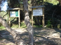
Sites of interest
Profile
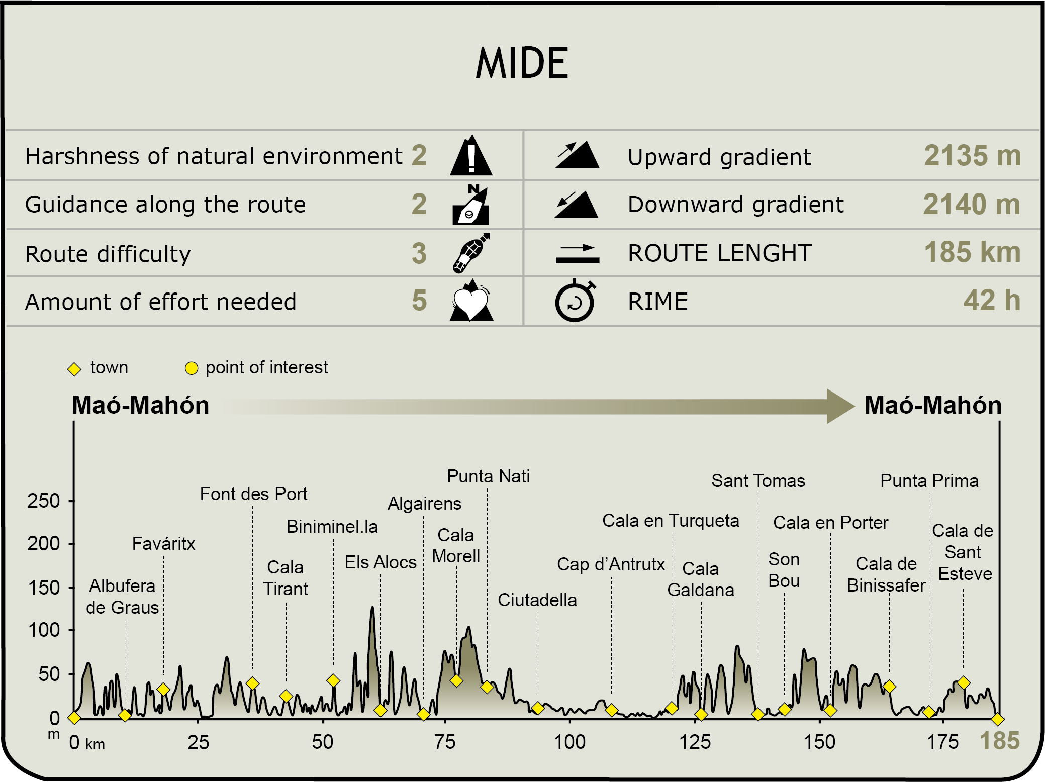
MIDE (Method for the Information of Excursions)
 Harshness of natural environment
- 1. The environment is not risk-free
- 2. There are more than one risk factors
- 3. There are various risk factors
- 4. There are quite a lot of risk factors
- 5. There are many risk factors
 Guidance along the route
- 1. Well defined trails and crossings
- 2. There is a clearly marked trail and signage
- 3. Requires the identification of geographic features and cardinal points
- 4. Requires off-path navigation
- 5. The trail is interrupted by obstacles that have to be gone around
 Route difficulty
- 1. Walking on a flat surface
- 2. Trails with different types of path
- 3. Walking on stepped paths or irregular terrain
- 4. The use of hands or jumping over the terrain is necessary
- 5. The use of hands is required to progress
 Amount of effort needed
- 1. Up to 1 hour of continuous walking
- 2. Between 1 and 3 hours of continuous walking
- 3. Between 3 and 6 hours of continuous walking
- 4. Between 6 and 10 hours of actual walking
- 5. More than 10 hours of continuous walking
Featured
Further information
The rural world
The Minorcan horseThe Minorcan horse is an autochthonous breed of the island of Menorca, preserved throughout centuries thanks to the prominence it acquired in the festivities of San Juan before the mechanisation of farms. There are currently 3,000 registered specimens.
LlocLloc is the word used for the agricultural estates of Menorca. They usually operate in a share-cropping scheme between the owner (Es Senyor) and the peasant farmer. These agricultural production units were the economic cornerstone of the island until the arrival of tourism. The main activity of the llocs is cattle farming, on which the production of the famous Mahon cheese depends.
Archaeological remains
Sanicera, Roman MenorcaThe archaeological site of Sanicera is located in the vicinity of the ancient natural port of Sanitja, next to El Cap de Cavallería, on the north coast of the island. Archaeological remains indicate that this settlement was most likely founded by Phoenicians or Carthaginians who turned it into an important urban and fishing hub. Nevertheless, its most prosperous period was under the Roman empire, during the era between the Republic and the 6th century AD. Cited by Pliny the Elder, in conjunction with Jammo (Ciutadella) and Magona (Maó), Sanicera was deserted on account of subsequent invasions and acts of piracy.
Talayotic culture in La Torre d’en GalmésThe Talayotic town of La Torre d’en Galmés is the largest archaeological site on the Balearic Islands. It is located on a hill from where a large part of southern Menorca can be seen, and is formed by three talayots, the most characteristic pre-historic constructions of the islands. The Talayotic culture is proper to Menorca and Majorca and evolved on the islands during the Bronze and Iron Ages. These first settlers on the islands lived in constructions known as room-shaped navetas which are spread across the whole territory forming villages.
Multimedia